Geology
These are some Geology related pictures that
I have taken over the years. They have been aquired over a number of
years during my work as a geologist since 1985. I have chosen these
photos largly for asthetic reasons as well as geological.
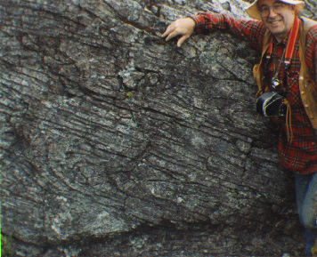
 An outcrop of schist in the
Whakamarina Valley, Marlbough, New Zealand. This is a regional
metamorphic rock that occurrs extensively thoughout the south Island.
Posing beside the outcrop is Dr David Skinner, a Geologist formily
with the Institute of Geological and Nuclear Sciences.
 Mount Nagarahoe seen from the upper
slopes of Mount Reuapehu. Behind it is Mount Tongarero. The three
mountains make up the Tongarero Volcanic Centre in the central North
Island, New Zealand. All three mountains are within the Tongarero
National Park.
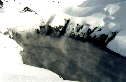
 The Crater Lake at the summit of
Mount Reuapehu. Mount Reuapehu is the highest active volcano in New
Zealand. It's last major eruptive period was 1995 to 1996
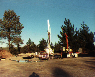
 This is a drilling rig that I was
working with in May 1986, when I was working on a drilling project at
Lake Rotokawa, near Taupo, New Zealand. The target body was a sulphur
deposit that was buried under a thich layer of pumice that was
erupted from a vent in what is now Lake Taupo in 186AD. This was one
of the largest eruptions in historic times - the effects were even
recourded by the Chinese.
 A senic shot of Mount Tauhara, near
Taupo. This photo was taken at the same time as the previous shot.
Mount Tauhara is a dacitic volcanic cone. Mount Tauhara is part of
the Taupo Volcanic Zone, a zone of volcanic activity in the North
Island of New Zealand that streathes from Mount Ruepehu (last
significant eruption 1995-6) to White Island in the north. In the
middle distance is Lake Rotokawa, which lies in an area of geothermal
activity. In the forground is some mining works where there was a
small scale operation mining a surface deposit of native sulphur
deposited by fumerol activity. The mine has since been closed.
 This is a photo of an embayment
called Slutter Guts, which is on the southern-most tip of Pitt Island
in the Chatham Island group. The Chatham Islands are a small group of
islands about 700 kilometres east of New Zealand, where I worked for
nearly two years as a field geologist. In this photo we are looking
seawards from inside the embayment. The entrance passage is about 50
metres accross - just large enough for a 40 foot fishing boat to get
in through. The passage is about 200 meters long. The embayment has
been carved by wave action into mafic volcanic rocks. This photo was
taken in January, 1986.
 This is an outcrop of Amuri
Limestone at Ward Beach in eastern Marlbough, New Zealand. This is a
formation of quite calcarious fine grained limestone which is also of
interest because of fossil sponges that may be observed in the rocks.
Ward beach is also interesting because of the many different rock
type that may be found as pebbles on the beach.
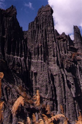
 These are the Putangarua Pinnicals,
which is a seanic rock formation on the south coast of the Wairarapa,
New Zealand. These are located in a seanic reserve about two houres
drive from Wellington. The pinicles have been carved out of tertiary
conglomerate material by the action of running water. The height of
these pinnicles are about 50 metres high.
philip_warnes@hotmail.com
This page hosted by  Get your own
Free Home Page


