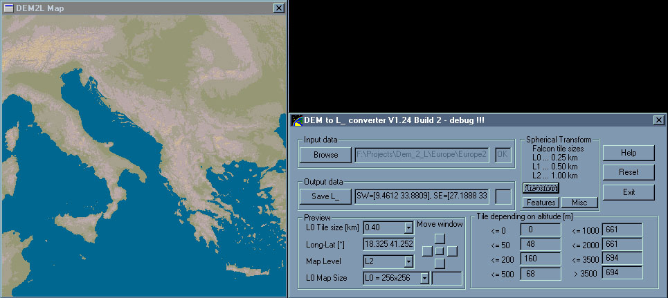
Explanation:
DEM to L2 is a program that transforms DEM maps into Falcon4.0 flight simulatior (or Siege of Power warfare simulation) L2 type (or any other Level of Detail) maps.
DEM maps are accessible on internet location http://www.ngdc.noaa.gov/ where you can get altitude maps of entire World in binary format, and at http://www.maproom.psu.edu/dcw/ where you can get features (roads, rivers) in coordinate fashion. Maps are formatted in Longitude-Latitude grid at density of 1/120 of a degree. Since meridians are far apart of eachother at the equator and very close at Earth`s poles (they all join into a point in the pole), you cannot just grab altitude based on this Long-Lat grid and make a square map out of it, since the map will be distorted (overstretched in East-West direction).
Therefore I made this program that recalculates and transforms altitude based on angular grid via spherical transformation into a flat map (orthogonal grid), thus eliminating the distortion to minimum.

What program does:
Program is capable of loading any size of DEM map, it then presents you a distorted image and a red box indicating currently selected boundries. You can also load angular data (coordinates) for roads, rivers and other features, autotiling specifications and at last you let it transform everything into flat maps that can be used in simulations.
Download:
Code NOT RELEASED for public browsing.
Last public release available here.
Sample images of terrain altitude maps and terrain features generated by this program:

Miran Klemenc, April 15th, 2002