GEORGE CATHCART'S
LEWIS AND CLARK JOURNAL
The record of a motor trip
in the footsteps of the Corps of Discovery
Week 2


Campsite, Makoshika State Park7-14 8:55 p.m. Makoshika State Park, near Glendive, Montana (pictured).

I drove a lot of miles today but didn't get very far. That's all right. I'm in Montana with a lot of miles to do that won't be on the Lewis and Clark Trail.

Maybe because it's Sunday I got a later than usual start this morning. I got gas in Williston, then went to Fort Buford, not even realizing it faces the confluence of the Yellowstone and Missouri.What a marvelous site! It seemed nearly pristine, with islands and marshes. I saw a muskrat swimming in a slough and a pocket gopher or ground squirrel alerting to me. Then I saw great flights of pelicans wheeling over my head as if they were posing. A red wing blackbird hovered over me and cried out a warning.

Then on to Ft. Union, a reconstruction of the American Fur Company post at exactly the site Lewis had recommended for a post. I met two rangers there and had great long conversations with both. The first one spotted my Diamondbacks hat and expressed his disdain for public financing for private stadiums. We got along anyway. Turns out he (Don Walden) teaches English at Glendale CC. He's working on his PhD in American Culture at UT Austin. We ended up having a nice chat, and he said he would call me this winter in Phoenix.

Then I talked with Mike Casel in the Indian Trade Room of the fort for a long time, and I bought a tin cup from him there.

It was 1 p.m. when I left there, but I gained an hour by crossing into Mountain Time. I improvised my route the rest of the day. I followed a gravel road into the Montana badlands to pick up U.S. 2 and follow the Missouri for a while. I stopped at a café in Culbertson for lunch, then visited the Culbertson Museum, where Ellamae Severson gave me a tour and loaded me down w/ brouchures for my travels in Montana. The museum was about the history of Culbertson, which was one of the railroad scams of the 19th century. Mostly Norwegians settled there.

The museum consists of donated items from townfolk and comprises rooms furnished with those items, starting with a church room with an altar that served both kitchens and shops, featuring manikins dressed for the parts. There was even a saloon with a bartender and a fancy bargirl playing poker. Ellamae admitted with a smile that the old saloon had indeed been a cat house, too, and the one over in Wolf Point was still operating as recently as the 1960s.

There is even a blacksmith's shop. The town celebrates its birthday with a big bash at the museum grounds last weekend in July.

I proceeded on toward Wolf Point, getting only occasional glimpses of the Missouri, which is fairly natural in that stretch. Lots of islands, marsh and braided channels. It hasn't been tamed between the lakes in the Dakotas and Montana, so I have gotten to see it as the explorers did.

Beyond Wolf Point, though, is Ft. Peck Dam, and the road swings far from the lake. So I crossed the Missouri at that point, drove south to a gravel road and cut back east all the way to Fairview, on the North Dakota line, more than 60 miles. There I picked up MT 16 and followed the Yellowstone uneventfully to here.

This state park is in a beautiful badlands south of the Yellowstone. Perhaps I'll work it into the book by having Hugh and Pryor explore in here on their way down the Yellowstone. Of course, perhaps Clark did that, too. I'll check his journals. Tomorrow to Pompey's Pillar and Billings, the largest town I'll see now until Portland. These plains and badlands are awesome, but a little daunting. I don't know why people would choose to settle here, but most of the fields look to be prospering. That can be deceptive, as financing doesn't necessarily reflect what the earth is doing, of course. But it was railroads, not great soil, that caused people to come here. Today the fields all seem to have a new form of wildlife, too, the Texas ground pecker -- oil wells. Someone must be prospering. With gas prices where they are it's no surprise that I saw only one idle pump today.

7-15 10:15 p.m. KOA Kampground, Billings, MT.

It cost more, the water is not conveniently located, and there are thousands of huge RVs here, but it's quiet, I'm right beside the river, and there isn't much choice around here. This KOA claims to be the first one ever in America.

Well, this was a much more straightforward day. I simply followed the Yellowstone, spending more time on the Interstate (94) than I would have liked, but getting some good glimpses of it (the river) often enough.

My first off-route adventure was at the mouth of the Powder River, where I followed a historical site sign under a railroad trestle, through a muddy bottom and up on a narrow 2-rut passage over about 2 miles of prairie. The first grave was a Scout who "fell on this spot Aug. 2, 1876." The second, 100 yards away at the base of a huge cottonwood overlooking the Yellowstone, was Pvt. Wm. George of the 7th Cavalry, who was badly wounded at Little Big Horn and being transported down river on the steamer Far West when he died. They pulled ashore and buried him right there.

I took note of the Rosebud entrance, and then at Custer did some searching to find the mouth of the Bighorn. The fishing access site there is named for Manuel Lisa, but there is no other official acknowledgement of Lisa's fort, built there in 1807 . I spotted a bluff that makes sense as the site, and there it shall be in my book.

Then it was on to Pompey's Pillar, fairly recently acquired by BLM. A friendly, helpful ranger took me up, showed me the signature and then went to the top with me on the BLM-built stairs.

I went to a bridge just upstream from the rock and talked for a while with Bob McFarland, a retiree who was drinking and admiring the river but went to some pains to tell me how much he hates farmers. Something about hunting rights. He thinks maybe Alaska would be a better place for him. He may be right.

Then it was into Billings. From the literature, I had planned to stay at Big Sky Campground, but they no longer offer tent sites, so I backtracked to here and like it much better. It's not so close to the highway, although I can hear it, and the river is right behind me. I got a shower, and I feel like I'm set for a comfortable night.

Tomorrow it's back to the Missouri, due north. I'll probably book it since there is nothing of L&C significance on the way. But who knows? God works in mysterious ways, and has done so repeatedly on this adventure. I'm just along for the ride.

7-16 6:30 p.m. Coal Bank Recreation area, S of Big Sandy.

This is a canoe camp, right on the banks of the Missouri, about a mile downstream of the Lewis & Clark camp of July 1, 1805. It's a BLM site for people floating the Missouri River, which is a Wild and Scenic River in this stretch, for about 149 miles, but it's accessible by car.

From where I sit right now, the Missouri is sliding by peacefully but powerfully. I waded out on a little gravel bar where the canoes land. It's cold and swift but still muddy. Across the river and downstream on both sides are thick cottonwoods. This site is mostly bare except for a few young cottonwoods and a willow or two. Just upstream is a large, wooded island.

The only other people here now are five old men on a ten-day canoe trip down to Kipp Landing. This was their second day out of Ft. Benton. I want to try to get a day trip on the river so I can see the White Cliffs, which begin just below here. The road passed them by a wide margin.

I started slowly this morning, lying in as long as I could. (There are 4 horses running and neighing in a field next to me here, just running free and playing.) I stopped for gas and major grocery re-fill and then started across the Big Empty, the vast treeless prairie between the Missouri and the Yellowstone. The sky was heavy and it wet me some, but traffic was practically non-existent, and the road was good, so I did 65-70 mph all the way.
I went past Roundup and Grassrange (home of Cow Patty's Café). I went over the Bull Mountains where something has killed off most of the ponderosa pines, and I don't think it was fire.

I had planned to eat lunch at Kipp Landing, and I got there in time enough, but it was lousy with mosquitoes, so I crossed the road and started up the Knox Ridge Road through the C.R. Russell National Wildlife Refuge. What a treat! It was just a one-track dirt road that followed the ridgeline and offered wonderful views of the Missouri and the Missouri Breaks. I finally stopped where I could look down on the river and a big island in the middle of it. I read Lewis's entry for May 26, 1805 and realized he might have been standing right where I was, thinking he was seeing the Rockies for the first time. He was wrong, of course. The snow-capped peaks he saw to the northwest were the Bears Paw Mountains, an isolated range. By now, in mid-July, the snow is long since melted. The highest peak there is just 6,916 feet.

But it was just as he described it. The Judith Mountains dominated the south, the Little Rocky Mountains the north, and there were the Bears Paws, peaking over the horizon. Perhaps Meriwether stood right where I was when he wrote:

    "these points of the Rocky Mountains were covered with snow and the sun shone on it in such manner as to give me the most plain and satisfactory view. While I viewed these mountains I felt a secret pleasure in finding myself so near the head of the heretofore conceived boundless Missouri; but when I reflected on the difficulties which this snowey barrier could most probably throw in my way to the Pacific, and the sufferings and hardships of myself and party in this, it in some measure counterballanced the joy I had felt in the first moments in which I gazed on them; but as I have always held it a crime to anticipate evils I will believe it a good comfortable road untill I am compelled to believe differently."

A surprisingly upbeat sentiment from Lewis, who seemed happiest in this stretch of the Missouri.

I proceeded on, by instinct at least as much as by map. The road got worse. I put J.W. Powell in 4X4 for the steepness. It was ungodly narrow, too, no room for error on either side. I just whooped and laughed and enjoyed it.

Finally it broke away from the river and reached cultivated land (geese are crying to each other (geese? I don't know)). The road smoothed and gradually widened. What few signs there were informed only those who might be going the other direction. They told me where I had been, and most of what they told me was only marginally on the map. I just trusted my higher power, and soon enough it was clear I was on the road into Winifred.

There I hit paved road, for half a mile, and then picked up State Route 236, a high-speed gravel road, which took me over the prairies and then down through the Breaks, with great views of the Judith River, to Judith Landing at the Judith-Missouri confluence. I stopped to take pictures and chatted with four Colorado women who were waiting for their ride. They had just taken out after 5 days on the river. Their favorite spot was the White Cliffs, further emboldening me to want to see that stretch.

Then it was back on the dusty gravel, speeding up from the Breaks and over the prairie again, finally onto pavement and the intersection with U.S. 87 at Big Sandy, then on to here. I would not have known about this site but for the Montana Travel Planner the lady gave me at the Culbertson Museum. What a great help it has been all through Montana.

Some impressions:

  • Speeding over gravel roads and throwing up vast white dust plumes;
  • Vastness, vastness, vastness;
  • Waving. Most locals wave. Most tourists don't. Either one makes me laugh. I wave at everyone. I laugh happily when they wave back, mockingly, I guess, when they don't. If I waved at night, I could always assume they wave back.
  • It's a good road, so far.

    7-18 7:30 a.m. A BLM campground on Holter Lake, N of Helena.

    I didn't get far yesterday. Soon after leaving my campsite I reached Loma at the mouth of the Marias River, where Lewis and Clark had to agonize over whether to defy their men and proceed on the Missouri or follow the muddy Marias, which the men were convinced was the correct route. The captains were right, of course.

    It is a little hard today to see how there could have been much choice, but in those days there was no removal of Marias water for irrigation, and with the river high with early spring run-off (early June) they could have certainly entertained some doubts.
    As for me: I wasn't satisfied with a few pictures at the bridge crossing. I ventured down a dirt road for a Wildlife viewing area. Signs informed me it was an area maintained by Montana Power and Pheasants Forever. After a little while I found myself on the banks of the Missouri with a 1/4-mile path to the beach point where the 2 rivers meet. Again, imagining a high spring flow, I could see being confused at that spot. There was a big island in the Missouri just above the confluence. The point itself would have made an excellent campsite.

    I kept following the dirt road, up a hill, where a path led steeply to a high knob with excellent views and some information about Ophir as well as Lewis and Clark, and the river boat industry. From the knob I could see the road I was on crossed the Missouri, and the map suggested that on the other side the road would come close to the river, so I proceeded on.

    The road took me up on the plateau, where there were wheat fields and pasture. A wheat field lay between the road and the edge of the bluff, where I wanted to go, but I found an unmowed tractor lane and soon stood on the precipice of a 300-foot cliff, looking down at the braided Missouri, and an island with a point on it, and pelicans wheeling below me.
    I gasped and awwed for a while, then went back over the river and followed a road to a boat ramp upstream, then beyond, well out on the flats until the road hit no trespassing signs. There was a beautiful stand of cottonwoods that would make an excellent campsite.
    From there, I shunned the highway and followed dirt roads through vast prairies and wheat fields across Rowe Bench, finally emerging N of Fort Benton.

    The Ft. Benton historical museum was disappointing, with almost nothing about L&C, but the BLM visitors center had a slide-tape show about the explorers' journey through the Breaks and White Cliffs. There is a marvelous sculpture of L&C and Sacagawea and Pomp overlooking the river.

    On then to Great Falls.
    I took the first road to a dam, the lowest of dams and the only one not associated with one of the falls. It was a long, bad road, and hardly worth the effort. Next I went to Ryan Dam, at the Great Falls, where I was appalled at the poor geography lesson on the signage. As with Rainbow Falls, Ryan Dam was built just upstream of the falls themselves, so they remain intact; however, most of the water is diverted through the power plants, so the effect of the falls is largely lost.

    I went to Big Spring State Park and looked at the springs and the hatchery fish. There's a sense of commercialism about all this now, and the object is current recreation, not history. Here in this part of the L&C expedition where they saw no people, I am finding it too crowded. And an astonishing number of the people whose job it is to greet and direct visitors know next to nothing about Lewis & Clark or about the monuments to them.

    There is another marvelous Bob Siever statue of the captains, this time with York and Seaman, at the Visitor Center at Broadwater Park. The park supposedly overlooks the Missouri-Sun (then Medicine) confluence, but it could not be seen through the highways and bridges. Of interest to me, there are plaques on the perimeter of the circle around the statue honoring the men of the expedition individually. Each plaque was donated. Not all have been placed yet, but there is one to Hugh Hall! I asked about the person who donated the plaque but nobody knew him. A subject for further research.

    My quest for that information diverted me from the effort to trace the portage route. I had pretty much determined it mostly crossed what is now Malmstrom Air Force Base. I paused in a used book store for a while and chatted with the clerk there, who is a Nez Perce buff and knows a bit about the captains, too.

    Then I started south on the River Road, getting a glimpse of White Bear Island, but soon finding myself speeding South away from the river. I kept going anyway until I reached a road that follows the Smith River north to the Missouri at Ulm, a little upstream of Great Falls. I crossed the river there and followed the frontage road along the river to here, crisscrossing the Interstate several times, but managing to avoid driving on it. It so closely followed the river that I got a real sense of how the expedition must have felt as they wound their way up into the mountains.

    Finally I turned off to Holter Lake here and found this campsite about 7:30 p.m. the tent sites are badly sloped. A storm was coming, so I didn't even put up the tent. I made my bed in the back of the Explorer, ate dinner and finished cleaning up just as the rain arrived. I did my writing in the back of the truck and slept comfortably there.

    This morning I'm taking my time because I want to take the boat ride through Gates of the Mountains, which is very near here, and the first boat leaves 2 hours from now. I'd like to take a shower first if I can, but I won't worry about it. I have no idea where I will end up tonight.

    7-18 9:30 p.m. In my tent at Lewis and Clark Caverns State Park, near the Jefferson River.

    The wind will test my tent tonight. Gusts roar down from the peaks around me and turn the poles around. I hope all holds.

    I took the boat tour through Gates of the Mountains.
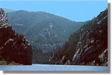
    Mel Sholt, the pilot, gave as good a presentation as I've ever heard of that kind. He was very knowledgeable about L&C, and he seemed to know geology and biology equally well. I told him how impressed I was. It was a decidedly positive experience.

    By the time I got back on the road, about 1:30 or so, a big dark cloud loomed in the south -- where I was going. Lightning streaked across the sky. By the time I got to Helena it was raining. I got cash and then decided to visit the renowned Helena Historical Museum. It had a gallery of Charlie Russell paintings and a gallery of Montana homeland with some interesting stuff. But the painting I went to see -- Lewis & Clark Meet the Flatheads at Ross's Hole -- wasn't there. I learned later that it hangs in the capital, across the street. Oh well.

    By the time I left there, the sky was blue, and the sun was western bright. I sped south toward Three Forks, finally seeing patches of snow on distant peaks. They turned out to be the Tobacco Roots and the Madison Range.

    I gassed up at the I-90 interchange at 3 Forks, then drove out to Headwaters State Park and saw where the rivers come together in wet, brushy, heavy growth. Good interpretive signs and exhibits don't detract from the effort to keep it very natural, and it's easy to believe L&C (and Hugh) saw scenes very similar to what I saw today.

    I debated whether to drive to Bozeman and over Bozeman Pass to re-create the 1806 return journey with Clark, but decided against it. The journals are sufficiently detailed, and I have some memory of it from my '87 trip through there.

    So I got back on the road and headed toward Dillon and turned the decision-making about my camp tonight over to H.P. I don't know why I had not really considered this spot before. Maybe I didn't realize it is right on my route, and I certainly didn't know what it offered except caverns. I don't need another cavern tour. Fisher Cave in Missouri will do me for now. Anyway, I pulled in here and saw that they have pay showers. I have camped w/o a shower since Billings KOA on Monday, and I've been feeling pretty ripe, so I was sold. It isn't crowded at all, and it's very spacious. No shade, which also means nothing to break the fierce wind, but I'll live through that.

    As happened last night, I finished dinner and clean-up just as a big black mountain cloud loomed up from the west. A drop or two fell before I went to the shower. When I finished my shower, big drops were falling, but not too many of them. I climbed into the Explorer and left the back gate up as it began to pour, while I worked on Hugh Hall.

    This is lovely, really. Earlier, I got talking with a Dutch gentleman who wanted to buy 2 quarters from me for five dimes so he could shower. We had a lovely chat about travel and writing. Everyone here is friendlier than at the other sites I've been in recently. Ever since I got to Montana, people have seemed more distant for some reason. Here they are warmer, they smile, wave, say hello, even chat freely. I think the chilliness of people was starting to depress me. Tonight I'm feeling better about it all. Really.

    Oh, yes, one more thing that I am grateful about. After having to pack wet and fast that first morning back at Arrow Rock State Park in Mo., I organized the back of the Explorer in a way that has served me well ever since.It is easy to pack in the morning and unpack at night. The biggest challenge is dealing with acquisitions along the way, but so far, so good.

    7-19 10 p.m. Salmon Meadows Campground, Salmon, ID
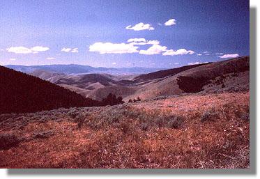
    This feels like my longest day of this adventure. I got under way at the usual time, about 8:30 or so, after watching 3 deer graze nearby as I ate my breakfast.

    I followed the roads along the Jefferson down to Twin Bridges, then took a tertiary road, East Bench, to approach Beaverhead Rock from a different angle. I cut back to Route 41, though, and was still able to see the Beaver's Head. I have no problem with it, but it could also be a dinosaur's head, frankly.

    Then I dashed on to Dillon, pausing at fishing access sites to get photos of the Jefferson. At Dillon I bought a 4-day fishing license, just in case. Then I went out to Clark's Lookout and climbed up there to see what he saw, and I read his account of it in the journal.

    I stopped in the museum and had a lively chat with "Doc" Holliday about his gold mining days. He showed me some of the other lovely stones he's gotten out of these mountains, too. Tomorrow, he will teach gold panning to tourists at Bannack Days. He has had his problems w/ ranchers, blocking access to his mine, and so on. He only comes to MT about 3 months a year any more. He's retired and living in Vero Beach, Fla. When I went in the museum, he said to sign the register and tell what state I'm from so he can insult it. I told him he can't say anything bad about Arizona that would bother me, so he said nice things about it. He also told me exactly how to proceed up to Lemhi Pass.

    I didn't see any place I wanted to eat in Dillon, so I got on the freeway (no choice, I'm afraid) and headed south. I stopped at a truck stop and had the greasiest chicken fried steak I've ever tasted. At Clark Fork Dam, I took some pictures of the end of the Beaverhead.

    Finally I started the long road up Lemhi Pass. All day, maybe for several days, I've had some odd reluctance, even fear, about crossing the Divide. Is it like crossing the Rubicon? Was I afraid I wouldn't make it" Does it mark a point of some significance I'm reluctant to face? From there it's all downhill -- well, not really, there's still Lost Trail Pass tomorrow, back into Montana, then the Lolo Trail. Then it's all downhill to be sure.


    It was moving to reach Lemhi Pass, even to drive up there, thinking of how hard the 2 months previous had been for the Corps -- indecision at the Marias, the impossibly hard labor of the portage, the draining work of dragging the boats up the Jefferson and Beaverhead, and finally ... what? The Continental Divide probably meant little to those men. There were months of hard work still before winter, and greater dangers than they had faced yet. They had no idea how long it would take, what they would find on the way or where they would truly end up. The Divide was just one more hump for them, not a destination. For the Corps, the journey truly was the thing, not the destination.

    I think that's what affected me most today, because it's like that for me now. Crossing the divide was splendid. Dipping my cup in the same spring Lewis had drunk from, reading his Aug. 12, 1805 entry in the journal, drinking again from the first stream I saw on the western side, all seemed natural and beautiful and necessary. I drove past the pass first, not over it, down to Sacagawea Memorial, a quarter mile away. That's where the spring is. I drank from it, then walked to the top and read the journal entry, before walking back to the car. I had been so reluctant to go up, then I didn't want to leave, of course.

    But I did, of course.

    I followed the very narrow, very steep dirt road down the Pacific side. It made Fish Creek Hill in Arizona look easy. It leveled off pretty quickly, and soon I was speeding along Lemhi Creek to here. I still had no idea where I'd stay. I got gas, then went in a photo store for film and got talking with the proprietor, Joel McNee, who showed me some of the great wildlife shots he's gotten along the Salmon River. So I decided to check in here and drive down the Salmon myself. I needed to do that anyway, to see firsthand why Clark decided against going down the Salmon. I didn't see any wildlife, and I didn't think the river lived up to Clark's characterization of "one continuous rapid," but it certainly would have been beyond the prudent capabilities of men with heavy laden dugout canoes, and there would not have been adequate timber for those anyway. Clark definitely made the right choice.

    It was after 8 before I got back here. I cooked and ate quickly, then showered. The lady said I could use the laundry after hours if I'd turn out the lights and lock up. so I worked on Hugh Hall while I listened to the machines wash and dry my clothes, and now I am here, at last, and very tired.

    I like adventure.


    7-21 Chief Looking Glass State Park, near Florence, MT.

    It's about 10:30 p.m. I'm in the tent, defying the mosquitoes.

    Yesterday I proceeded slowly up to Missoula. I had bought a Montana Fishing License in Dillon the day before, so I had to use it. After crossing Lost Trail Pass I stopped at most of the Sportsman Access points on the Bitterroot R., beginning where the forks join to form the main stem. It was excellent conditions, just a nice cloudy day, but there were few flies (mostly caddis) and no top action. I continued stopping but had no luck.

    I went into Missoula and slept in a bed for the first time in 2 weeks. I didn't get enough sleep, and I woke with the kind of blahs I get after taking a day off from adventure. So that's what I did.

    But first, last night I went to a wonderful International Choral Festival in Missoula, a once in four years event, w/ choirs from Belgium, Austria, Taiwan, Hong Kong, Korea, Argentina, Poland, Singapore, Thailand and the U.S. Oh, yes, and a Ukrainian mens' choir based in Edmonton.

    It was the culmination of a week of chorus concertizing in Missoula, and it was quite wonderful. Free admission. The field house at the University of MT was packed to the rafters. The Polish and Korean choirs were my favorites.

    So, today was a day off. About 1:30 I drove N from Missoula to the National Bison Range, about 50 miles away. The US FWS has a wonderful site there, with a 19-mile one-way gravel loop around Red Sheep Mountain. I saw -- and got lots of pictures of -- bison in great numbers, pronghorn. I also saw at a great distance some elk. Today I really wished I had found my binoculars before I left Phoenix.

    Anyway, it took a couple of hours to drive that loop, so I came on down to here for the night, about 15 miles south of Missoula. There are only a couple of other people camped here. It's mostly used as a fishing access site. After I ate I fished for about an hour and caught one little 6" rainbow. Oh, well. Maybe I'll do better in Idaho, but this was never meant to be a fishing trip. I'm not disappointed.

    From here in the morning, I'll resume my pursuit of Lewis and Clark, crossing Lolo Pass and following Lolo Trail as far as I have the guts to. Farewell to Montana. As always, it's been beautiful.

     Proceed on to Week 3

    Home 
    1