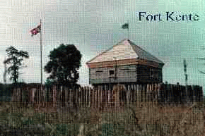
Carrying Place, Ontario, CanadaA Brief HistoryUNITED EMPIRE LOYALISTS
The first Indian land purchase in what is now Ontario was in August, 1764 at Fort Niagara from the Six Nations, but was never completely executed. In 1783 Sir John Johnson, appointed by The Governor of the Province of Quebec as General of Indian Affairs for British North America, became responsible for the negotiations of land titles from the Mississauga Indians. Sir Johnson was sent a letter from a Captain William Crawford of Cartleton Island informing Sir Johnson that all the lands from Gananoque to the Trent River had been purchased. These purchases were to be invalidated, but on Sept. 23, 1787 at The Carrying Place at the head of the Bay of Quinte, The Gunshot Treaty was signed, and is numbered #13 in the government report of Indian Treaties and Surrenders (1680-1890). In effect, the Mississauga Indians ceded lands from the Bay of Quinte to Etobicoke and northward from Lake Ontario to Lake Simcoe and Rice Lake. This was also considered not to be a valid treaty, thus on August 2, 1805, #13A was signed at the River Credit and annexed to the original "Gunshot Treaty" ( Toronto Purchase). The Mississauga Indians had signed away most of Eastern Ontario.  Fort Kente: Fort Kente:Carrying Place, Ontario Kente, pronounced Ken-tay is an Indian word, from the Iroquois
language meaning " meadow" and was the first name early European
explorers heard to describe the narrow isthmus of land between Lake Ontario
and the Bay of Quinte. To-day, that word would more closely resemble "Ghentay"
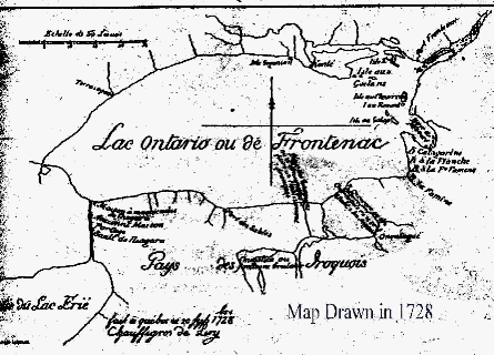
with the gh pronounced as in ghost. Early explorers heard a "k" sound.In a letter dated 1771, General William Johnson said".......ye neck of land whereon Kente stands." Historical maps dated 1674 show this site as Kente. Similar maps show Quebec as "Kebec". Kente went through several spelling and pronunciation variations. With the arrival of more English
settlers, the word became anglicized into Quinte. Quinte is now the designation for the Bay and the area.

This route dates back to pre European times and was a major artery for trade and exploration. For more information about the rebuilding of this historic site, contact: Dr. Paul Germain, R.R,#2, Carrying Place, Ontario, K0K1L0 613-394-2313
|