Mason-Dixon Line Crownstones
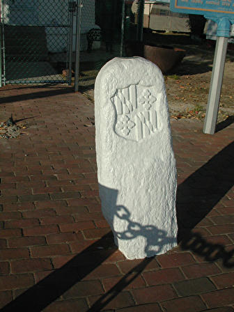 Surveyors Charles Mason and Jeremiah Dixon were commissioned to settle the boundary dispute between Maryland and Pennsylvania.
Working from 1763 to 1767, they put a series of stones every mile along what became known as the Mason-Dixon
Line. Every 5 miles they put in a Crownstone bearing the coats
of arms of the second Lord Baltimore (Cecil Calvert) on one side and William Penn on the other.
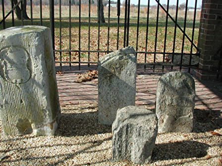
These were carved English limestone posts. Over 200 years later the carvings are still there, but they do show a lot
of wear and tear. On this page are pictures we took of three crownstones that are
along the highways in or near towns along the DE and MD border.
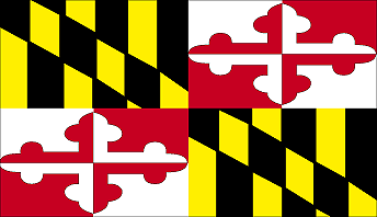
Maryland Flag and a picture of the Fenwick Island (DE) Crownstone bearing the Calvert Family Crest
Delmar Roadside Pullover
(right side of road heading
west 6.5 miles from Delmar on Rt. 54 towards Mardela Springs, MD). 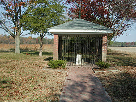
Close-up of the 4 stones, below:
Marydel Crownstone Site
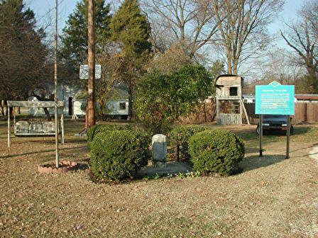
(on the left side of road before
"Welcome to DE" sign)
close-up of stone, below:
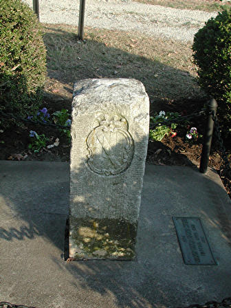
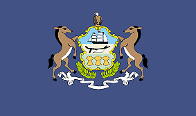
Penn Family Crest on the 1763 Crownstone at Marydel, MD and PA State Flag
LINKS
Pennsylvania Symbols
Maryland: Eastern Shore (by county)
Historic Sites (DE)
Why does DE have such a strange shape?
Mason-Dixon Line
The Transpeninsular Line Monument Stone of 1751 at Fenwick Island, DE. "It was set in place by the Commissioners of Maryland
and Pennsylvania to mark the Transpeninsular Line of 1751. The line was
the result of an effort by the King of England to bring an end to a complex,
nearly century-long boundary dispute between the Penns and the Calverts."
Fenwick Island and the Transpeninsular Line
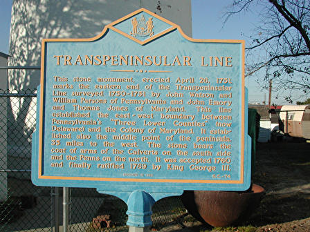 Sign at the Fenwick Island Lighthouse from the Delaware Public Archives:
"This stone monument, erected April 26, 1751, marks the eastern end
of the Transpeninsular Line surveyed 1750-1751 by John Watson and William
Parsons of Pennsylvania and John Emory and Thomas Jones of Maryland. This
line established the east-west boundary between Pennsylvania's 'Three
Lower Counties' (now Delaware) and the Colony of Maryland. It established
also the middle point of the peninsula, 35 miles to the west. The stone
bears the coat of arms of the Calverts on the south side and the Penns
on the north. It was accepted 1760 and finally ratified 1769 by King
George III."
DE has only three counties (Newcastle, Kent, and Sussex) which were originally the lower three counties
of PA. The 1751 Transpeninsular Line bisects the peninsula almost 70 miles from the Atlantic Ocean at Fenwick Island to the Chesapeake Bay. Mason and Dixon accepted the mid-point of that line as the southwest corner of what is now Delaware. From that point on north is the Mason-Dixon Line, which then continues west forming the southern boundary of the commonwealth of PA.
The 40th Parallel and How It Affected the Boundary Between Maryland and Pennsylvania
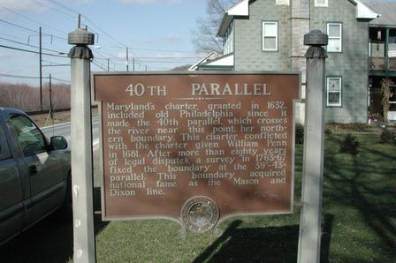 Maryland's charter, granted in 1632, included old Philadelphia since it made the 40th parallel, which crosses the [Susquehanna] river near this point, her northern boundary. This charter conflicted with the charter given William Penn in 1681. After more than eighty years of legal disputes, a survey in 1763-67 fixed the boundary at the 39°- 43' parallel. This boundary acquired national fame as the Mason and Dixon Line.
[This sign is located along Rt. 441 (River Road) in Washington Boro, Lancaster County, Pennsylvania.]
©JKH, updated January 2004
 Surveyors Charles Mason and Jeremiah Dixon were commissioned to settle the boundary dispute between Maryland and Pennsylvania.
Working from 1763 to 1767, they put a series of stones every mile along what became known as the Mason-Dixon
Line. Every 5 miles they put in a Crownstone bearing the coats
of arms of the second Lord Baltimore (Cecil Calvert) on one side and William Penn on the other.
These were carved English limestone posts. Over 200 years later the carvings are still there, but they do show a lot
of wear and tear. On this page are pictures we took of three crownstones that are
along the highways in or near towns along the DE and MD border.


 Sign at the Fenwick Island Lighthouse from the Delaware Public Archives:
 Maryland's charter, granted in 1632, included old Philadelphia since it made the 40th parallel, which crosses the [Susquehanna] river near this point, her northern boundary. This charter conflicted with the charter given William Penn in 1681. After more than eighty years of legal disputes, a survey in 1763-67 fixed the boundary at the 39°- 43' parallel. This boundary acquired national fame as the Mason and Dixon Line.