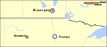
| Starting Point: Fargo, ND |
to | Ending Point: Winnipeg, MB |

| Starting Point: | City-to-City Directions: |
|
| |||||||||||||||
REMEMBER that no revolvers, pistols or fully automatic firearms can be brought into Canada...
Donít underestimate the size of Manitoba: The distance between Winnipeg and Churchill is greater than that between New York City and Chicago.....
Donít worry! Those distances marked on road signs are in kilometers, not miles (a kilometer is approximately 0.6 of a mile)....
Donít forget to buckle up: seat belts, child safety seats and motorcycle helmets are required by law in Manitoba..
Did you know....
...the Goods and Services Tax (GST): 7 % - rebate is available to non-residents of Canada on accommodation and on many convention related costs?
...Manitoba is a vast, resource-rich province somewhat larger in size than the states of California, New York and Indiana combined?
...to the south, Canada shares an 8892 km boundary with the United States? To the north, the Arctic islands come within 800 km of the North Pole. Canada's neighbour across the Arctic Ocean is Russia.