LOCATION
At the north of the junction of Brenda Road (B1277) and A178 near
Seaton Carew, HARTLEPOOL. - - - Map Ref.- -NZ522278 (54°38.6'N 1°11.5'W)
 
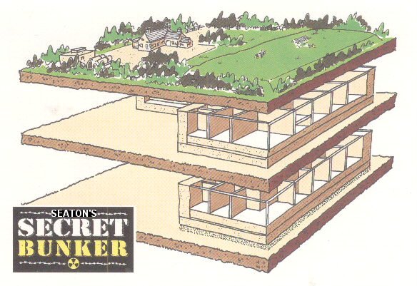
Built 100 feet below ground, and encased in 15 feet of reinforced concrete, this is where government and military commanders would have run the country from had the UK been attacked and nuclear war broken out. The innocent looking farmhouse concealed the entrance for over thirty years. The Bunker covered 24,000 sq ft of secret accomodation on two levels.
   Big Map
CONSTRUCTION
The bunker was set in a hole 40 metres deep on a gravel bed. The building itself had an outer shell of concrete 3 metres thick reinforced every 15 centimetres with tungsten rods. The whole structure was encased in pitch. The excavated earth was piled on top with concrete rafts for added protection. The farmhouse entrance was also reinforced with concrete and steel.

PURPOSE - ROYAL AIR FORCE
After the Second World War relations between the Western Allies and Warsaw Pact countries deteriorated. This created the Cold War. The British Government built a chain of bunkers along the East Coast to act as early warning radar stations in case of nuclear attack from the USSR. |

