Deal's Right -Historic Maps

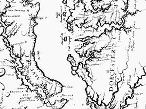
There is ample evidence that Deal’s Right (or Dail’s Right or Dale’s Right) has been continuously occupied since the 17th century. This is a piece of a map by Augustine Herrman from 1673. Click here to enlarge - but be patient.

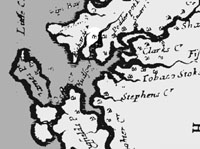
Zooming in a bit closer, you can see the fine detail in this early map. In those days, mapmakers were some of the world’s finest artists, and we are lucky to have so much of their work survive through the ages.Click here to enlarge

Here’s a slightly altered version – with Dale’s Right highlighted. Incidentally, Podderpot Point is now Butterpot Point - known locally as one of the best spots for rockfish. It’s about 100 yards off our shore. Click here to enlarge
Go back to Deal's Right Home Page