|
|
|
Lesson 1 - Determine magnetic azimuths using a lensatic compass. Lesson 2 - Convert magnetic azimuths to grid azimuths. Lesson 3 - Convert grid azimuths to back azimuths. Lesson 4 - Plot back azimuths and determine location on a topographical map. |
|
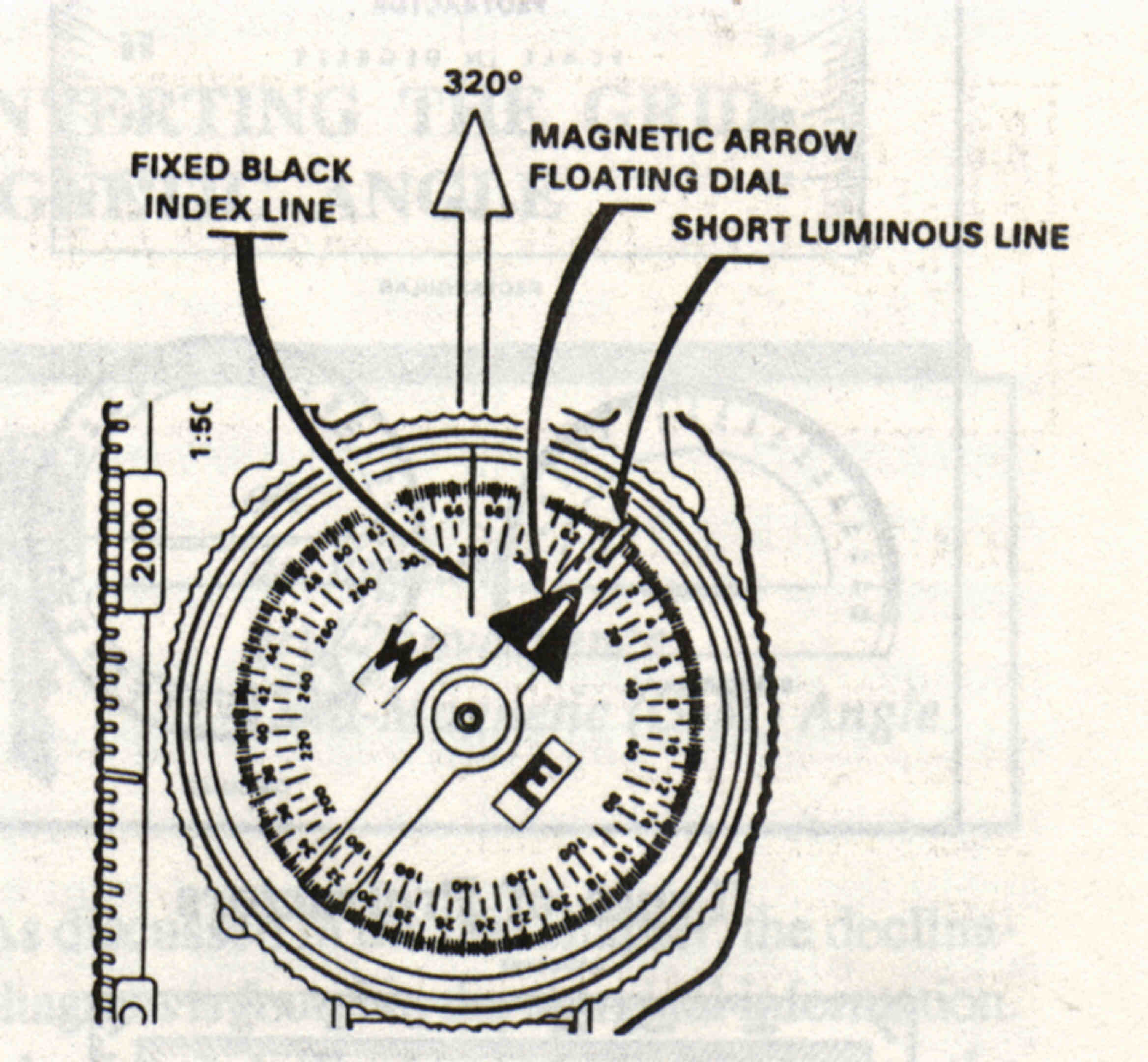
The center hold technique is the fastest and easiest way to measure a magnetic azimuth. 1. Make sure the needle on the lensatic compass is floating freely. 2. Hold the compass between the forefingers and thumbs of both hands and pull your elbows down to your sides (Figure 1). This action will place the compass between your chin and waist. 3. To measure an azimuth, simply turn your entire body toward the object, pointing the zero or index mark directly at the distant known location. 4. Once you are pointing at the object, look down and read the azimuth from beneath the fixed black index line. The second diagram below (Figure 2) illustrates a magnetic azimuth of 320 degrees. You must measure at least two well defined distant locations that can be pinpointed on the map. Two is what we will cover in this lesson but three would be more accurate. To determine the second azimuth repeat steps 2 to 4 on another well defined distant location. |
 |
 |
|
|
|
|
|
![]() Go to Student
Activity 1: Measure azimuths using a lensatic compass
Go to Student
Activity 1: Measure azimuths using a lensatic compass