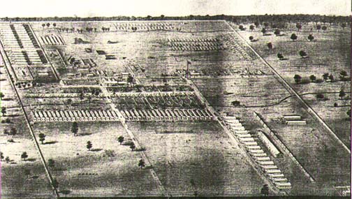


~ Camp Chase, drawing by A. Ruger, Co. H, 88th O.V.I. ~

"The above scenes will be familiar to those who were in the Camp Chase Prison.
The street at bottom of picture is Broadway ( now Broad Street), and the "mile
house" illustrated in December veteran, is near the center of this area. The
main prison is at upper left-hand corner and about half-way from Broadway to the
Confederate Cemetery. The group of buildings, six in a row to the right of the
main prison, is the Confederate Hospital, while the two-story building at the
lower right-hand corner of the picture is the Federal Hospital. Camp Chase was
a regular camp of instruction, and long rows of buildings at right of campus,
comprising two squares, indicate the Federal soldiers' quarters. It is evident that
in a few years the city will extend fully out to the cemetery."
~ Confederate Veteran January, 1897, Vol.6, No.1 ~


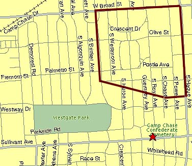
An approximate overlay onto a modern map to show the boundaries
of Camp Chase and the location of Camp Chase Cemetery.
Map Source: Map Quest. Graphics: MP

Back To Main Page
Back To History Page
This page hosted by
 Get your own Free Home Page