Research Center
Islam
Games
Links
Chat Room
World Time
Autobiography
Email Me
Net Search
This Site Contains No Frames!
Webmaster: Anees Udyawar
Copyright ©1998, 1997 by Geocities
Corp.
This site is restrictedly for educational,
entertainment and leisure purposes.
If you do copy some
of my articles or pictures please email me and tell me where they have been placed. |
Stonehenge
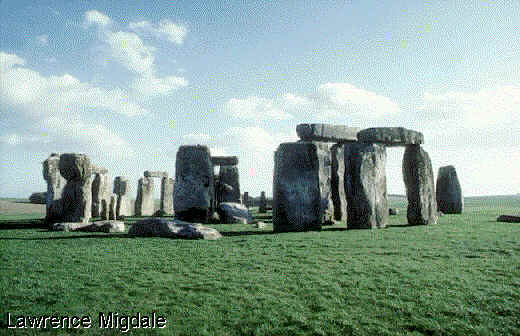
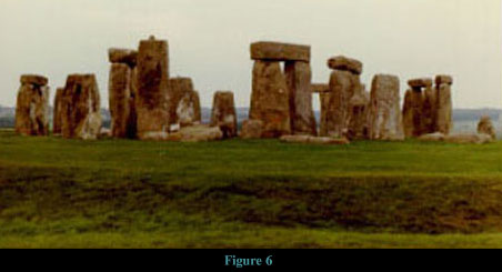
A prehistoric ritual monument, situated on Salisbury Plain,
north of Salisbury, England, is Stonehenge,
dating from the late Stone and early Bronze ages (circa 3000-1000
BC). It is the most celebrated of the megalithic monuments of
England. Stonehenge is surrounded by a circular ditch, 104 m (340
ft) in diameter and 1.5 m (5 ft) deep, within which is a bank and
a  ring of 56 pits known as Aubrey holes
(named after their discoverer, the British antiquarian John
Aubrey). At the northeast end a break in the ditch affords access
to a ditch-bordered avenue that extends in a generally
northeastward direction to the East Avon River. The avenue is 23
m (75 ft) wide and nearly 3 km (2 mi) long. The monument itself
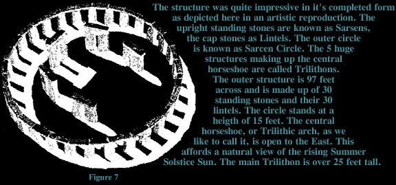
consists of four concentric ranges of stones. The outermost range
is a circle, 30 m (100 ft) in diameter, of large, linteled,
sandstone blocks called sarsen stones. Within this circle is a
circle of smaller blue stones consisting mainly of spotted
dolerite, with four specimens each of rhyolite and of volcanic
ash. The latter circle enclosed a horseshoe-shaped arrangement of
five linteled pairs of large sarsen stones. Within this
arrangement is a smaller horseshoe-shaped range of blue stones
enclosing a slab of micaceous sandstone known as the Altar Stone.
Near the entrance to the avenue lies the so-called Slaughter
Stone, a sarsen stone that may originally have stood upright. ring of 56 pits known as Aubrey holes
(named after their discoverer, the British antiquarian John
Aubrey). At the northeast end a break in the ditch affords access
to a ditch-bordered avenue that extends in a generally
northeastward direction to the East Avon River. The avenue is 23
m (75 ft) wide and nearly 3 km (2 mi) long. The monument itself
consists of four concentric ranges of stones. The outermost range
is a circle, 30 m (100 ft) in diameter, of large, linteled,
sandstone blocks called sarsen stones. Within this circle is a
circle of smaller blue stones consisting mainly of spotted
dolerite, with four specimens each of rhyolite and of volcanic
ash. The latter circle enclosed a horseshoe-shaped arrangement of
five linteled pairs of large sarsen stones. Within this
arrangement is a smaller horseshoe-shaped range of blue stones
enclosing a slab of micaceous sandstone known as the Altar Stone.
Near the entrance to the avenue lies the so-called Slaughter
Stone, a sarsen stone that may originally have stood upright.
Grouped around the main structure are a number of barrows, some
of which contain chips of a blue stone similar to that found in
the concentric ranges. The blue stones are from the north  flank of the Prescelly Mountains in Wales. The Altar
Stone is believed to have come from the region near Milford
Haven, Pembrokeshire. flank of the Prescelly Mountains in Wales. The Altar
Stone is believed to have come from the region near Milford
Haven, Pembrokeshire.
Stonehenge was desecrated sometime between 55 BC and AD 410 by
the Romans, who tore down a number of the upright stones. In
addition, two uprights and a lintel west of the Altar Stone fell
in January 1797, and two other stones, an upright and its lintel,
fell in 1900. In 1958 these five stones were raised, giving the
monument the approximate appearance it had during the Roman
occupation. On some of the fallen stones shallow carvings were
found (1953) depicting bronze axheads of a type used in Britain
between 1600 and 1400 BC and a hilted dagger of a type used in
Mycenae, Greece, between 1600 and 1500 BC.
The outer bank, the ditch, and the Aubrey holes encircling the
main construction date probably from the late Stone Age or early
Bronze Age (circa 2000 BC). The main structure is dated between
the early Bronze Age and the end of the Iron Age. The sarsen
stones are dated from the  carvings at about
1500 BC. carvings at about
1500 BC.
Parts of Stonehenge undoubtedly were built by a people who had
widespread European trade connections and who established their
principal settlements in the area between 1600 and 1300 BC.
Although Stonehenge is related basically to the circular stone or
wooden temples that were constructed in Britain during the Bronze
Age, it is structurally unique among European prehistoric
monuments.
The function of Stonehenge has long been a matter of conjecture.
In 1964 the American astronomer Gerald S. Hawkins reported
findings obtained by supplying a computer with measurements taken
at Stonehenge together with astronomical information based on
celestial positions in 1500 BC when Stonehenge was in use.
According to Hawkins the Stonehenge complex could have been used
to predict the summer and winter solstices, the vernal and
autumnal equinoxes, and eclipses of both the sun and moon.
Moreover, a variety of other information pertaining to the sun
and moon could also be predicted with remarkable accuracy.
Hawkins concluded that Stonehenge functioned as a means of
predicting the positions of the sun and moon relative to the
earth, and thereby the seasons, and perhaps also as a simple
daily calendar.
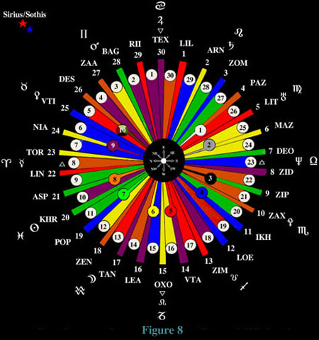
The OAI system utilizes the layout and
correspondances of Stonehenge in it's execution. The following
diagram shows some of the layout as pictured from above the
sanctuary. (Figure 8) Persons familiar with various branches of
Occult litrature may recognize some of the symbols and words
associated. This diagram was part of the original information
imparted during "Alien" contact. It was a baffling and
strange compilation of data during those initial months of
investigation.

The End
|

 ring of 56 pits known as Aubrey holes
(named after their discoverer, the British antiquarian John
Aubrey). At the northeast end a break in the ditch affords access
to a ditch-bordered avenue that extends in a generally
northeastward direction to the East Avon River. The avenue is 23
m (75 ft) wide and nearly 3 km (2 mi) long. The monument itself
consists of four concentric ranges of stones. The outermost range
is a circle, 30 m (100 ft) in diameter, of large, linteled,
sandstone blocks called sarsen stones. Within this circle is a
circle of smaller blue stones consisting mainly of spotted
dolerite, with four specimens each of rhyolite and of volcanic
ash. The latter circle enclosed a horseshoe-shaped arrangement of
five linteled pairs of large sarsen stones. Within this
arrangement is a smaller horseshoe-shaped range of blue stones
enclosing a slab of micaceous sandstone known as the Altar Stone.
Near the entrance to the avenue lies the so-called Slaughter
Stone, a sarsen stone that may originally have stood upright.
 flank of the Prescelly Mountains in Wales. The Altar
Stone is believed to have come from the region near Milford
Haven, Pembrokeshire.
 carvings at about
1500 BC.
