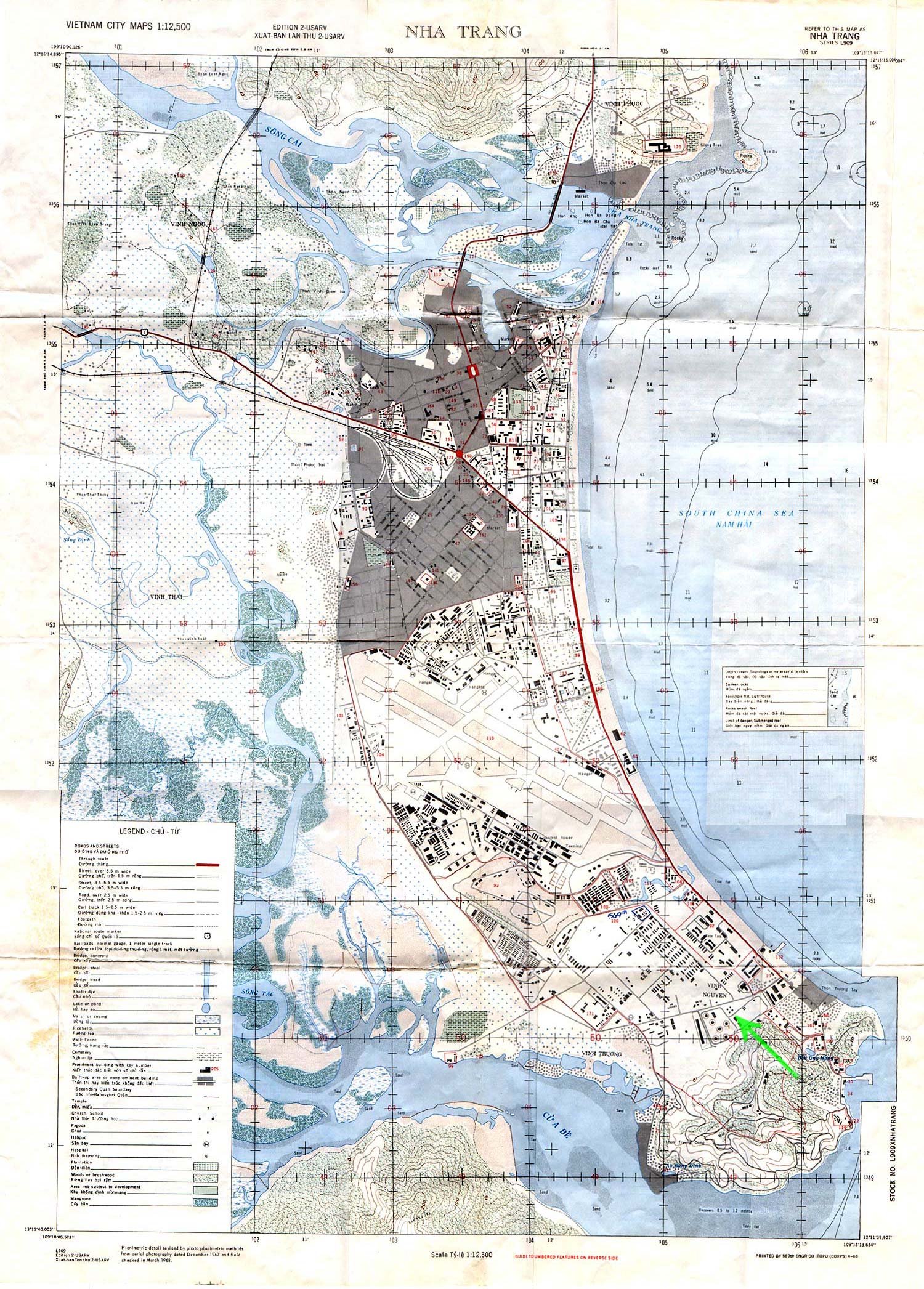
The map of Nha Trang displayed below was printed by the 569th Engineering Company based upon aerial photography done in December 1967. Some features visible in the 1970 photo didn't exist at the time, but many did. At the bottom right corner you will see a bright green arrow pointing out four small storage tanks that are laid out to form a distinctive diamond pattern. Compare this map with the panoramic image created from two photographs I took during 1970. The green arrow on the photograph marks the position of the same four storage tanks.
Whoever owns the original of the map reproduced here marked the location of the 569th Engineering Company billets at Camp McDermott. We might have been neighbors. I was assigned to the 459th Signal Battalion.
