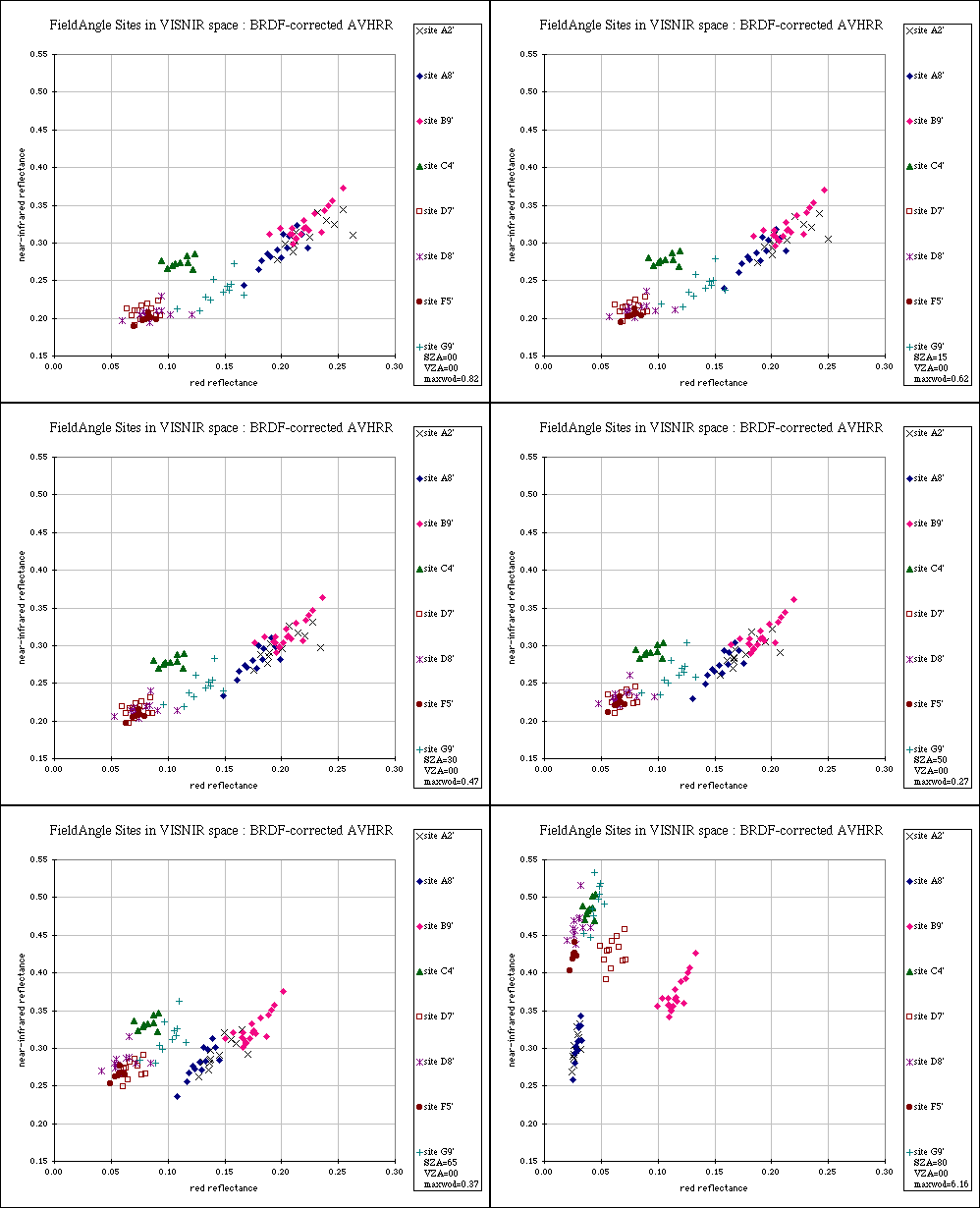

Compare with the uncorrected data. More information on the sites (including codes, photos, maps) is given on this page.
The animated scatterplot above shows atmospherically-corrected and
cloud-screened reflectances for eight point sites from 21 orbits from
the period 3rd to 19th August 1996, adjusted for BRDF effects to
represent the best estimate of what would be obtained with nadir
viewing and different solar zenith angles in the principal plane
(SZA=solar zenith angle, VZA=view zenith angle). The maxwod value is
the maximum
weight of determination,
a quantity describing the noise incurred on modelling to each target
geometry, given the angular sampling used in model inversion; this is
based on theory originating with Gauss. As the solar zenith angle
increases, the potential for discrimination between the classes (grassland
types) also increases, although there is a penalty to pay in terms of
increased noise, with the maximum weight of determination exceeding 1.00
when the solar zenith exceeds about 70 degrees. Nevertheless, the
improvement over
uncorrected data is massive.