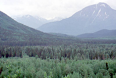
The Cassair Highway runs north to south from the border of the Yukon and British Colombia (60º N) to the junction with the road to Prince Rupert (54º N). The scenery on this road is absolutely magnificent. As you drive south the vegetation slowly changes from typical short boreal, the trees getting larger and larger, more deciduous and other species of spruce start to appear. The road is quite rough in parts, other parts are newly paved and some are compacted dirt. Thankfully this road is not as traveled as the Alaska Highway and so stopping to take pictures is easier.

The lack of traffic (especially on the way down) meant that we saw a lot more wildlife on and next to the road. On the way we some dall sheep (looking very much like scruffy domestic sheep) and lots and lots of black bears (also one brown bear). The black bears below were a mother and teenager browsing on the side of the road.


As the road meandered down south it passed through some wonderful carved glacial valleys. In most of the valleys (especially in the northern parts) the forest was completely untouched and wild. The road offered some magnificent views and some handy pulloffs so that the occasional truck didn't flatten you.

The road passed over some quite varied terrain - from low areas in valleys
to passes over 4000 feet. It was on this pass that we saw the dall sheep.
On all of the mountains in area were still covered in snow (down to about
4500 feet). In the area there a lot of finger lakes - some 40-50 miles
long - beautiful, clear waters fringed by spruce and alder.

