This information may not be accurate or current and is not valid for navigation, flight planning, or for use in flight. Always consult the official publications for current and correct information. No warranty of fitness for any purpose is made or implied. If you find errors in the information provided, here is how to report them.

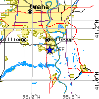
   Lat/Long: 41-07-05.995N / 095-54-45.041W
             (41.1183319 / -95.9125114)
             (estimated)
  Elevation: 1048 ft. / 319.4 m (surveyed)
  Variation: 06E (1985)
  From city: 8 miles SE of OMAHA, NE
      Facility use: Private use
   Sectional chart: OMAHA
     Control tower: yes
             ARTCC: MINNEAPOLIS CENTER
               FSS: COLUMBUS FLIGHT SERVICE STATION [1-800-WX-BRIEF]
   NOTAMs facility: OFF (NOTAM-D service available)
        Attendance: MON-FRI 0600-2200, SAT-SUN 0700-1900
  Pattern altitude: VFR RECTANGULAR TFC PAT 2500'; OVERHEAD TFC PAT 3000'.
                    OVERHEAD TFC REMAIN WITHIN 5 NM.
  Segmented circle: no
            Lights: DUSK-DAWN
            Beacon: white-green (lighted land airport)
       Landing fee: no
Airline operations: not certified under FAR Part 139
  Int'l operations: not permitted
                    ACFT ARR FM FOREIGN AREAS CONFIRM ETA & CSTMS RQR ONE
                    HR PRIOR NTC THRU FSS.
           ATIS: 126.025 [0500-0000]
                 273.5 [0500-0000]
  OFFUTT GROUND: 121.7
                 275.8
   OFFUTT TOWER: 123.7
                 348.4
 OMAHA APPROACH: 120.1(WEST)
                 124.5(EAST)
                 263.0(EAST)
                 363.8(WEST)
                 349.1
OMAHA DEPARTURE: 120.1(WEST)
                 124.5(EAST)
                 263.0(EAST)
                 363.8(WEST)
        CLASS C: 124.5(EAST)
                 263.0(EAST)
     CLASS C IC: 120.1(WEST)
                 363.8(WEST)
      COMD POST: 311.0
                 321.0
          EMERG: 121.5
                 243.0
            GCA: 340.9
                 372.8
                 378.8
           PMSV: 344.6
        RAF OPS: 318.7
       RESERVED: 135.35
            SFA: 335.5
  VOR radial/distance                 VOR name   Freq   Var
  -------------------  -----------------------  ------  ---
  OVRr242/8.5                     OMAHA VORTAC  116.30  08E
  LNKr064/39.3                  LINCOLN VORTAC  116.10  09E

  NDB name                    Hdg/Dist  Freq  Var  ID
  --------------------------  --------  ----  ---  -------------------
  PLATTSMOUTH                 354/10.0   329  07E  PMV  .--. -- ...-
  MILLARD                     111/10.2   371  06E  MLE  -- .-.. .
  RED OAK                     278/30.4   230  04E  RDK  .-. -.. -.-
  NEBRASKA CITY               351/30.9   347  05E  AFK  .- ..-. -.-
  SHENANDOAH                  309/31.3   411  05E  SDA  ... -.. .-
  WAHOO                       096/31.8   400  07E  AHQ  .- .... --.-
  FREMONT                     120/33.8   311  06E  FET  ..-. . -
  HARLAN                      218/37.8   272  05E  HNR  .... -. .-.
      Fuel available: 100 B+
                      F18 FUEL NOT FOR SALE TO PUBLIC.
    Airframe service: MAJOR
  Powerplant service: MAJOR
      Bottled oxygen: LOW
         Bulk oxygen: LOW
                    Dimensions: 11700 x 300 ft. / 3566 x 91 m
                       Surface: concrete/grooved
            Runway edge lights: high intensity
                                RUNWAY 12                RUNWAY 30
               Traffic pattern: left                     left
                Runway heading: 123 magnetic, 129 true   303 magnetic, 309 true
                      Markings: precision instrument     precision instrument
            Markings condition: good                     good
                      Latitude: 41-07-46.995N            41-06-32.996N
                     Longitude: 095-55-31.043W           095-53-32.038W
                     Elevation: 1048.0 ft.               971.0 ft.
        Visual slope indicator: 4-light PAPI on left     4-light PAPI on left
                 RVR equipment: touchdown                touchdown
               Approach lights: NSTD                     NSTD
                                & 30 NSTD ALSF-1; APCH
                                LGTS TERMINATE 1000 FT
                                PRIOR TO DSPLCD
                                LANDING THLD.
  Runway end identifier lights: yes                      no
             Centerline lights: no                       no
           Instrument approach:                          ILS
           DISPLACED THRESHOLD: yes                      yes
                   DT distance: 1000 ft.                 1100 ft.
               Touchdown point: no                       no
                  OBSTRUCTIONS: NONE                     RR
                Slope to clear:                          18:1
       Distance from threshold:                          450 ft.
Additional obstruction remarks:                          50+-1 FROM DSPLCD THR.
  Ownership: U.S. Air Force
  Owner: USAF                           Manager: CHIEF OF AFLD MANAGEMENT
         3902D AIR BASE WING/SAC/                3902D AIR BASE WING/SAC/
         OFFUTT AFB, OMAHA, NE  68113            OFFUTT AFB, OMAHA, NE  68113
                                                 Phone: 402-294-2793

      Inspected by: Airport owner
Last owner mail-in: 01 January 1977
     Aircraft based on the field: 2      Aircraft operations: average 168/day
                        Military: 2                             100% military
AirNav created by Paulo Santos, <pas@airnav.com>
Copyright © 1996-1999 Paulo Santos. All rights reserved.