| Account |
Image |
Start with a detailed topological map of the local area.
Find out the following:
- Datum
- Grid Scheme
- Contour Interval
This one uses a UTM grid, GDA1966 datum and 20m contour interval |
 |
Eyeball the route you will take, considering:
- Interesting Landmarks
- Steepness of contour
- Elapsed time to complete
- Temperature
- Provisions required
|
 |
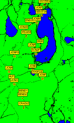
| Mark significant waypoints of your primary route
(start point, car, junctions , end point)
See table at the end of this page with each waypoint,
note there will be a symbol, short name and a longer comment
associated with each waypoint. In the comment you might
include:
|
 |
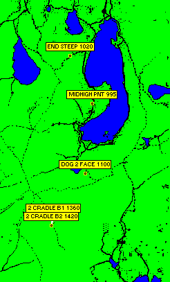
| Enhance your route waypoints by including midpoints
or sudden changes in steepness , doglegs (switchbacks).
On long or steep sections it is nice to know when you
are halfway |
 |
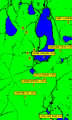
| Add waypoints for surrounding landmarks
(nearby peaks, emergency shelters, ranger station)
at each waypoint consider how your would abort the route and
return directly to the start or safe point.
Add proximity waypoints indicating dangerous points such
as steep sections or wrong way tracks |
 |
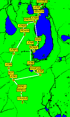
| Program the sequence of waypoints into a route |
 |
| Walk your route. The walk is broken down to a series
of smaller walks from waypoint to waypoint.
Here we are approaching Little Horn |
 |
| Record your track log. Along the way mark any interesting points
as a temporary waypoint |
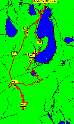 |
| Compare the final track log with the route.
If you had accurately defined your waypoints, your track log should
closely co-incide with your waypoints. Steep or densly covered
areas may reduce the GPS signal quality and introduce anomolies
in the track log. |
 |
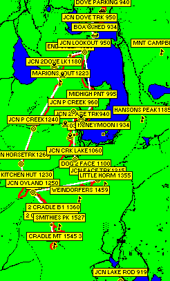
| Here is everything on the one map, a little crowded |
 |
All walkers must register before walking.
The Park Ranger will use this information such
as leader and number in party when searching
for bodies.
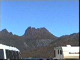
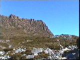
View of the summit from the registration booth.
I recommend that if you cannot see the summit then
do not attempt the climb, wait until a clear day ( very rare )
Cradle Mountain Summit Route II
|
|
|
|
|
|
|
|
Waypoint
|
# |
Map Grid
UTM
55G
(Datum GDA66)
04easting
53northing
|
name6 |
comment16 |
Elevation
(m)
|
Temp
Prid |
|
|
|
123456 |
1234567890123456 |
|
|
| Ranger Station & Visitor Centre |
|
10760 94400 |
ranger |
ranger stn 800 |
800 |
4-14 10 |
| Waldheim Car Park Walker Registration |
|
11960 90640 |
walreg |
waldheim park900 |
900 |
4-14 10 |
| Dove Lake Car Park Walker Registration 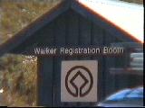
|
1
21 |
13380 88400 |
dovreg |
dove parking 940 |
940 |
3-13 9 |
| Junction Dove Lake Track/Dove Lake Cir |
2
20 |
13160 88150 |
jcnt |
jcn dove trk 950 |
950 |
3-13 9 |
| Boat Shed |
3
19 |
13260 87990 |
boatsh |
boat shed 934 |
934 |
3-13 9 |
| Junction Marions Lookout/Dove Lake Tr |
4
18 |
13090 87720 |
jcnm |
jcn lookout 950 |
950 |
3-13 9 |
| Marions to Ballroom dove track hightest point |
5 |
13220 86880 |
high |
midhighpoint 995 |
995 |
3-13 9 |
| Junction To Face Track/Dove Lake |
6 |
13070 86550 |
jcn2f |
jcn 2face trk940 |
940 |
3-13 9 |
| Junction Plateau Creek/To Face Track |
7 |
12910 86740 |
jcnp |
jcn p creek 960 |
960 |
3-13 9 |
| ballroom forest wrong creek1 |
|
13040 86660 |
xc |
wrong way creek |
960 |
3-13 9 |
| ballroom forest/plateau creek 2 far up |
|
12780 86540 |
xp |
wrong way p creek |
1020 |
2-12 8 |
| ballfrom forest too high |
|
12860 86340 |
xs |
wrong way spur |
1060 |
2-12 8 |
| Junction Rodway Track/Dove Lake |
|
13720 87910 |
jcnh |
jcn hansons |
960 |
3-13 9 |
| Hansons Peak |
|
14080 86630 |
peakh |
hansons peak |
1185 |
|
| Honeymoon Islands |
|
13420 86380 |
island |
honeymoon i 934 |
934 |
|
| Mount Campbell |
|
14390 87740 |
peakc |
mnt campbell1248 |
1248 |
|
| Junction Kitchen Creek/To Face Track
Lake Wilks in the background on the way to the face track.
Tip: on a hot day
take a dip in the lake to cool down
On a cool day you will freeze This is where we turned
back on our first attempt. Visibility to Honeymoon island in
dove lake was only intermitant and temperature
was 8 Degress celcius with an icey
wind.
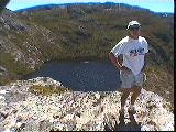
|
8 |
12940 85950 |
jcnk |
jcn crk lk 1060 |
1060 |
2-12 8 |
| Dogleg in dove to face track 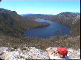
|
8.5 |
13120 85740 |
dogfce |
dog 2 face |
1100 |
2-12 8 |
| Junction Face Track/To Dove Lake |
9 |
13330 85620 |
jcnf |
jcn facetrk1215 |
1215 |
0-10 6 |
| Little Horn |
|
13460 85550 |
peaklh |
little horn1355 |
1355 |
|
| Weindorfers Tower |
|
13040 85300 |
peakwe |
weindorfers1459 |
1459 |
|
| Junction Overland Track/Face Track |
10
12 |
12240 85410 |
jcno |
jcn oland 1250 |
1250 |
0-10 6 |
| Junction Rodway Track-Emergency Shelter/Face Track |
|
13710 85900 |
jcnr |
jcn rodway-emer |
1100 |
|
| Kitchen Hut 
|
13 |
12140 85540 |
hut |
kitchen hut1230 |
1230 |
0-10 6 |
| Smithies Peak |
|
12700 84840 |
peaks |
smithies pk 1527 |
1527 |
|
| 2 cradle bend1 |
10.4 |
12600 85010 |
bend1 |
2 cradle bend1 |
1360 |
(-1)-9 5 |
| 2 cradle bend2 |
10.5 |
12560 84880 |
bend2 |
2 cradle bend2 |
1420 |
(-2)-8 4 |
| Cradle Mountain (peak) 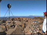
|
11 |
12630 84540 |
cradle |
cradle mtn 1545 |
1545 |
(-3)-7 3 |
| Benson Peak |
|
12700 83260 |
peakb |
benson peak1368 |
1368 |
|
| Junction Lake rodway/rodway track |
|
13740 83960 |
jcnlr |
jcn lake rodway919 |
919 |
|
| Junction Horse Track/Overland |
14 |
12040 85870 |
jcnh |
jcn horse trk1260 |
1260 |
0-10 6 |
| Junction Plateau Creek/Overland |
15 |
12240 86450 |
jcnpo |
jcn p creek1240 |
1240 |
0-10 6 |
| Marions Lookout |
16 |
12690 87220 |
peakm |
marions lout1223 |
1223 |
0-10 6 |
| from marions to dove steep left |
|
12580 87500 |
xl |
steep l |
1160 |
|
| from marions to dove steep right |
|
12720 87340 |
xr |
steep r |
1160 |
|
| End steep track marions to dove |
17.5 |
12840 87660 |
endst |
end steep 1020 |
1020 |
2-12 8 |
| Junction to Dove Lake/Overland |
17 |
12580 87410 |
jcn2d |
jcn 2dove lk1180 |
1180 |
1-11 7 |
| Wombat Peak |
|
12210 87880 |
peakw |
wombat peak1105 |
1105 |
|
| Crater Peak |
|
11600 87300 |
peakc |
crater peak1270 |
1270 |
|
|
|
|
|
|
|
|


