To Murphy Hogback campground. Riding: 33.19 miles, 1960', average 9.6 mph. Hiking: 4 miles, 130'.
Up as soon as it was light enough to see, about 6:45. On the road before 8:30. As with yesterday, I’m the only one eager to get out and ride. Fine with me. The only other way I could ride alone is to dawdle, and I don’t want the sag breathing down my neck.
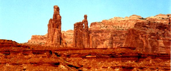
People at camp last night were talking about Washer Woman arch and Monster tower, saying they weren’t sure which one was which. Maybe they didn’t see the angle I saw – it was sure obvious to me!

Tom also went down Lathrop canyon yesterday. He looked pretty bad when he got back – overdid it. Took an ibuprofen, then had a beer – they didn’t mix very well, so he was in even worse shape last night. Happy to report he was okay this morning.
Here’s Monument basin from the white rim road.
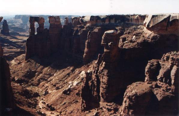
It occurs to me that if there are ever earthquakes in this part of the world, they must bring down a lot of delicately balanced rock! Conversely, when one of these big guys does come down, for whatever reason, it may create enough seismic effect to trigger its own secondary rockfalls.
Figured I had time to take the scenic side road, got several more pictures from there. Walked all the way out to the end of the point – the last two rocks were isolated chunks of white rock balanced atop red columns. First a step across a foot of open space, then a jump across about 18". About 500' straight down through the cracks. Gulp! That’ll give me a cold sweat whenever I think of it, tomorrow and tomorrow, and tomorrow. Glad Jacky wasn’t there to see.
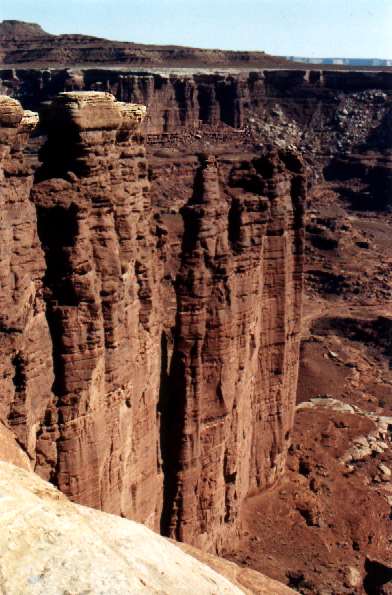
There are actually several layers of the hard white rock.
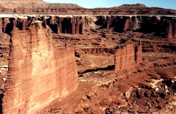
Rode on to White Crack camp, where we had agreed to congregate for lunch. After my side trip I figured I’d be the last one there: the place was deserted. Scrunched up in the shade of a juniper to wait, updated my diary. After yesterday’s experience, I brought a third water bottle today. Good idea – I was well down into it before anyone showed up.
After sitting around an hour, I wandered out on the rim (skipped the last two rocks this time). More great views.
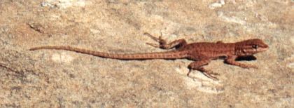
Pat said she hadn’t seen many lizards. But they were there if you watched for them…
Good view of The Loop on the Colorado river, especially the teardrop-shaped high place in its center. I wondered why the narrow place is low, even though the river hasn’t yet cut through it; finally decided a concept like angle of repose applies to solid rock as well as loose material: the neck was simply too narrow to support a full-height web at the angle of repose characteristic of that particular flavor of solid rock. The topo map shows a smaller teardrop island behind the big one, same story, but not visible from White Crack overlook. Can’t quite see the river, either.
I am but a child of my time. Just as I shall never be able to hear the Dance of the Hours without an unbidden mental image of hippopotamice in tutus, I cannot see country like this without thinking of Wile E Coyote and Beep-Beep. It’s hard to realize that the cartoons are not exaggerations.
Everyone showed up. My juniper shade got crowded. Someone found some flint fragments, chipped with a sharp edge. Butterscotch color, clearly not native rock. Later I heard that they found a number of fragments, darker colored, and possibly a tool for chipping the rock. Apparently the local Indians had traded for someone else’s flint with whatever they had (what they had was a juniper and an invigorating view: maybe their stock in trade was gin and tonic).
Once again I left early. The road follows the white rim, then climbs (walker) to a shoulder in the red rock, then climbs (walker) again to another shoulder, then climbs to Murphy Hogback. That last climb, even though only about 400', was not one walker but three – whenever the grade evened out, I got back on the bike. Toward the top, the surface actually offered enough traction that I could have stayed on the bike – but my heart rate red-lined, so I walked up that one too. About 1:30, high 80s.
Turned in at the first campsite. A bunch of bikies offered me a refill of the water bottles and I accepted gratefully.
From the Hogback, there’s a view of the Green river. The country on that side looks (from this distance) much tamer. The high point in the picture is Candlestick tower; in front of it is the Soda Springs basin. The White Rim road is just visible here and there along the near edge of the basin.
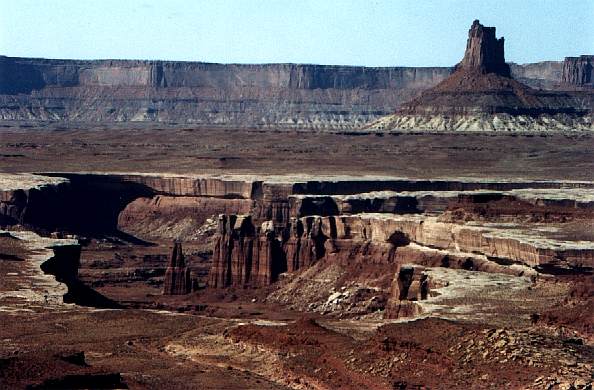
Pleasant place: 5300', cool breeze, junipers, bare rock. We’re in campsite C, right at the top of the northwest rim. Soil more a brownish gray than red (my bike looks badly rusted from the red dust coating everything). Biting flies – maybe I’ll put up the tent tonight.
Decided to hike up Murphy trail. I didn’t have lots of water, and I only had cycling shoes, so I wasn’t going to climb the switchbacks to Murphy point. But the Hogback itself is virtually flat. It’s about two miles each way to the foot of the talus. The Hogback necks down to about 500' wide, offering long views in both directions from the same point on the trail. Nice walk.
Everyone at camp when I returned. Our neighbors include some manufacturer’s people. They had some test designs, funny bikes – Cannondales. Some of them were at the base of the last section of grade trying to ride all the way up. While I was watching, no one did.
There was a 5-gallon can of Moab water, which though potable, tasted so bad that we only used it for washing. Someone had a shower attachment for a water bottle; there was a sandy spot surrounded by waist-high rocks suitable for use as tables; we took it in turns to wash up.
Tonight was “our” turn to sponsor a meal. Pat and Mark did all the work, with a few of us hovering around making little helpful gestures from time to time. Mexican food, shredded beef, spicy chili. Pretty good. Beans were guaranteed to be non-flatulent – what fun is that? I asked for my money back.
I’m surprised that my appetite is so moderate – upon reflection, this tour really isn’t that difficult: 40 miles and 2000' per day. Even with the heat and the occasional walker, it’s nothing like the exhaustion I routinely inflict upon myself on weekend rides.
Every night the moon rises an hour later. The darkness was especially nice tonight – lots and lots and lots of stars. Milky way clearly visible, even its irregularities. Tom turns out to be quite the amateur astronomer. He had binoculars and a star chart and was helping people find M31, our sister galaxy. My eyes just aren’t good enough, sorry to say. Best thing I saw was a meteor. Still glad I wore standard bifocal glasses – gave me a lot better view of the sky than I would have had with the usual progressives. That’s why I wore them.
To Denver. Rode (est) 35 miles, 1940'.
Jerry offered a convincing demonstration that “snore” and “snort” are derived from the same root. Really talented. Too bad I didn’t camp at the other side of the site!
Volunteered to drive sag this morning. Time to take my turn. Everyone headed out, some walking down the initial grade. Dan K crashed. Covered with dust, skinned knee. Someone started down with his rear wheel already locked up – fortunately he made it!
This Jeep is a big vehicle, maybe the biggest I’ve ever driven. First time with a 4WD. Fifty feet from where I started, I stuck the nose out into space, swallowed hard, and drove over the edge. A true act of faith.
That thing has a high hood! Left turns aren’t so bad, because I can lean out the window. The ones I hated were the steep climbs, foot down hard, nothing but sky ahead, nothing but sky on the left, and a hard blind right at the top! Fortunately I encountered no other traffic during my shift. Acquired considerable respect for 4WD – that damn thing went over stuff I wouldn’t have thought possible, and I surely wasn’t pushing its envelope.
Charlie drove the other sag, far enough back to avoid eating my dust. As we started to catch up with riders, we’d stop and look out across Soda Springs basin.
The idea was that we’d change drivers at Candlestick camp, but Mark kindly waited for me at the top of a rise before then. I was more than happy to give him the Jeep. Charlie found that none of his crew had waited at Candlestick. So he went on to catch a victim.
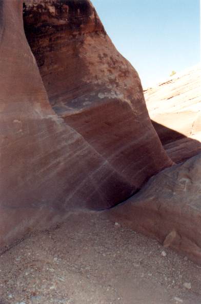
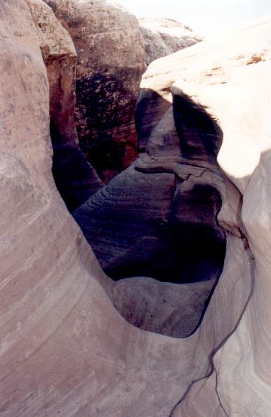
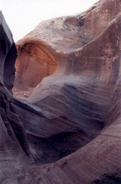
Turns out everyone was stopped at Wilhite trail. On my bike now, I stopped too, of course. To the right of the road it’s a trail; to the left, it’s a slot canyon, beautifully eroded by flash floods. It would be quite a sight to see water roaring down here! I entered at the road, descended until I reached a wall I thought I couldn’t climb back up. Called it good, since I didn’t know what I’d be committing to if I couldn’t return. Turns out most of the people had gone further down along the rim before descending into the canyon, so they saw the lower section. Not complaining – the part I saw was pretty awesome!
Rode on before most of the others. Pretty much alone again, sag well off my back. This is the Green river at Beaver bottom, where the road first comes out directly over the water.
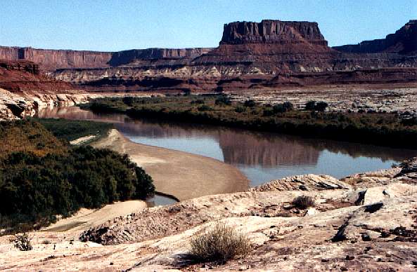
Everyone congregated for lunch at Potato bottom camp. Nice: one big cottonwood and tamarisks dense along the shore. Tunneled through the tamarisks to the river. Although it looks motionless from a distance, bits of foam on the surface revealed a speed of three or four miles per hour. Green muddy water. Pat went in, talked about swimming to sandbar opposite, but didn’t. I’m told that she pulled Charlie in after I had gone on.
Climbed over the tip of Bighorn Mesa – walkers here, too. The downhill side of this ridge was deep in soft sand. Rode it down, white knuckles all the way. Trying to brake the rear wheel without locking it up; too steep to use only the rear brake – gentle but firm on the front brake – keep the steering straight! Made it!
Hardscrabble Bottom is mis-named, at least as far as the road is concerned. It’s all deep soft sand. Good practice at steering a straight line, trying to stay within a pre-existing rut. Sand was deep enough that my pedal frequently dipped in. If you drift out of your rut, you stop, the foot goes down, you walk until you find a shallow section.
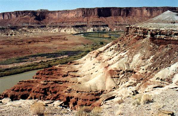
Met four cyclists stopped for water break – one of the bikes was a tandem. Met a ranger, equipped for everything – he had a mountain bike in the back of his pick-up. Later, the sag drivers said he had stopped them and chatted – checking them out, but in a friendly way.
Caught up with a couple more of our group. One of them was Dave, who dropped out of school in tenth grade. Discovered nature through an Outward Bound program, turned serious, got his general equivalence certificate, finished his PhD in psychology a couple years ago. Thesis topic was the correlation (strong!) between attitude and health. I asked him how a psychologist makes money – what does he trade to whom? He said his major client was the state of Colorado. He evaluates patients and recommends a course of treatment. Does he ever recommend three days in the wilderness on a mountain bike as a course of treatment? “Yes,” he said, “but that advice is rarely followed.” Too bad.
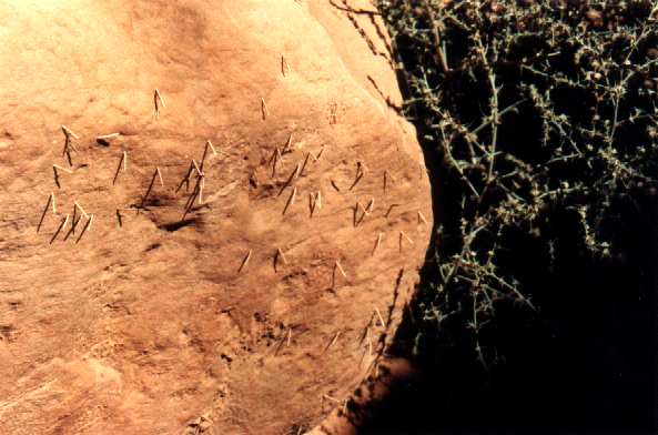
Stopped at Syncline trailhead at the foot of Upheaval canyon. While munching a granny bar, I noticed what looked like straws sticking out of the rock. About half an inch long, they’re not stuck into holes, but are flexibly glued onto the surface of the rock. I tried to split one with a fingernail to see what was inside. It was tough, not crisp like a straw, and I was unable to open it up. My guess is that they’re insect egg sacs of some kind…
From the map, I thought the Upheaval dome might be interesting, but the various views I got weren’t exciting. Maybe you have to be close in. From a distance, it’s round and lumpy, visibly different from the vertical columns of its neighbors, but not particularly symmetric or beautiful or majestic or anything else.
Along by Labyrinth camp to Woodruff bottom, the road runs along a narrow ledge just above the river, cliffs rising tight on the right. River wide, green, tamarisks everywhere. Red rock beyond, only sparse vegetation away from the river. Classic desert scenery.
A fast mountain bike passed me while I was stopped to suck on the water bottle. I caught up with him and his friend later at Horsethief bottom. They were stopped, getting psyched up for the climb. Went on ahead, expecting him to pass me on the hill.
After the stories I’d heard in camp, I expected this climb to be a real bitch, but it was only about 8%, uniform grade, good traction. These are within the envelope of my gearing, cadence and heart rate. And a little less than a thousand feet to boot. Only real difficulty was the temperature: 93°. So there was some huffing and puffing and sweating, but it’s all part of the day’s work. Topped out about 2:30.
The fast guy made it to the top a few minutes later. Chatted a few minutes while he waited for his friend. They had just done a down-and-back day trip from Horsethief point. Compared notes… turns out he grew up in Palo Alto; his father is a professor of geology at Stanford. Small world.
Figured I had an hour or so before everyone else showed up, so I decided to explore the little side road about a quarter mile up from the top of the grade. Long walker stretch of soft sand – so little traffic on this road there are no ruts, and the softness of the sand isn’t visible until you’re in it. Beyond the sand is hard rock with (dry) potholes, and beyond that, the edge. Not worth it! Nothing I haven’t already seen many times. Only interesting thing is the tracks of the little animals everywhere in the sand – field mice and ground squirrels.
Almost everyone was there by the time I got back about 3:45. Took my camera to a strategic point overlooking the last hairpin to see who else was coming up. Shirley rode up the last bit, but we know what happened before she got to that last bit!
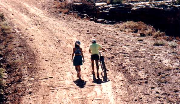
Sorted people and baggage into the right vehicles, said our good-byes. Drove to Moab for gas, only needed ten gallons. Of course, this is in addition to the six that we carried separately the first day.
Stopped again at the Dewey bridge. Dark by the time we reached Grand Junction. Went into Wendy’s – soap and running water – clean arms – heaven! Baked potato, chili. Peg (Tom’s wife) was in Grand Junction on business; she joined us. While we were there, the other two vehicles pulled in. Sometimes the world is so small it’s horrifying.
Mark and Tom took the air filter out of the Jeep, tapped it on the pavement, raised big clouds of red dust. We had been discussing the wisdom of carrying a quart of oil, maybe a fan belt and a radiator hose on future expeditions.
Thoroughly dark by now. Tom drove back to Morrison. I sat up front and tried to maintain a little conversation to help him stay awake. The other three dozed in the back, sometimes listened, occasionally joined in.
It was interesting to see a runaway truck ramp that didn’t go uphill – it was merely a lane with a foot of soft sand in it, barrels of sand at the end. I can certainly attest to the fact that soft sand absorbs energy in a hurry.
Arrived at Ken and Loral’s place in the wee hours. Tom stayed up to remove bike racks, then went on home, but my agenda (well past my bedtime!) was to do the minimum necessary unloading and queue for a shower. When I turned on the water, a swirl of red appeared at my feet as the dust rinsed off. Then I applied soap and got some really serious red! Great improvement, greatly appreciated. To bed.
Home. 22.97 miles, 100', av 15 mph.
Despite predictions about sleeping in, all four of us were up and about by 7:00 or thereabouts. I washed my glasses – this is great!
Coffee, OJ. Loral fixed pancakes for all, while Dan stirred up scrambled eggs. Dan is going to play a little golf with Loral before flying home later today. Mark will clean up the Jeep and go get a new air filter. Pat drove me to the airport.
After their efficiency at San Jose, United’s Denver operation was a great disappointment. It must have taken them half an hour to sell me a bike box. It turned out that they couldn’t take plastic for the bike box (in San Jose they did)… Loaded up the bike, checked it and the two panniers, went off to the Red Carpet club to update the diary, call the office to see if there were any interesting messages. Cycling attire in the Red Carpet club put me somewhere between the avant garde and the lunatic fringe.
These cycling shorts have to go. The seam in the crotch is failing; even worse, the lycra itself is starting to disintegrate. This is doubtless due to the stress it undergoes flexing over my mighty muscles, though if pressed, I would also admit that the UV in the sunlight might have something to do with it.
I had a row to myself on the plane, moved over to the window. Just as they started to button up the plane for takeoff, one of the baggage handlers came up in a hurry and handed in one of my panniers. Hmm… what would happen if the pannier with my tools didn’t make it and I couldn’t re-assemble my bike? Maybe next time I’ll keep at least a minimum subset of tools with me, or ship tools along with the bike itself. The only tool I need is a 6 mm Allen wrench – it fits pedals, handlebars, stem – would be easy to carry.
Nice view. The aspens of Colorado are bright enough to be seen from the air – they look like lichens on the ground below. The pilot said we were over Grand Junction heading for southern Utah. Will I see anything I recognize? Yes! The Island in the Sky! Well off on the horizon. Can see the Colorado river, can see The Loop with its teardrop island, can see the white rim. Cannot see the road, can only hazily see the Island itself, can’t see the Green river gorge because I’m looking across it instead of along it. Great!
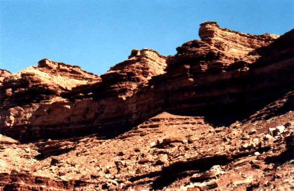
Later on saw a volcanic cone with a plug in it – I didn’t know there had been volcanoes in the Great Basin. Broken clouds over most of the Basin, solid over the high Sierra. San Jose had low threatening clouds, looked as if it could rain. Cold.
Guess what? The pannier I saw loaded at Denver was the only one that made the trip, and it didn’t have the tools in it. United was very efficient: as soon as they entered the claim check number into the computer, the computer told them the bag was in Lincoln, Nebraska. Great.
The option of last resort was to phone Jacky for a rescue. But first, let’s see if there’s something I can do. Started by sorting through my belt pack and rack pack to see if I happened to have an orphan Allen wrench. No. Asked United guy if one of their mechanics might have some metric Allen wrenches. He said they don’t use that kind of fastener on aircraft – probably true. He wasn’t eager to be helpful.
Put the pedals on. Finger tight is fine – riding only tends to tighten them. The problem was the handlebars and stem. Recalled the time I got to Boulder Creek before I discovered I’d done a dumb thing to my derailleur – got an assist at a foreign car shop… Ha! off to the rental car counter. Tried the two companies with no line of customers. One sends all their cars out for mechanical work. The other suggested I go out and ask the outdoors crew.
Good idea. I knew there was a reason I flew out of San Jose – the rental lot is a hundred feet away instead of two miles. Walked out there… Avis fellow pointed me across the street to a Hertz maintenance center.
Walked in, told my story to the woman sitting by the door. She disappeared in back, took a long time, came back somewhat apologetically, said it had taken a long time to find wrenches. One of these universal sets, a dozen sizes all together in one. Watched while I put the bike together. Gave her a big round of thanks – told her she was a lifesaver!
Stopped off on my way home to drop film for processing. Home, unloaded bike, started tidying up, putting things away. Took a shower. As I emerged from the shower, the doorbell rang. Peeked out the upstairs window: a courier from United with my pannier. 5:30 PM. From the tags, it went back through Denver on its way to San Jose. I guess I can’t be too grouchy when they fix it that quickly.
Great trip! Charlie said Canyonlands is the ultimate mountain bike experience. Does that mean it’s all downhill from here?