|
They finally got around to officially dedicating the extension to the bike
path recently. So I thought I would share a few pictures with you.
A bit over a year ago I posted an entry with some pictures of the bike path -- those pictures were taken at the Amtrak Station end
of the bike path. The path is laid out following the abandoned roadbed
of the Narragansett Pier Railroad, which ran from the New York. Providence,
and Boston Railroad station in West Kingston (now the Amtrak station) to
Narragansett Pier, a resort community on Narragansett Bay, a total of about
eight miles. (Railroad service began in 1876, carrying both passengers
and freight; passenger service ended in 1952 and the entire line was abandoned
in 1981.)
The first phase of the bike path ran from the train station (well, actually
from the end of the station parking lot) down to the village of Peace Dale,
about four miles. Phase two, just completed, continues through Peace Dale
and down through the center of the village of Wakefield, ending at Rt.
108. The third phase, coming in another year or two, will extend the path
to Sprague Park in Narragansett. The path can't continue the remaining
mile or so to the bay because that part of the railroad roadbed has long
since been covered by streets and houses. There is a proposed additional
phase being discussed, to continue the path from the park to the South
County Museum property.
 |
Here's where the new end of the bike path starts -- Rt. 108 (Kingstown
Road) -- I'm standing on the other side of the road, looking toward the
beginning of the bike path. This is a heavily travelled road (I took this
picture on a Sunday morning and it took me two tries to snap one without
a car in the way) and that traffic light will be needed when the future
extension to Sprague Park is built.
For a block or so we have trees on one side and the back of a small retail
center on the other, then we are get to have trees and greenery on both
sides. |
 |
This where bicyclists will have to cross Main Street. (See where that car is entering Main Street from the left; that's about where I was standing when I took the first picture in reporting about our town's Block Party in early August. That is a blinking yellow caution light and there are
signs up telling motorists to watch for bicyclists; however, this is one
of those spots where caution is needed. |
 |
Shortly after after crossing Main Street (and I do mean shortly, maybe
fifty or sixty yards) the path crosses the Saugatucket River (where the
old railroad bridge used to cross) on a new bridge build for the bike path.
This picture is the view to the left when crossing the bridge. That bridge
in the distance is a pedestrian bridge that crosses from the municipal
parking lot (behind a row of Main Street commercial buildings) to the fields
and playgrounds behind Wakefield Elementary School on the opposite side
of the river.
The picture below is the view to the right when crossing on the bike path
bridge, looking upstream along the Saugatucket River.
The trees that line the river banks make it seem as if this is flowing
through wooded countryside, but this is what passes for an urban core around
here. |

 |
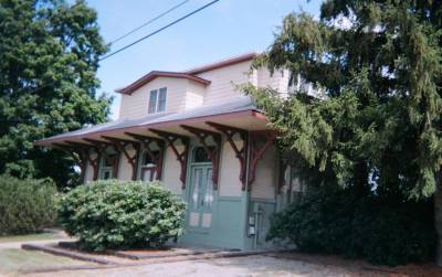
In a little bit after crossing the river, the path follows an actual street
for a long block -- where the old right of way was buried beneath parking
lots and warehouses -- One side of the street is residential but the other
side has but a single home... this one, the old Peace Dale train station,
now restored as a private home. |
 |
There are a couple of spots where caution must be used in crossing busy
streets -- and a spot where a pair of steep 180 degree turns had to be
employed to climb up a hill (there had once been a railroad bridge there,
but it was torn down twenty years ago and would have cost too much to rebuild
it).
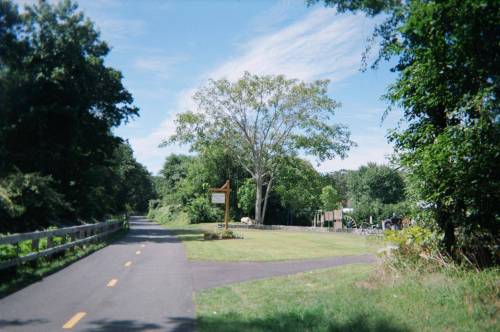
This picture is just past where we join up with the "old" bike
path. On the right is a small neighborhood park: a playground, some benches,
and a basketball court. |
Well, that's it.... hope all these pictures didn't take too long to download.
|
