My Road Trip from LA to Ohio - August of '02
DAY 1 - LA to Las Vegas
The trip got off to a rather inauspicious start. After leaving 4 hours later than I had wanted, things just cascaded. First, I had to revise my plan (what there was of it), as I was not going to get into Utah in one evening’s drive. Especially when my departure happened to coincide with LA rush hour. So I decided Vegas would be as far as I would go.
I figured I could make it by 11 p.m., giving me an hour for the black jack tables and some time left over to figure out the new camera. Well, I didn’t make it in until after midnight. There was this little episode where I almost ran out of gas in the middle of the desert 10 miles from any civilization or major road.
It all started when I pulled into Barstow with an eighth of a tank and famished for some In-N-Out. I was so hungry, unbelievably hungry. Of course, In-N-Out was crowded, and it took a good ten minutes for me to get my Double-Double. By the time I finally got the burger (oh so good), my mind had been washed clean of all other things. So in my satiated bliss, I forgot to fill up on my way back to the freeway. 20 minutes and 20 miles down the freeway the burger’s mind numbing effects wore off, and I suddenly remembered the gas. A quick check of the trip computer told me that I had “30 miles till empty.” At this point I had no idea how far the next exit would be and if there would be any gas. Flipping a U-turn through the desert median wasn’t an option, so all I could do was pray.
About five miles down the road there was an exit that said it had gas, food, and campers. When I got off the ramp, there were no legible signs other than an arrow to the right for “campers”. Since there appeared to be nothing to the left, I went right. It was the straightest, emptiest road I’ve ever seen. But I could see some lights way off in the desert night. Six miles down the road and nothing has changed. Now the computer says “20 miles till empty.” The road turns to the right and then left, and then I see the sign for RV campers unlit and not looking promising. “15 miles till empty.” At this point I figure I can still make it back to the freeway before breakdown, which is better than risking that I MIGHT find a gas station out in the middle of nowhere. If I ran out of gas out there… well, I don’t really want to think about it.
So I turned around. As I crossed over the freeway to head back towards Barstow, I noticed that had I turned left as I got off the exit originally, I would have seen that the “gas” and “food” referenced in the exit sign was for a defunct truck stop all but invisible in the darkness. So I get on the ramp to head back toward Barstow. SIX MILES TILL EMPTY! All the stopping, going, and accelerating had eaten up even more gas. I passed another exit with another fake-out gas station. Luckily, with economical highway driving (drafting a big-rig doing 55), I stretched those 6 miles quite a bit. But how much luck was I going to need?
As I slowed for the California fruit patrol station, the computer ticked off the last mile: “0 miles till empty.”
The patrol guy told me I had to go another 5 miles. As I pulled out of the checkpoint, I took a real hard look at the analog gauge. I saw the faintest sliver between the dial and the bottom edge of the line denoting empty: a sliver of hope. I was riding on fumes and a prayer. With each mile, my hope grew. “At least the walk will be shorter” crossed my mind. Then I saw the exit only a mile away. Oh, what a beautiful site! I coasted down the off ramp and slid into the gas station.
There was an audible gasp as I removed the gas cap. It sounded very similar to the sigh that I had made just a few seconds prior. Before that night, the most gas that tank ever took was under 19 gallons. Now that number is over 20. I have the receipt to prove it.
DAY 2 (midnight to 2 am) - Las Vegas
I should have known that I used up all my luck for the night before I sat down at the Imperial Palace $5 black jack table just after 1 am. The only good thing to come out of it was my hundred bucks didn’t even last a half an hour - so I got to bed a little sooner. I admit, I got some perverse pleasure in gambling away money from the last of my unemployment checks.
Day 2 - Las Vegas to Moab, Utah
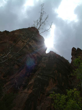
Friday was a new and glorious day. I had left Sin City behind me by 9 am. At noon, I had lunch in Zion National Park. The contrast in spirituality was as disparate as the names. When I entered Zion, I purchased the $50 National Parks pass that gets me admission to all the Parks for one year. I intend to get a much better return on that investment than I have in the stock market. I also took my first pictures with the new camera there.
I then continued along the scenic route through Bryce Canyon National Park. I was disappointed that I didn’t need my new Pass to gain entry to that part of the park. But it was beautiful none the less. I was also impressed with Red Canyon in Dixie National Forest, which I passed through just before entering Bryce. I ran into some rain coming out of the Park and realized I was in need of new windshield wipers, something that can go unnoticed in a Southern California summer. It was not very easy to find a place that sold replacement blades along the scenic route. It was probably about my fourth stop until I had any success.
That was just after passing though Capitol Reef National Park (no need for the pass here either). Capitol Reef consists of the remnants of an old Mormon settlement in a canyon with a large dome formation that bears resemblance to the Capitol building in Washington. Not much is left of the settlement other than a restored schoolhouse and the fruit tree orchards that are now maintained by the park’s rangers. You can pick your own fruit there for a small fee.
After passing through my third National Park of the day, I had some serious driving ahead of me to make it to Moab. It took 5 hours of solid driving, half on state routes and the other half on I-70, to make it into Moab by 11. Unfortunately, I wasn’t able to check out the nightlife and the 3:2 beer because I had a big day ahead of me.
DAY 3 - Moab to Denver
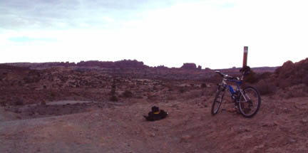
Morning came early. I was out of my flea bag motel by 7 and on my bike by 8. The ride was the Klondike Bluffs Trail: 14.4 miles there and back with a hike into Arches National Park (no Pass required and no bikes). The ride up was a little rough for my untrained cardiovascular system. I walked about 2 miles of the trail, including almost the entire slickrock ascent. “Slickrock” is the name for the sandstone rock that mountain bikers the world around travel to Moab to ride. I also decided to walk over some of the more technical aspects of the trail since I was by myself and didn’t want to face-plant with out someone to go for help if needed.
The hike into Arches was awesome. The view was magical. It was so silent. I had the place entirely to myself (I passed some folks on my way in and later on my way out). I hiked the boulders that overlooked stunning rock towers rising 100’s of feet from the canyon floor. Then I ate a snack sitting on the top of a cliff overlooking a large valley with a number of stunning rock formations. What an experience!
Knowing that I had much further to go that day, I reluctantly hiked back to my bike at the Park border. It was now after 10, and the Moab biking book I bought said to try and be off the trail by 9 in the summer months or risk being baked. Luckily the sky was still slightly overcast with only occasional patches of direct sunshine coming through. The temperature was still pleasant, but I didn’t know how much longer it would last.
The ride down was intense. My triceps and quads ached from the constant crouch as I descended over 500 feet of elevation. It was difficult to control my speed coming down the slickrock, and at one point I caught full air when a drop off came up too quickly and I was forced to launch myself. It was awesome, but if I had eaten it there, I would have had a 4-mile hike with a mangled body and bike. At those speeds, my bike took quite a beating, but it held up pretty well. I did break off a toe clip by snapping the two screws that held it to the peddle - a bit of an inconvenience but an easy, inexpensive fix.
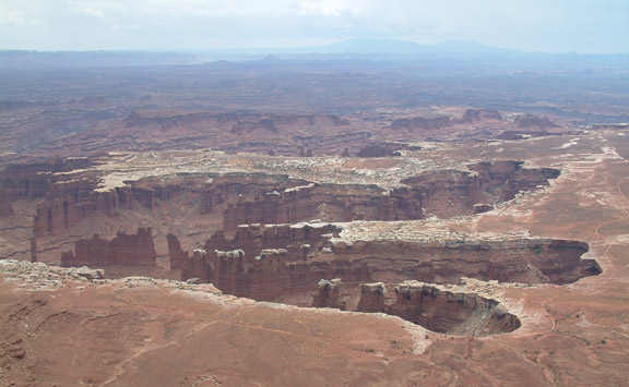
After the ride, I drove over to Canyon Lands National Park. The 30-mile drive to get to the park from the nearest state highway was amazing. I stopped numerous times along the way to take pictures. But the drive in was only a precursor. I was happy that my pass finally got me free admission. Immediately after I entered the park from the Island in the Sky entrance, I realized what the name meant. As I crossed a section called “the neck”, I could see that there were deep canyons on both sides of me. I drove directly to the Grand View point (12 miles from the entrance) that put me on the very end of the “Island”. I looked out at the canyons carved from the Colorado and Green rivers. What was most amazing was how both canyons were within a bigger canyon that this “Island” was standing above. It’s hard to describe, but believe me it was breathtaking.
On the way out of the park, I stopped at a number of sites. I enjoyed Mesa Arch the most. Since I didn’t see any arches when I hiked into Arches earlier, I was very excited to finally see one. It wasn’t very big but it framed the valley below and the far mountains beautifully. I also enjoyed the half-mile hike to get there. I found myself looking around for all the BIG sites that I almost missed the ones right next to me on the trail. On the hike back to the car, I began to notice the old juniper trees that the trail wound through. They looked like something out of a bonsai garden. Grey weathered trunks that looked like driftwood somehow had live green branches sprouting from their tortured wood. And to think I almost missed them; there’s a lesson there somewhere.
After Canyon Lands, it was a long drive to Denver. There was more rain and construction as I climbed up the Rockies and passed all the ski resorts. When I came down the other side I spotted a hotel that claimed rooms available for $19.95. It turned out that the real rate was $44 if you didn’t have a reservation. Whatever. I was tired and needed my rest. It seemed like forever ago that I was bolting down slickrock trying not to kill myself.
DAY 4 - Denver to Devils Tower
I decided I’d had enough of Interstate highways and wanted to see America. It was the right choice. I recently read that riding across the country using the interstate highway system was the one sure way not to see anything at all. So instead of taking Interstate 25 north into Wyoming, I hopped off onto US Highway 287. After Fort Collins, Colorado, I pretty much had it to myself. I was now in, what is accurately called, The High Plains.
As I continued north, the scenery consisted of rolling grassy hills with mountains off to my left and the occasional mountain range to my right. I passed through tiny towns with names like Medicine Bow, Rock River, and Bosler. I noticed the majority of roads I intersected were not paved. I relearned the excitement of passing another car on a two-lane highway when you weren’t sure if another car was coming around the corner or over the hill. Instead of exit signs with city names and municipal buildings, the signs pointed out “Scenic Overlook” or “Cow Crossing”.
It was just after turning onto Wyoming State Highway 487 that I really started to feel I was in empty land. At one point along a fairly long stretch of road, I wanted to stop and get a picture of the Shirley Mountains (my mom’s name is Shirley), but there was no shoulder or turnout to stop in. So I just stopped in the middle of the road. It wasn’t until I had taken the picture and had the car back in drive that a car crested the hill behind me. Think about that. Having driven for the past 6 years almost exclusively in Southern California, it blew my mind.
After a while I came upon the raging metropolis of Casper, Wyoming, and I had to get back on Interstate 25. 19 miles later I was off the beaten path again, cutting the corner along the state routes leading North through Thunder Basin National Grassland. I didn’t know there were “National Grasslands”, but I guess you can’t call it a National Forest when there are virtually no trees. Yep, I was definitely drifting in the High Plains now.
At the intersection of SR 387 and SR 89 was the small ranching town of Wright, WY. I stopped for gas and a bite to eat. I was nearly blown over by the wind when I got out of my car. With nothing to impede its flow, the wind can really get moving. I ate at a charming little restaurant for the road weary. Since they featured Bison from the local range, I went with the buffalo burger made from “America’s first meat.” While waiting for it to arrive, I entertained myself with the copy of “Roaming Wyoming.” There were copies at each of the tables. It was cheaply but effectively bound with a thick paper cover and staples. It mainly consisted of short stories and pieces of advice about the local ways. I found a humorous piece critiquing the wildlife policy on wolves, from the wolves’ point of view, very enlightening. The burger finally came. It was mighty tasty, I must say.
Back on the road trying to reach Devils Tower before sundown, I had to get onto I-90. But soon enough I was off again on US 14 and then SR 24. I was on the look for the Tower as I crested the hills, but I was looking in the wrong direction. Finally, from about 10 miles away, I spotted it. It was just BLAM! There it was, like liquid rock frozen and crystallized as it reached for the heavens.
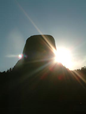
As the sun quickened its decent to the horizon, I rolled into the KOA campsite sitting just next to the lengthening shadow of the huge monument. I hurriedly pitched my tent to claim my space and biked over to the Park entrance. Standing at the entrance, the sun was perched along the side of the Tower and bursting around it like the beaming face of a child playing peek-a-boo.
My pass got me free admission, and I began the ride up to the visitor center on the opposite side of the Tower and a few hundred feet up. The sun was still illuminating the far side with its warm glow as it fell closer and closer to the western hills. I stopped along the way to try and get pictures of the prairie dogs popping out of their holes, but the sun was too low on the horizon and the shadows prevented me from getting the pictures I wanted. I had to race the sun now if I was going to get the pictures I wanted of the Tower. I stopped half way around (and halfway up) long enough to catch my breath and snap some profile shots of the tower.
As I climbed further up the road, some guys on their Harleys passed me on their way down. The last one must have been appreciative of my effort; he gave me the Harley wave. For those that don’t know (I only learned this fact a month ago), Harley riders wave differently than other bikers. They drop their hand beneath the handlebars and face their open hand to the opposing rider. The kind gesture gave the added encouragement I needed to get to the top.
Once there, I found I was now higher than the hills to the west. So I had another 20 minutes or so before the shadows would start climbing up the Tower. I used the time to catch my breath and admire the behemoth monument. That close and from that perspective, the Tower dominated my view. It was difficult to determine the immensity of its scale. Then one of the other people there pointed out a climber going up the Tower. The climber was a mere spec on this giant monolith. Having a reference point, I could now tell how truly massive the Tower was.
It was now sunset, and the park ranger began shutting down the Visitor Center. I decided I should get going before it got too dark and I would have to share the road with all the cars parked up there with me. The ride down was a breeze, literally. I actually got a little nervous at one point, thinking about the severity of road-rash I would get at that speed. I had seen deer on my way up and wondered what a deer strike on a bike would be like. Fortunately, I didn’t get to find out.
Back at the campsite I kicked back in my camp recliner and relaxed by drinking a couple beers, eating a snack, and strumming a few tunes on my guitar. The night sky bloomed with bright stars popping up around this big dark shadow in the sky. Later on, while gazing at the Milky Way, I saw some satellites whiz through the star fields. I also got quite a meteoric light show. One was bright green and fanned out at the end as if it exploded. At first I thought maybe it was a flare, but there was no sound, and flares have to go up before they come down. There was another falling star that slashed across the sky leaving a bright white scar that faded quickly, but longer than any other I have seen.
After a while, I crawled into my tent, wrapped up in my sleeping bag, and thanked God for all His wonders.
DAY 5 - Devils Tower to Theodore Roosevelt National Park
I awoke to a spectacular sunrise.
After snapping a few more shots, I packed up and hit the road. I had a short drive through the northeast tip of Wyoming, the northwest corner of South Dakota, and finally into the western end of North Dakota. The drive was easy and all by my lonesome. I passed more Harleys than cars. Apparently, the Sturgis Biker Rally was either ending or beginning.
I was on such a sparsely traveled road that they didn’t bother putting up a sign to welcome me to North Dakota. I just happened to notice that the state route signs were now marked with ND instead of SD. 49 down, one more to go.
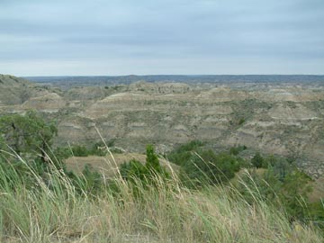
I made the southern section of the Theodore Roosevelt National Park just after noon. The northern section is another 100 miles or so farther north. I didn’t make it to that part of the park. I self registered at the campsite, pitched my tent, and then began the 30-mile loop of the park. The Park protects the North Dakota Bad Lands that Theodore Roosevelt (none of the Rangers there would refer to the man or the Park as Teddy Roosevelt) ventured to as a young man. He claimed that it was his time there that made him into the man he was, and that he would never have been president were it not for his time in the Bad Lands of North Dakota.
The term “Bad Lands” was from the Dakota Tribe that referred to the land as worthless. Being a nomadic tribe that followed the bison, they had little use for the hard to travel gullies, gulches, gaps, and ravines that mark the Bad Lands. They tell me the Bad Lands were formed eons ago by the rivers flowing down from the newly created Rockies. First, the rivers deposited the silt and soil from the mountains that make up the prairies of the high plains. Then, after building the land up, they began to cut it down - creating the drastic landscape that characterizes the Bad Lands. In the southern section of the Park, the work was done by the Little Missouri River.
So I took a few hours to drive the loop and stopped along the way for hikes to vistas, valleys, and other areas of interest. I also saw bison. At first it was one here, a couple there, a few more here. But then later, while checking out a vista over a big bend in the Little Missouri, I saw a whole herd of about 40 or 50.
To me the Park wasn’t as beautiful as the other parks, but it was just as impressive. This was unique and unspoiled land, desolate and untamed. I can see the attraction ol’ Teddy had for the place. It’s a place you can go to find out what kind of man you are.
I’ll keep my own conclusions to myself for now.
After the self-guided tour, I headed into town to call my folks and let them know I was still alive. It was almost dinnertime, so I walked around the little town for awhile checking out all the souvenir shops and such. I was wearing my leather cowboy hat that serves as my camping hat, and I felt a little silly walking around in real cowboy country with it. But it also felt good. People treat you differently when you’re a little scruffy, a little dirty, and you’re wearing a beat-up cowboy hat. Perhaps they notice you more and you present a little bit of a mystery. Or maybe I was just a little more conscious of people’s reaction to me. Either way, there was something I liked about it.
Feeling the cowboy thing, I decided I’d get my dinner at a tavern that actually had swinging doors. I went with a cool Pabst Blue Ribbon to wash my steak sandwich down. The place had the most pitiful salad bar I have ever seen. But then again, I never expected to find a salad bar in this place anyway. All it had was lettuce, baby carrots, and croutons with two choices of dressing: ranch (of course) and Italian.
Back at camp, I trekked over to the bank of the Little Missouri, just a stones throw from my tent. I saw bison hoof prints all along the riverbank. Then I then came across a beaver gathering branches into his den built into the side of the river. I ran back to get my camera, but he only appeared one more time, and I wasn’t able to get a clear picture with light already fading.
As dusk slowly turned to darkness, I went for a bike ride in the park. I road over to the stables a couple miles from the campsite. As I road up, I came upon a ranch hand who greeted me. He was probably only about 19 or 20, but his skin was already a deep leathery brown and he had squint lines around his eyes. Why do cowboys never wear sunglasses? He told me a little bit about the history of the place. The ranch had been there for well over a hundred years. It had served many purposes over those years and was now a private concessionaire that served the park's guests with guided horseback rides. He also informed me that a herd of bison had just gone by. I figured it was the same herd that left all those tracks along the river. The ranch hand further explained that the bison were in “rut” and that the bulls weren’t too friendly at the moment. I thanked him for his time and headed back.
I decided to take a quick detour to check out the herd the ranch hand mentioned. They had already crossed the main road I was traveling on, so I slowly road on by them and then turned around to go by again on my way back to camp. I then noticed that a big bull was trailing the group and we were about to cross paths. The words of the friendly ranch hand danced in my head, but before I could get too nervous, the bull dropped down and began rubbing himself in the dust on the ground. To me it was a rather strange behavior, but I didn’t question him as I road on by.
It was now fully dark as I road into camp. The nightly campfire program put on by the rangers was just beginning so I dropped in. It was led by a park service intern, who hoped to be a full-fledged ranger by this time next year. He gave an entertaining and informative talk about the history of elk and how they had been brought back from near extinction through the efforts of people like Theodore Roosevelt.
When the program was over, I headed back to my site and settled in for a good night’s sleep. I couldn’t help wondering what would happen if the bison herd decided to waltz through my campsite. Once again, I was fortunate not to find out.
DAY 6 - Theodore Roosevelt National Park to Minneapolis
With two days and over twelve hundred miles left in my journey, it was time to do some serious driving. I was in Fargo, North Dakota by 2:00. I ate at a taco bell and was disappointed that the clerk didn’t sound like the people in the movie “Fargo”. But after downing the grilled stuffed burrito a little too quickly, that famous quote from the movie, “I think I’m gonna barf,” came to mind.
By 6:00 I was checked into a Comfort Suites hotel in Plymouth, MN, a suburb just west of Minneapolis. I arranged to meet up with a local girl that randomly emailed me earlier in the summer after seeing a profile I put up on Match.com during a free trial offer. I had told her that I would be going through her fair town along my trip and to give me a ring on my cell if she wanted to get together while I was in town. She called me while I was I forcing that burrito down in Fargo.
So after a little miscommunication regarding the location of my hotel, she picked me up and took me to a lovely area on one of the lakes (it is the land of a thousand lakes, you know). This girl was absolutely beautiful. Dinner was fun, I talked a lot, she laughed a little, and we had a good time. I’m not gonna say much more because she may end up reading this. I do have to describe one thing, though.
The most bizarre thing happened while we were sitting on a bench outside waiting for our table. We were just chatting away when all of the sudden some kid in a saturn ran over the curb and (WHAM!) hit a lamp post 10 feet behind us and (CRASH!) knocked it down. The kid was in shock, as were the rest of us. Nobody had a clue what to do. Then this female friend of the driver came running up laughing hysterically and we overheard his explanation. Basically he wasn’t paying attention and ran into the curb, then in a panic he tried to slam the breaks but hit the gas instead. Oh well, we all got a laugh and a story out of it.
I got dropped off at the hotel after dinner not really sure what to think about my odd little date, but happy about it anyway. I was quickly in bed and sleeping like a baby.
DAY 7 - Minneapolis to Catawba Island, OH
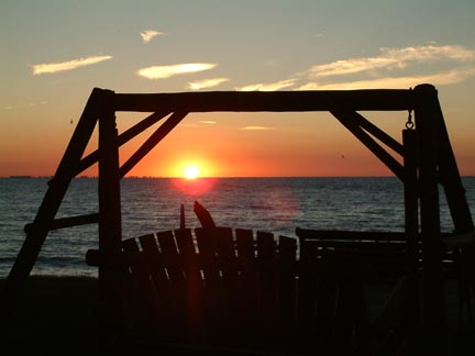
There’s not much to report about day seven other than driving. I went through four states and hit the worst traffic of the trip, since leaving Los Angeles, while driving through Chicago. Luckily I had an early start and after about eleven hours of straight driving, I ended up at my folks’ cottage on Catawba Island. I beat them there by a few hours (they were driving down from their house in Michigan), but was greeted with a beautiful sunset over Lake Erie.
My folks showed up a little while later and we went out for pizza. When I got back, I was beat tired and went to bed. Before I drifted off to sleep to the sounds of gentle waves beating against the lakeshore, I thanked God for seeing me through this first leg of my trip and for all the blessings He so freely gives. I also asked for guidance and protection as I continue on life’s journey. Then a peaceful sleep enveloped me and I truly rested…
|
I took this out of my sunroof while waiting to go through the tunnel at Zion National Park.
Taking a break along the Klondike Bluffs trail that leads into Arches National Park.
The Grand View from the Island in the Sky in Canyon Lands National Park.
Devils Tower: Peek-a-boo, there's the sun!.
The Bad Lands of Theodore Roosevelt National Park.
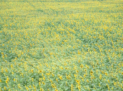
North Dakota was full of sunflower fields - I took this from an on ramp to I-90.
The view I was greeted with when I finally made it to my destination.
|
|

