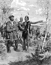
| In 1535, two Indian Youths told Jacques Cartier about
the route to "kanata." They were referring to
the village of Stadacona; "kanata" was simply
the Huron-Iroquois word for "village" or
"settlement." But for want of another name,
Cartier used "Canada" to refer not only to
Stadacona (the site of present day Quebec City), but also
to the entire area subject to its chief, Donnacona. The
name was soon applied to a much larger area: maps in 1547
designated everything north of the St. Lawrence River as
"Canada." Cartier also called the St.
Lawrence River the "rivière de Canada", a name
used until the early 1600s. By 1616, although the entire
region was known as New France, the area along the great
river of Canada and the Gulf of St. Lawrence was still
called Canada.
Soon explorers and fur traders opened up territory to
the west and to the south and the area depicted as
"Canada" grew. In the early 1700s, the name
referred to all lands in what is now the American Midwest
and as far south as the present day Louisiana.
|
 |
