|
| LinkExchange Member | Free Home Pages at GeoCities |
|
| LinkExchange Member | Free Home Pages at GeoCities |
Atherton is the agricultural hub of the Atherton Tableland, where huge maize silos interrupt the rural and rainforest landscape. This farming hamlet is situated 100km south west of Cairns on the Kennedy Hwy and is surrounded by a patchwork of dense rainforest which abounds in exotic varieties of birdlife and tropical vegetation.Of interest:Old Post Office Museum, Herberton Road. Maize Festival held in Sept. and Tablelands Band Festival in Nov. Other festivals on the Tablelands inculde Tobacco Festival at Dimbulah (May), Tin Festival at Herberton (Sept) and Torimbah Forest Festival at Ravenshoe (Oct.).Fascinating Facets.Underground Tunnels and chambers, and the Crystal Caves, mineral, gemstone and agate museum, both in Main St.In the area:Atherton Tableland, one of the oldest land masses in Australia, provides picturesque alternative to coastal route;rainforest-fringed volcanic crater lakes, spectacular waterfalls and fertile farmlands. At Tolga 5km north: Woodworks and tours of peanut factory. Mareeba, 32 km north, tobacco and rice growing area; annual rodeo held in July. Lake Tinaroo, 15km north-east; swimming and fishing. Cruises on crater lakes, Lake Eacham and Barrine, set in national parks 25km east, through historic Yungaburra; steeped in Aboriginal legend, lakes are well known for their crystal-clear waters and picturesque beauty. The Curtain Fig Tree, 2.5km south of Yungaburra; spectacular aerial roots in curtain formation. Mt Hypipamee National Park, 26km south; sheer-sided explosion crater 124m deep. At Malanda, 25km south-east:Malanda Falls Environmental Park with marked rainforest walk at edge of town. McHugh Road Lookout, 20km south of Malanda, offers panoramic views. At Herberton, 19km south-west; Foster's Winery and Historical Village with 30 restored buildings.
Email me for more info!
In 1874 Mulligan, leading a party from Cooktown, named the Hodgkinson and St George Rivers and Mt Mulligan, north of the tobacco town of Dimbulah. He returned in 1875 and found a beautiful river flowing north, which he presumed was the Mitchell before it swung west to the Gulf of Carpentaria. He had in fact discovered the Barron River, which eventually flows east to the Pacific coast. Mulligan travelled up the Barron and camped at Granite Creek, where Mareeba now stands. He travelled over rich basaltic plains, now the tobacco fields on the Kuranda road, until stopped by dense, impenetrable jungle near what is now Tolga. He marvelled at huge cedar and kauri trees, but skirted the jungle westwards and camped three kilometres from the site of Atherton. In the ranges nearby he discovered the Wild River and traces of tin. However, as the nearest ports were Cooktown and Cardwell, some 500 kilometres away, Mulligan considered the area too isolated for tin-mining.
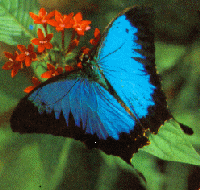 Ulysses butterfly.
Convinced that there was gold in the Hodgkinson River valley, Mulligan set off again and found extensive strikes as he prospected the valley. The Hodgkinson gold-rush started as soon as he reported his find, most of the diggers coming from Cooktown and the Palmer River. The towns of Kingsborough and Thornborough quickly sprang up in 1876 between Mt Mulligan and Mareeba. In two years the population was some 10,000, but the field was not as golden as the Palmer.
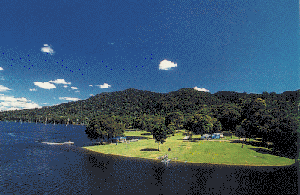 Tinaroo Dam on a beautiful sunny day.
This caused an unusual situation, the interior being opened up before a direct route to the coast had been discovered and a port founded. During 1876 several difficult tracks were cut down the steep, densly jungled coastal ranges towards Port Douglas and Trinity Bay eventually being dominant and becoming Cairns. Some epic hauls up the range were recorded. A double team of bullocks, yoked four abreast, took ten tonnes of mining machinery from Port Douglas to Kingsborough; in 1881, eighty bullocks hauled up the complete battery for the Great Northern tin-mine at Herberton. An impressive monument at the foot of the Cairns-Kuranda road, the Kennedy Highway, commemorates the trailblazers who opened tracks from the Tableland to the coast and the outlet for the Hodgkinson gold.
The railway line from Cairns to Kuranda on the edge of the Tableland, is only thirty-four kilometres long but took four years to build, cost twenty workers their lives, and has fifteen tunnels. It was completed in 1888, and the prosperity of the Atherton Tableland, and Cairns, was assured.
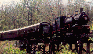 The Railco Steam Train to Herberton.
In April 1877, John Atherton settled at the junction of Emerald Creek and the Barron River, and formed Emerald End station. When he found alluvial tin in the headwaters of the creek, he reputedly yelled 'tin-hurroo' to his mate; hence the name of the area,Tinaroo.Atherton was interested in cattle, not tin, but he led others to major tin lodes on the Wild River, discovered by Mulligan four years earlier. Mining commenced and the town of Herberton came into existance. The Tate River field was also an important find, and tin proved to be more influential in the development of the area than the short-term excitement of gold.
In 1880, Atherton built a wide-verandahed shanty at Granite Creek, a popular camping ground halfway between Port Douglas and Herberton, used by men flocking to the new field. This became Mareeba. Eventually the railway linked Herberton and Ravenshoe with Cairns. Today, Herberton is an interesting historic town which holds an annual Tin Festival in August. The local museum, called the Tin Pannikin, is in a classic old (unlicensed) pub, and is a tourist 'must'.
Ravenshoe (pronounced Ravens-ho, not Ravens-shoe) is on the Palmerston Highway, ninety-three kilometres west of Innisfail, and is thirty kilometres south of Atherton on the Kennedy Highway. It is noted for its gemstones and the fine cabinet timbers grown and milled in the area. The Torimba Forest Festival shows off the district's products every October.
Mount Garnet, forty-seven kilometres west of Ravenshoe, is an old copper-mining town where tourists can 'pan the tailings' for alluvial tin.
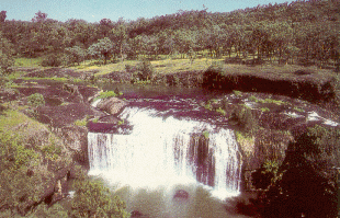 Millstream Falls at Ravenshoe.
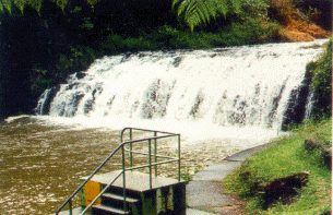 Malanda Falls swimming & Picnic area.
The rich dairy country around Malanda, fourteen kilometres south-east of Atherton, supplies milk for what is known as the longest milk run in the world: to Weipa, Mount Isa, Darwin, and into Western Australia. A Dairy Festival is held every August.
Millaa Millaa, twenty-four kilometres south of Malanda, has a cheese factory, and the Millaa Millaa, Zillie and Elinjaa waterfalls are nearby. McHugh Lookout gives an excellent view of the southern Tableland.
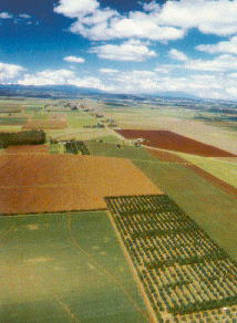 Farmland around Atherton.
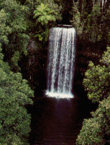 Millaa Millaa Falls.
Tinaburra is a popular tourist settlement on Tinaroo Dam. Nearby on the Malanda-Yungaburra Road is the amazing and much-photographed Curtain Fig Tree.
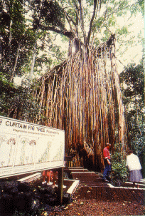 Curtain Fig Tree near Yungaburra.
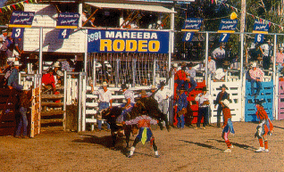 Mareeba Rodeo.
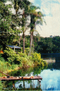 People relaxing at Lake Eacham.
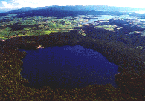 Lake Barrine.