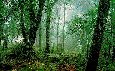
Khao Yai National Park, Nakhon Ratchasima Province

Evergreen Forest Hill at Khao Yai National Park.

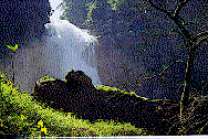
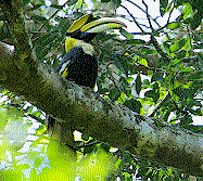
Thailand's first national park, Khao Yai, covering 2,168 square kilometres across the peaks of four provinces - Nakhon Ratchasima, Nakhon Nayok, Saraburi and Prachinburi. Khao Yai features a plethora of forest types 400 metres above sea level, meaning the park is cool and pleasant all year round, with temperatures dropping as low as 4-6 degrees.
The park is easily accessible from Bangkok, through Saraburi and Pak Chong along the Friendship Highway, turning into Thanarat Road for further 40-kms drive into the Park, a total of about 200 kms from Bangkok. Alternativvely, it can be reached through Nakhon Nayok, turning at Highway 33 and carrying on for a further 20 kms.
The park is closed to tourists at night. So accommodation can be found along Thanarat Road, where there are resorts, bungalows and other places to stay at rates as widely varying as 80 to 35,000 baht a night.
Declared a national park in September 1962, Khao Yai proved popular among nature lovers and trekkers who spent large amounts of time exploring and mapping the Park's best features and routes. This popularity led to bungalows being built in the park, even a golf course.
However, in 1991 the Government declared the Park closed to preserve the habitat and protect the wildlife. The golf course shut down, and tourists were only allowed to spend dats, but not nights in the Park.
Nevertheless, Khao Yai remains as popular today as it ever was, with the major rivers of Lam Takhong and Nakhon Nayok running through it, over 20 waterfalls, marshes, and plenty of trekking routes.
Special travel routes :
From Krong Kaew-Haew Prathun-Haew Suwat waterfalls, 12 kms.
From Haew Suwat-Kluay Mai Cliff, 3 kms.
From the park office-Mor Singto-Wang Champee-scaffold to observe wildlife, 5 kms.
From Nong Pakchee-Krong I Thao-Bung Pai-Dan Chang, 13 kms
From Tad Manao waterfall-Tad Loo-Tad Ta Kong, 12 kms
From Dang Ngu Hao-Pong Krueng Bin, 3 kms
From Khao Yai Road-Prachin Buri-Haew Narok waterfall, 2 kms
From Nong Khing-Khao Khieo summit, 10 kms
From Km 5-Pa Tabaek waterfall, 3 kms.
Apply at the park office for permission to enter these areas. A small fee will be charged and your trek will be supervised to ensure you do not get lost.
Seasons
Dry Season : November to February. Khao Yai is always crowded at this time. The weather is cool, with temperatures as low as 4-6 Celsius, and clear skies. Take along winter clothes, socks and shoes, as well as hats and sunglasses. A good time for trekking, visiting waterfalls, and bird watching.
Hot Season : March to April. Daytime is very hot, but nights can be pleasant. A good time for trekking, observing wildlife and nature. Don't forget hats and sunglasses.
Rainy Season : May to October. Can be heavy going. Best to study plants as there are over 3,000 species in Khao Yai. Take along medicine and ointment to counter leeches. Take with you covered shoes, heavy socks, rain coats, and winter clothes.
Getting there
By car, take Highway 2 out of Bangkok, going through Saraburi. At Km 165, turn left into Thanarat Road for another 40 kms to reach Khao Yai. There are many resorts and accommodation along the way.
Alternatively, take the Bangkok-Nakhon Nayok-Prachinburi Highway. Exit at the Siyaek Nern Yai Hom intersection at Highway 33, and turn left. Continue for about 20 kms to reach the Park.
You can catch a bus from Moh Chit bus terminal to Pak Chong district in Korat. From there you connect a minibus to the Park, which operates from 6.00 to 18.00 hrs. Groups should consider hiring their own coach or minivan.
Though Khao Yai is a "closed" park, it is open to tourists during the daytime, teaching more about nature and wildlife than any classroom.
C.Charlls, "Thailand's best-loved National Park", Holiday Time in Thailand, June 1997, P. 27-33.
: [HOME] [THAILAND] [MY KING]
1