
Translate:
Español - Français
- Deutsch
- Italiano
- Português
- Japanese
- Korean
- Chinese

Translate:
Español - Français
- Deutsch
- Italiano
- Português
- Japanese
- Korean
- Chinese

 With an area equal to about a quarter of the U.S.A., Mexico is a country that holds the rank of being the third most biologically diverse in the world. Although with a history dating back several thousand years, Mexico is also a nation still embracing its past, as opposed to its northern neighbour, the United States, just a little over 200 years old and charging ahead towards the 21st century. But, this does not necessarily make one better than the other.
But for ourselves, as travellers, Mexico is an incredible land to try and cover. Our main focus will be centred towards its Precolumbian history - a study on the societies of that period and, perhaps, to find a more logical conclusion to its demise rather than that of 'mysterious' disappearances; a notion that is generally fed to the public of industrialized nations. Even the Spanish Conquest being regarded as the ultimate cause is now considered not entirely a complete explanation; historical texts can sometimes be tainted with exageration and misinformation which often conflict with one another.
It's a relief to know that there is reliable evidence, at least, of the existence of these ancient societies in the form of magnificent architectural structures left in ruin and their displaced descendents who still uphold ancient traditions against the 'bulldozer-like' pressures of the modern age.
 Whatever the outcome may be, the idea of independent travel along with self-study has to be one of the most exciting and enjoyable ways for us to find out.
March 13, 1999 -- We leave El Paso, Texas (0830) on a bus heading across the border to Ciudad Juarez, one of 8 border cities that spread themselves along a frontier of 2400km with the U.S.A.
Border formalities into Mexico were fairly easy, but apparently, the Greyhound bus that was waiting while passengers go through immigration didn't wait long enough. So we got left behind. The plan was to get to the Juarez bus station to connect with another bus going direct to Chihuahua. This was to avoid the high prices of goods and services that all USA/Mexico border towns are well-known for.
We bite the bullet and once the visas were issued, we grab our packs and start walking into town in search of a cheap hotel.
 It's a shocking contrast when coming in from El Paso - like night and day. We could feel the poverty; buildings and pavements unmaintained, people driving
past us in rusty pre-80's wrecks and drunks passed out along the streets. It's not really a great first impression but we knew this was not representative of Mexico.
Ciudad Juarez has a few of the country's total of over 2000 maquiladoras (foreign-owned industries that import raw materials duty-free and export the finished products with US tariffs paid only on value-added amounts). These industries provided great employment opportunities in Mexico. But recently, several large plants were ordered closed to control pollution. An interesting fact about the maquiladoras is that 90% of the labour force are women thus resulting in males making up a very large portion of the current regional unemployment figures.
March 14, 1999 -- A 4 hour bus heading south takes us to the city of Chihuahua, centre of a mining and cattle area. It's historical significance revolves mainly around the Mexican Revolution of the early 1900's in its quest for land reform.
 The local hairless dog of the same name has a constant body temperature of 40 degrees Celsius(104F).
We stayed at a hotel in the city central for 2 nights during which we walked around and get to know the area. From the constant stares we received from locals passing by, we assumed that this is a city not frequently visited by foreigners but there was no sign of any kind of negative attitude towards us.
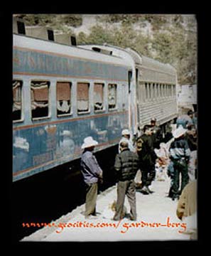
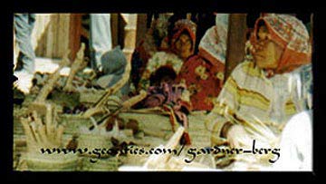
March 16, 1999 -- We leave Chihuahua on a 6:00am train to Los Mochis. A fantastic 17 hour trip winding over, around and through the 'Barranca del Cobre' (Copper Canyon). The views are particularly spectacular from Creel (1/2 way) onwards. A little further on from Creel we stop at El Divisadero for about 20 minutes; just enough time to buy a bracelet from a local Tarahumara Indian.
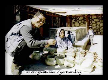 The Tarahumara people (also known as Raramuri - 'those who run fast') were of nomadic origin dwelling in caves around the Sierra Madre region, but now work as day-labourers in the logging stations and sellers of artisan products at markets and transport stations.
It is said that these people had a reputation of being able to outrun a galloping horse and run down birds.
It's very sad to see some of them now, begging at the station.
March 17, 1999 -- After a night stay in Los Mochis we take a bus to Mazatlan (6 hours), heading south along the coast. Mazatlan is the largest port on Mexico's Pacific side and also an important industrial and commercial centre of the western region.
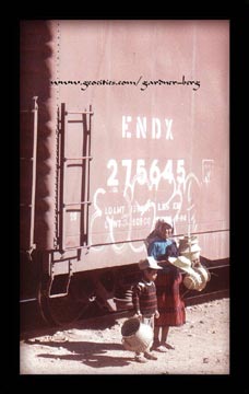 We spent 2 days here walking around the old and new sections of the town. New Mazatlan is the main tourist hang-out, particularly at this time of year where "Spring-breakers" from the U.S.A. are concentrated, along with the familiar foreign-owned franchises to cushion some of the culture shock. A walk
south through the old section to the tip of the Mazatlan peninsula took us to El Faro Island where there were great views of the town and coast from the lighthouse at the top of the hill (157m a.s.l.).
March 20, 1999 -- (0915) A 5 and a half hour bus ride south along the coast to Tepic then straight on another bus for a 3 hour run to Puerto Vallarta.
Ranked as Mexico's second largest resort, Puerto Vallarta has become a popular tourist destination. Highly commercialized marred by congestion and widespread condominium developments.
A 3-day stay south of the Rio Cuale was enough time to relax in warm weather and to wander through the cobbled streets of Viejo Vallarta (Old Town).
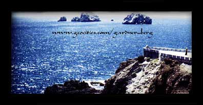 March 24, 1999 -- (9.00am) A heading eastward inland to Guadalajara (5 hours by bus). On the way there, about 6 kms from Guadalajara, we catch sight of dry land covered in blue agave plants. This area is where tequila is produced and the blue agave is the raw material used, Mixed with liquified sugar; then fermented and distilled. There are about 400 varieties of agave, but the blue agave is the only one suitable for production. The producing centre of tequila is confined around the small town of the same name, Tequila.
During pre-columbian times, the Indians used the agave sap to brew Pulque, a mild alcoholic drink which, apparently, is still drunk today.
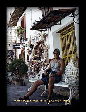 Guadalajara is Mexico's second largest city behind Mexico City but the similarities between the two centres are few. The general character of the 'Guadalajaran'(or 'Tapatio'- said to be a more correct term) is largely one of conservativeness. Brought up in a strong Catholic family environment, dominated by conservative traditions and pride in Spanish ancestral lineage.
Even in business, the city maintains a structure of family firms rather than entering into partnerships with transnational corporations.
Interestingly, as a result, Guadalajara has contributed much to Mexican nationalism, e.g. tequila and mariachi music; and Tapatio' artists improving Mexico´s culture as a whole.
March 25, 1999 -- We walk around a pedestrian mall called Plaza Tapatia and the huge indoor market, Mercado Libertad in search for food, water and personal supplies. In the evening, the centre becomes vibrant; mariachi music in the park as well as those in many restaurants - a very enjoyable time to have dinner.
March 29, 1999 -- We leave at 10.45am for Toluca(west of Mexico City) taking 7 hours to arrive. Toluca is about 8000ft a.s.l. so we had some altitude to get accustomed to. The basin of Toluca is drained by the Rio Lerma and flows into the Pacific. This area used to contain the lake and headwaters of the river. The availability of water and fertile land led to early settlement dating back from 10,000 BC. It was later to become the centre of the Matlazinca culture.
The first of our visual studies of Mexico's archeological history begins here.
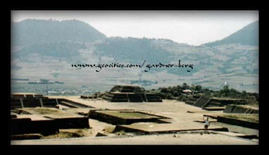
March 31, 1999 -- A few kms north of Toluca are the ruins of Calixtlahuaca consisting of 2 pyramids and an Aztec seminary. The circular pyramid was used to worship the 'Wind God' - Quetzalcoaatl and the square one for the 'Rain God' - Tlaloc.
April 1, 1999 -- A half hour bus ride south of Toluca lie the ruins of Teotenango - built by the Matlazinca and additions made by the Aztecs during their occupation of the region. This archeological zone consists of 5 plazas, 10 separate structures and 1 ball court.
April 2, 1999 -- A visit to the ruins of Malinalco 1 and a half hours south. Also of Matlazinca culture, the temple is rock-cut into the side of a mountain, in which are sculptures of eagle and jaguar effigies. Very interesting entrance into the temple, representing a serpent´s mouth with its tongue as a stepping platform.
Around the town of Malinalco celebrations for Easter were underway. Reinactments of the trial and sentencing of Christ mark the height of the growing frenzy among the people of this small town.
Photos and Text Copyright © 1999-2001 Gardner-Berg. All rights reserved.
Sources of Further Reading-
Fisher, Richard. Mexico's Copper Canyon. 1998
Fontana, Bernard L. Schaefer, John P. Tarahumara: Where Night is the Day of the Moon. 1997
Graham, Martha. Mobile Farmers: An Ethnoarchaeological Approach the Settlement Organization Among the Raramuri of Northwestern Mexico. 1994
Jacobs, Donald Trent. Primal Awareness. 1998

