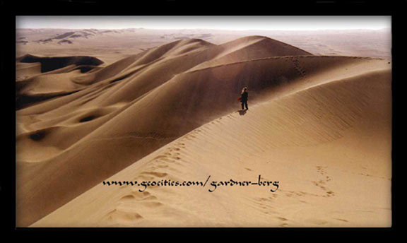
Sand Dunes Around the Oasis of Huacachina, PERU
| Translate: EspaŮol - FranÁais - Deutsch - Italiano - PortuguÍs - Japanese - Korean - Chinese |

Sand Dunes Around the Oasis of Huacachina, PERU
| Translate: EspaŮol - FranÁais - Deutsch - Italiano - PortuguÍs - Japanese - Korean - Chinese |

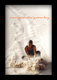 JULY 24, 2000 -- We move onwards south to Ica (70kms south from Pisco) to try sandboarding the sandy slopes of Huacachina.
Huacachina is a lake resort 5 km west out of Ica with incredible sand dunes completely surrounding it. Very popular with foreigners and locals alike and a lot of fun. The lake contains salts of sulphur in which many claim to be curative. A very relaxing and recreation-filled oasis with great photography opportunities.
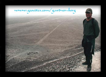
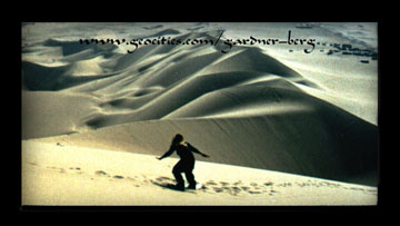 JULY 27, 2000 -- 2 and a half hours further south is Nazca. One of Peru's most popular tourist destinations where many foreigners (including ourselves) flock to view the incredible ancient geoglyphs spread out on the Khumana Plains.
Over the past 50 years there have been numerous theories involving the lines and geometric figures which can be viewed better from the air. Theories like: Ancient hot air balloons based on evidence from pottery designs and tapestry depicting balloonists; a spiritual map for shamans to navigate their way during their drug-induced flights; or the lines used as tracks for running contests; take off and landing runways for extraterrestrial craft; weaving patterns; fertility rites; astronomical calender to signal the summer and winter solstices; a geographical map showing directional lines to water sources; representation of Wari and Tiwanaku cultures; the list goes on...
With the fact that these geoglyphs have remained visible for almost 3000 years and no written language left behind to explain their origin, function or who was responsible for building them, all of the numerous theories put forward can not be dismissed. This huge flat land (approx. 700 sq.kms) filled with about 13,000 straight lines and around 60 geometric figures is the only one of its kind in the world, generating mystery, wonder and amazement to us all here in the modern age.
Dr. Maria Reiche, originally from Germany, had begun studying the Nazca Lines in 1945 at the age of 53. From over 40 years of on-site study, the late Dr. Reiche had put forward her theories which sat well with her contemporaries in the scientific world.
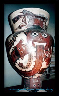
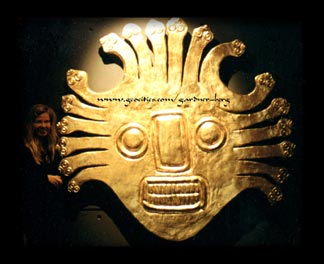
The Nazca Culture (200 BC - 600 AD) is said to be traced back to the Paracas Cavernas and Necropolis (as previously mentioned) of the Pisco region. After 200 BC Nazca civilisation had become completely established in the Andean world, giving rise to small state formation, controlling several adjoining valleys. Agriculture was highly improved by the construction of sophisticated irrigation systems of canals, aqueducts and soil-prepared terraces.
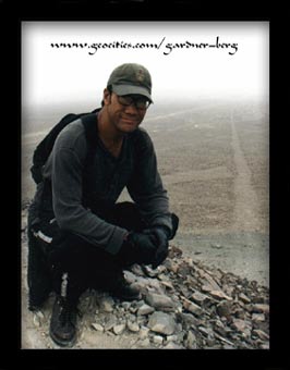
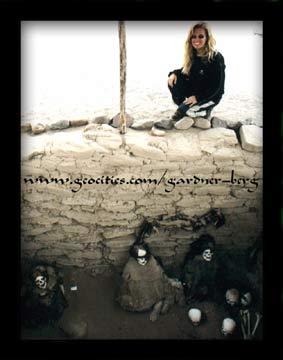
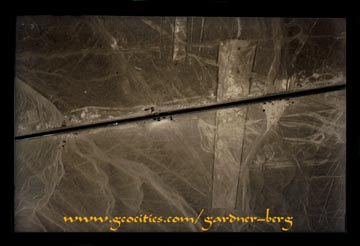 JULY 29, 2000 -- We head out to Cerrito Mirador and the observation tower (built by Dr. Reiche) to view the lines at close range. The terrain is incredibly dry, desolate and otherworldly. The following day we visit Chauchilla cemetery where, at one stage, there were hundreds of skeletal remains scattered all around - the result of huaqueros digging up and stripping the tombs for anything of value. The cemetery is now cleaned up and made more orderly for the benefit of tourists. The underground aqueducts, built with stone separated by adobe - constructed approx. before the beginning of the first millennium, are seismic-proof and still functional.
 Which brings us to the extensive studies made by Dr. Reiche, who had made detailed observations and analysis, leading her to speculate the explanation on the building of the lines and their probable meaning. She believed that most of the figures and tracks were linked to astronomy, for agricultural purposes; a belief that was backed up by Gerald Hawkins, a specialist in ancient astronomy. She also stated that the figures were also venues for propitiatory rites and festivals linked to production and to the cult. As for the building and the remarkable preservation of the lines; the terrain was once an ancient sea bed. The blanket of stones that cover the plains and remained exposed to the extremely hot and dry conditions over thousands of years, became darker due to slow oxidation of the iron contained in them. All the builders had to do was turn a series of stones over to their unexposed side to produce a visible mark. According to drawings and paintings on Nazca pottery and carvings, a tool called a 'tupu' may have been used to guide builders into maintaining a straight line. Simple and ingenius.
 Until her death on June, 1998 at the age of 95 years, Dr. Maria Reiche strongly maintained that the Nazca lines and the ceremonies surrounding them were all related to one significant and ongoing problem that faced all past cultures that settled here: the availability of water.
We were a little saddened at how this valley is now being commercially exploited, and disappointed in ourselves as travellers for contributing to it. The town of Nazca is now a tourist centre where goods and services are overpriced and foreigners are forced into group tours like cattle. Local government corruption is rife here. There is even a person, claiming to be Dr. Reiche's daughter, trying to charge admission to the observation tower. It's supposed to be free. Dr. Reiche had never married and she lived alone leading a very simple life among the local townsfolk. It has taken such a long time before and after her passing to receive the respect for her dedication to the science world from her peers and from her adopted country that owes so much, yet had given so little, for her support and efforts to preserve such a unique monument.
JULY 30, 2000 -- (9pm) A 10 hour, overnight bus along the coast and rising up to over 2000 m.a.s.l. to the foot of a beautiful volcano (El Misti) where the city of Arequipa sits.
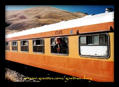
AUGUST 2, 2000 -- We take an early morning train to Puno. A beautiful morning with great views of the surrounding mountains and smoking volcanoes that guard the northern gateway to the Altiplano - a long and wide stretch of flat land at high altitude (over 4000 m.a.s.l.). Our carriage (Pullman Class) is full of happy foreign travellers heading to Lake Titicaca. Around 2.30pm, the train derails and stops by a lake filled of water so blue, it didn't seem natural. The
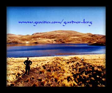 surroundings - a great expanse of harsh land with a few ice patches. Strange flourescent green moss adds, at least, some sign of vegetation on which livestock can graze on.
The day turns warm and many passengers begin to feel the effects of soroche - altitude sickness. Slowly, the long delay has everyone becoming restless and impatient to the point where some leave and head to the buses that catch sight of our stranded train and stopping to pick them up. The long delay stretches into the night and becomes a security risk. Police vehicles show up to guard the train from local thieves and possible hold-ups. A few passengers suffering the worst are taken to hospital.
We arrived in Puno Station at 2am. Not really a great time to go walking around town looking for a cheap hostal. The town of Puno (3822 m.a.s.l.), nestled on the NW edge of Lago Titicaca, is another tourist trap. All of the
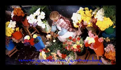 town's hotels targeting foreigners to take tours. The indigenous locals, quiet and reserved but wary and suspicious, go about their daily routines and
market activities as they would in any village environment seemingly separated and indifferent to the fancy hotels, European-style restaurants, cafes and souvenir/boutique stores that surround them. It's a huge profit-making business - the exploitation of ancient Indian heritage and its surviving descendents by Peruvians who prefer to embrace their European roots.
We didn't stay long. Our Peruvian visa ends in a few days, so we prepare to head to Bolivia. The plan is to re-enter Peru for the much anticipated 'Inca Trail' hike to Machu Picchu.
Photos and Text Copyright © 1999-2001 Gardner-Berg. All rights reserved.
Sources of Further Reading-
Reinhard, Johan. "Discovering the Inca Ice Maiden: My Adventures of Ampato" 1998
Sawyer, Alan R. "Early Nasca Needlework" 1997

