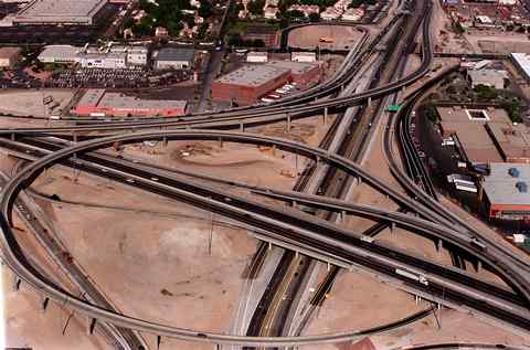
 s is true in most suburban areas, cars are virtually a necessity of life in Las Vegas. Public transportation is handled by Citizens Area Transit (CAT) which operates buses over a fairly comprehensive route system from early morning till just after midnight (a few routes run 24 hrs/day). Taxis are plentiful, but reasonably expensive -- about $2/mile outside The Strip area. Traffic is legendary along The Strip, which residents refer to as "the world's longest parking lot." The worst areas off The Strip are the "Spaghetti Bowl," pictured above, and many intersections where lengthy red lights and left-lane stacking make drivers steam. New housing construction, especially in the western and southern areas, further compound the problem. s is true in most suburban areas, cars are virtually a necessity of life in Las Vegas. Public transportation is handled by Citizens Area Transit (CAT) which operates buses over a fairly comprehensive route system from early morning till just after midnight (a few routes run 24 hrs/day). Taxis are plentiful, but reasonably expensive -- about $2/mile outside The Strip area. Traffic is legendary along The Strip, which residents refer to as "the world's longest parking lot." The worst areas off The Strip are the "Spaghetti Bowl," pictured above, and many intersections where lengthy red lights and left-lane stacking make drivers steam. New housing construction, especially in the western and southern areas, further compound the problem. he beltway (I-215), which will run along the western edge of the city, will certainly help alleviate through traffic on I-15, but it won't be completely finished until about 2003. he beltway (I-215), which will run along the western edge of the city, will certainly help alleviate through traffic on I-15, but it won't be completely finished until about 2003.
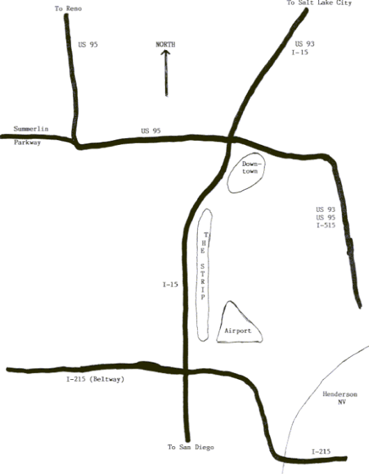
 he sketch below shows the major freeways in the city. The "Sphagetti Bowl" is the junction of I-15, US 93, and US 95. he sketch below shows the major freeways in the city. The "Sphagetti Bowl" is the junction of I-15, US 93, and US 95.
|


