Tour Two:
THE NORTH COAST
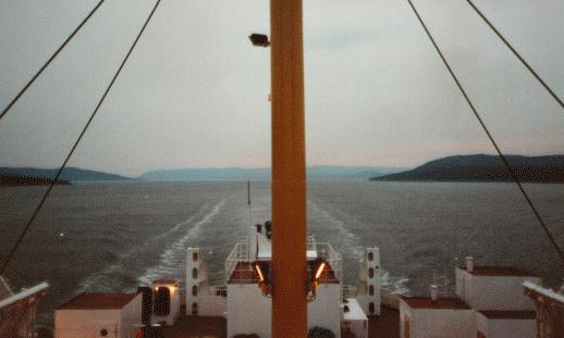
Near the Narrows: The coastal boats that serve the northern Labrador pass through the dramatic gates of Hamilton Inlet. The 40-mile wide Groswater Bay narrows to a turbulent passage a mile wide at Rigolet, and widens out into Lake Melville, 100 miles long and 30 miles at its widest. The Narrows are a dramatic start to your tour of the North Coast.
Labrador's North Coast is remote and roadless. Six communities are strung out along a coast indented with hundreds of bays and inlets, and uncounted islands. Access to the region is by air, or by a coastal boat operated by Marine Atlantic. The MV Northern Ranger serves all of coastal Labrador, and provides links to Lewisporte, Newfoundland, and Happy Valley-Goose Bay, where this tour begins.
The Northern Ranger departs Goose Bay, and steams down the broad expanse of Lake Melville towards Rigolet. Rigolet is located on the northern shore of the Narrows, where the great Hamilton Inlet, the largest bay on the entire Labrador coast, shrinks to less than one mile in width. The scenery in this region is grand, with the Mealy Mountains, Mount Nat and the Backbay all visible from the ship. As you enter the Narrows, you will see Eskimo Island. Long rumoured to have been the site of a great battle between the Innu and Inuit, it was in fact a winter camping site for the Inuit. In the late 1700s, Inuit families were brought to England, where they contracted smallpox. The survivors brought the disease home with them, and with no natural immunity, whole villages, such as the one on Eskimo Island, were wiped out. The skeletons of the epidemic's victims were visible on the island for many years, probably accounting for the ghost stories and tales of fierce battles. At Rigolet today live the descendants of the southern Labrador Inuit, and are the southernmost Inuit in the world. Rigolet is renowned for its ornate grass basketwork.
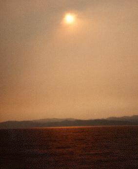
The Eastern Mealy Mountains: The scenery is very grand as the Northern Ranger steams out of Hamilton Inlet. Just a few hours out of Goose Bay, you pass the rugged eastern range of the Mealy Mountains. They rise out of the southern shore of Lake Melville to reach heights of over 4,000 feet.
The tour continues as the vessel makes her way up the coast—or "down" as it is said locally. The Labrador dialect incorporates many Newfoundland expressions, with many unique local and aboriginal words thrown in for good measure. The next stops are Makkovik and Postville. They trace their recorded history to French-Canadian fur traders who established posts here in the late 18th century. A Moravian mission station was established at Makkovik in 1896. Postville is located in Kaipokak Bay—its original Inuktitut name—one of the many deep, long bays which indent the coast in this region.
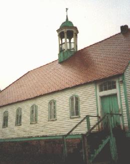
Hopedale: Hopedale was settled as a Moravian Mission in 1782. The Moravians were a German Protestant denomination that early in the 18th century began missionary efforts in many parts of the world. Hopedale was its second mission to the Labrador Inuit. The history of the Moravians in northern Labrador can be learned by touring the Hopedale mission buildings.
Hopedale, built around a Moravian mission station, is a mixed Inuit and settler community originally called Agvituk, or "place of the whales." It boasts the oldest frame buildings in Canada east of historic Quebec City, dating from 1782. The prefabricated Moravian mission houses were built in Germany and shipped in pieces to Hopedale to be re-assembled. The Moravian church once had an extensive presence throughout northern Labrador, from Makkovik to Killinek at the extreme northern tip. Many of the stations were closed or abandoned, and it is now reduced to three locations in the north: Nain, Hopedale and Makkovik. The history of the Moravians can be learned by touring the mission site. To arrange a visit, call 1.709.933.3777.
The north coast is home to both Labrador's aboriginal inhabitants. As well as the Inuit, there is the Innu community of Utshimassits (Davis Inlet). A new community for the Innu of Davis Inlet is under construction at nearby Shango Bay.
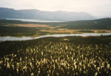
Near Shango Bay: The Innu of Davis Inlet recently voted to remove their community to a new location at Shango Bay to the west.
Labrador was the site of literally earth-shattering news in late 1994. A small mining company, Diamond Fields Resources, announced the discovery of an rich and enormous nickel/copper/cobalt ore body at Voisey's Bay, located between Davis Inlet and Nain. The mine will eventually be brought into production by Voisey's Bay Nickel, a subsidiary of mining giant INCO.
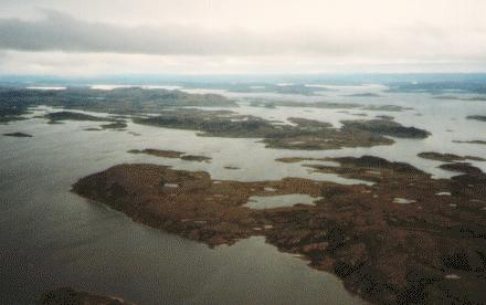
The coast near Nain: The Labrador coast near Nain is an intricate maze of islands, rocks, bays, and "tickles". The extreme heads of the bays may be fifty miles inland from the farthest-flung islets. Navigation here is a challenge to the newcomer, but old hat to local residents and the crews of the coastal boats.
The Northern Ranger's final port of call is Nain, the northernmost permanent community in Labrador. Nain is the largest community on the north coast, with over 1,000 people. It is an administrative centre, the headquarters for the Labrador Inuit Association, and a staging point for mineral development and exploration in and around Voisey's Bay. It was established as the first Moravian mission station in Labrador in 1771. The history of the Labrador Inuit and the Moravian influence is on display at the Nain Piulimatsivik—Inuktitut for "place where we keep the old things", a perfect and practical translation for the English word "museum"!
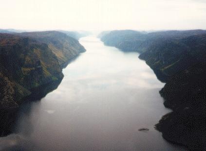
Harp Lake: It looks like a fjord, but is actually well inland, on the Ugjutok River. It is one of the many incredible places in northern Labrador that invite the adventurous and the nature lover.
The coast beyond Nain is even more remote and more spectacular than the populated area to the south. There are no permanent settlements here, although many localities are used for hunting, fishing, and recreation. It is home to abundant wildlife, including caribou and the occasional polar bear. This is the wildest scenery on the Atlantic coast of North America. Fjords stretch in from the ocean, including one known as the Pearly Gates. There are several mountain ranges, with the highest peaks rising 5,000 feet. In many places the steep mountain cliffs soar straight out of the surface of the Labrador Sea. While there is no scheduled coastal boat service to this region, it can be toured by small boat, plane, or helicopter.
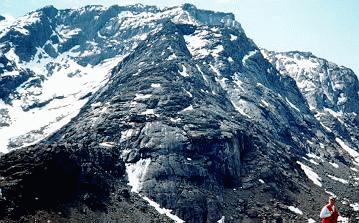
The Kiglapait Mountains: North of Nain stretch several ranges of mountains. The Kiglapaits are about 40 miles north of the community, and are easily accessible by boat or aircraft. There is no other place on the Atlantic coast of North America that can compete with northernmost Labrador for unimaginable grandeur.
![[MAIN]](main.gif)
![[SOUTH COAST]](south.gif)
![[TLH]](tlh.gif)
![[HISTORY TOUR]](hist.gif)
![[NATURE TRAIL]](wild.gif)
![[LABRADOR LINKS]](links.gif)
![[MAIL FOR INFO]](info.gif)
This page hosted by 
Get your own Free Home Page


![[MAIN]](main.gif)
![[SOUTH COAST]](south.gif)
![[TLH]](tlh.gif)
![[HISTORY TOUR]](hist.gif)
![[NATURE TRAIL]](wild.gif)
![[LABRADOR LINKS]](links.gif)
![[MAIL FOR INFO]](info.gif)