
Sunshine Peak, in the San Juan Range, is the lowest of Colorado's 14ers, but it is truly a beautiful hike. Even getting there is very scenic. From Lake City (be sure to visit the museum while you're there; Alferd Packer's old stomping grounds) head west past Lake San Cristobal for about 15 miles to the Bureau of Land Management's Mill Creek Campground (elevation 9,450 ft.) - a good place to overnight before your ascent.
We rose at 5:00 am, August 2, 1996 - still dark but a near full moon obliterating all but the brightest stars. Left camp at 6:00. You cannot see the peak from the campground - you have to hike a steep hill to the north of the campground, attain a ridge, and follow it west to the summit.
A unmarked trail leads up the steep hill, north, across the road from the campground. Staying on the trail as it traverses the hill is sometimes difficult - whenever we lost the trail we just followed what seemed natural until we found the trail again.
The path finally leads to a gulley which runs virtually straight up the hill. We took our first rest at 7:00, about 200 feet below what we thought would be the crest of the hill. Coninuing up, we passed a small boulderfield, the "path" marked by cairns, at 7:20, with a view of the campground far below. After crossing two more boulderfields (or perhaps different sections of the same one), you make your way up through a richly wooded area, continuing up the slope until you reach the crest, just above timberline (about 11,800 feet). We reached the ridge at 8:15, hidden from the campground.
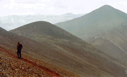
From the ridge you get a great view of Sunshine Peak to the west and Redcloud Peak to the northwest. You follow the ridge west, gradually gaining altitude among grassy tundra until you reach a small knoll which overlooks a small flatland between you and Sunshine proper at about 12,500 ft. After crossing the flats, you enter the "dead zone" as the trail heads steeply up again, where nothing grows but lichen on the rocks.
Now you are heading for Sunshine's false summit, which you can pass on the south (but not too far south, else you'll drop off Sunshine's 800 feet cliffs), or go directly over. We chose to skirt the false summit (13,600 ft.) to the south, picking our way over the boulders, but found that it didn't make any difference as there was no small descent past the false summit before the final ascent up Sunshine's east ridge.
From here you can no longer see Redcloud; it's obscured by an unnamed peak of 13,841 feet. You can see, however, that the ridge between Sunshine and Redcloud dips down quite a bit - so that if you are planning on hiking both mountains, you'll lose quite a bit in altitude after leaving Sunshine before ascending Redcloud.
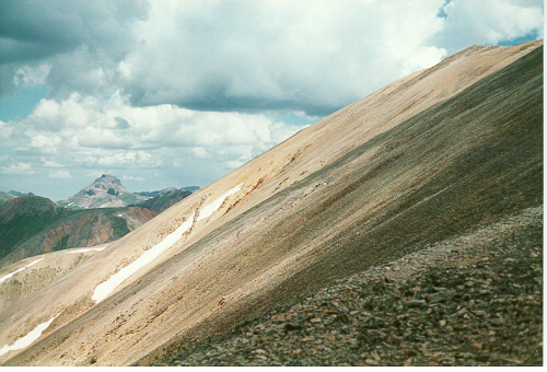
We reached the summit at 10:20, the earliest we've attained the top of a 14er. After sharing the summit with two other people for about five minutes, we had it all to ourselves as they headed back down. Wonderful view atop! Of course, there is Redcloud Peak off to the north. To the west is Handies Peak, and north, just to the west of Redcloud but further away, is Uncompahgre Peak. The photo below is of Uncompahgre in the distance from the slopes of Redcloud.
 We'd begun the day with the
intention of hiking both Sunshine and Redcloud, so after a early lunch of oranges and
sardines, we headed down the north ridge to the saddle between the two at 13,500 ft. Once
at the saddle, you can look down the cirque to the northwest and be amazed that people
actually use this trail (South Fork Trail) to get here.
The rock underfoot changes color quickly to the bright red from which the mountain gets its name. Continuing up along Redcloud's south ridge, you skirt the 13,841 ft. peak's summit to the west and follow a pretty gentle slope up to Redcloud's summit, about a mile from the saddle. There are false summits to encounter along the way, but you'll know the true summit when you're there.
Unfortunately for us, we had to turn back about 150 meters from the final summit, due to bad weather rolling in from the west. You don't want to get caught above timberline in a thunderstorm! As we retraced our steps back to Sunshine, it started to snow, but once we were back to timberline, the weather was beautiful. After picking up a couple of elk skulls (which still grace our back yard) along the way, we finally made it back to camp at 4:52 pm.
Here's an alternate route up Redcloud and Sunshine which starts a bit more to the west and comes up a different watershed.
This page hosted by ![]() Get your own Free Home Page
Get your own Free Home Page