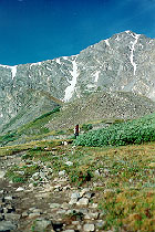
Torreys Peak
Elevation 14,267 ft (4,348 m)
 The local name(s) for
Torreys and Grays Peaks was apparently Twin Peaks until 1861 when
both were named after botanists (John Torrey and Asa Gray). A third to the north - Mt.
Engleman at 13,164 feet - was also named for a botanist, but its name was subsequently
changed to Kelso Mountain. Actually, Grays and Torreys are about as close to
"twin" peaks as possible... the difference between summit elevations is only
three feet. To us, from no matter what angle we view the pair, Torreys looks higher.
Of Colorado's 54 Fourteeners, only Grays and Torreys are found on the Continental
Divide, the spine of North America which separates the east coast rivers from the west
coast rivers.
To get to Torreys Peak, take I70 to the Bakerville exit, just east of the Eisenhower Tunnel. As you leave the
highway, you can see an imposing view of Torreys rising to the south through Grizzly
Gulch. Travel south on the dirt road where there is now a sign pointing the way to Grays
Peak. If it's been a rainy summer, the road can get quite bumpy (lots of boulders), but
still passable in a two-wheel drive car.
After about a mile, the road forks - a right leads down Grizzly Gulch - not
the way you want to go. Take the left fork which continues up and around Kelso Mountain
into Stevens Gulch. You'll be driving through private property so keep to the road. Just
before the Stevens mine on the east side of the gulch there is a large parking lot.
If you arrive before 8:00 am, you shouldn't have any problem finding a place to park -
later than that in the summer and you may have to park on the road. Since we were at the
area in 1993, a bridge has been built across the following the road and the trail has been
improved. The first few hundred yards, in fact, are wide enough to drive a truck on
(though, of course, that's not allowed!).
The trail begins at about 11,300 feet in elevation and leads over the bridge and up on
the northern side of the gulch. The trail gradually climbs southwest through brush and a
smattering of trees until it breaks above bush/timberline where there is some good, flat
land to camp on just before the trail leads across a small boulderfield.
Torreys and Grays seem to be the most traveled mountains in the state! Literally
hundreds of people climb these peaks daily on summer weekends. If you want to avoid the
crush, leave the main trail at this point and head northwest toward the saddle between
Torreys and Kelso Mountain. (You'll see a cabin at the base of the saddle.) Taking this
ridge up Torreys will be a lot more isolated (though there are often people on it, too),
and, although you'll find the going a lot tougher than the main trail, no technical
climbing is required.
Assuming you don't take Torreys' northeast ridge, continue on the main trail as it
crosses the large cirque beteen the two mountains and onto the slopes of Grays Peak. At
this point, keep on the lookout for the pikas
and marmots that you'll undoubtably
hear as you cross the boulders. (Marmots, in particular, like to bask in the sun, while
the pikas are a bit more busy scurrying around!)
After a couple of switchbacks you'll want to head toward the snow patch which always
graces the saddle between the two mountains. Be careful when you reach the snow!
Don't be fooled by the path across the middle which you can see from a distance! The slope
is very steep and the path may be very icy! If it's later in the day and
it's been pretty sunny, you can traverse the snow by digging your feet in and making your
own steps. But if you get there early, as we did, what appears to be snow from a distance
is really ice - impossible to cross without an ice pick and the knowledge of how to use
it. Don't even try! Skirt the snow to the Grays Peak side, even though you'll have to
climb uphill and have to come back down before ascending Torreys' southern slope.
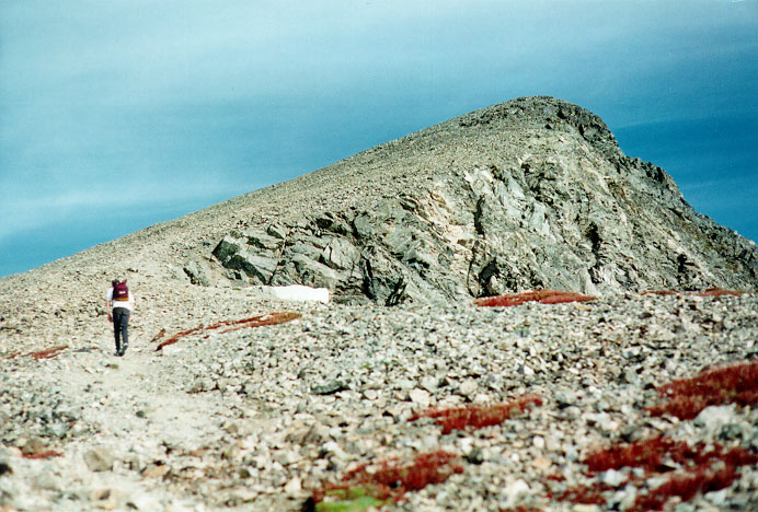
 Once you're on the saddle
at approximately 13,500 ft, its a simple hike up the south ridge to the summit. It's a
great view from up here! Other 14ers you can see include Mount of the Holy Cross in the
Sawatch Range to the west, Quandary Peak in the Mosquitos to
the southwest, Grays Peak (of course) to the south, Longs Peak
off to the north, and Evans/Bierstadt
to the east.
It's a rather small summit - we had it all to ourselves at 9:27 am on August 30, 1997
for about a half an hour. Next to join us was someone who came up Torreys' north ridge. As
we began our descent, a swarm of people was making its way off of Grays' summit and onto
Torreys. A word to the wise: climb Torreys first and you might have it to yourself if you
start early. Climb Grays first and you'll be in good company.
This page hosted by  Get your own Free Home Page
 The local name(s) for
Torreys and Grays Peaks was apparently Twin Peaks until 1861 when
both were named after botanists (John Torrey and Asa Gray). A third to the north - Mt.
Engleman at 13,164 feet - was also named for a botanist, but its name was subsequently
changed to Kelso Mountain. Actually, Grays and Torreys are about as close to
"twin" peaks as possible... the difference between summit elevations is only
three feet. To us, from no matter what angle we view the pair, Torreys looks higher.
  Once you're on the saddle
at approximately 13,500 ft, its a simple hike up the south ridge to the summit. It's a
great view from up here! Other 14ers you can see include Mount of the Holy Cross in the
Sawatch Range to the west,