![]()
Lurgan is a town in north Armagh. It is approx. 23 miles south west of Belfast. The name Lurgan comes from the Irish name for the 'long hill ' or from 'lurga the shin'. Lurgan is the parish of Shankill and in the barony of ONeilland East. Lurgan was in the Poor Law Union of Lurgan.
During the Plantation of Ireland (i.e. when lands were confiscated from Irish natives) in the early 1600's, John and William Brownlow were granted 2,500 acres in the barony of O'Neiland. On these lands, John Brownlow formed a Manor called 'Doughcoron'. This Manor included the 'balliboe' of Shankill. William obtained his patent in June 1610 for the adjoining lands. These lands were known as Ballynemony.
In Carew's report given in 1611 list's both Brownlow's residence. The Brownlow's had brought over 6 carpenters, one mason, one tailor and 6 workmen from England. They also had placed one freeholder and 6 tenants upon their lands.
By 1619 John Brownlow had died and William now owned both manors. The town now consisted of 42 houses, all of which were inhabited by English families. There were 2 water mills and a windmill, all for corn, and a store of arms in the manor. By 1630, William had leased land to Irish natives but was 'brought to book' for these lettings. In 1629 the two manors became united under the name 'Manor of Brownlow's Derry'. A market was now allowed every Friday at Ballylurgan.
In 1630, a Muster Roll of the tenants was taken and the roll gives the names of 42 men capable of bearing arms. William Brownlow's manor was attacked by the Irish during the 1641 rebellion. Among these were Macans (McCanns), Magennises (McGuinness) and the O'Hanlons. The town was burnt to the ground and several English were killed. Brownlow and his family were taken prisoner. They were firstly brought to Armagh and then on to Dungannon, Co. Tyrone. From there they were brought to Charlemount. Here they were freed by the English.
In Cromwell's Inquisition of 1657 the town had a church and also a school. The Presbyterian built their first church in 1684, the Quakers built a meeting house in 1696. Towards the end of the 17th century Lurgan had began to develop it's linen trade.
![]()
Click the thumbnails to see full sized maps, photos etc etc.
 Church Place and Edward Street, Lurgan approx 1880.
 Edward Street, in approx 1920.
 High Street, Lurgan , in approx 1920.
 Church Place leading to Market Street, Lurgan. Taken in approx 1880.
![]() Lurgan Hospital, Sloan Street, Lurgan. (May 2000)
Lurgan Hospital, Sloan Street, Lurgan. (May 2000)
![]() Edward Street, Lurgan. (May 2000)
Edward Street, Lurgan. (May 2000)
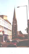
 St Saviours Church, Lurgan. (May 2000).
![]()
Emerald Homepage Towns Index Maps Initial Search
![]()