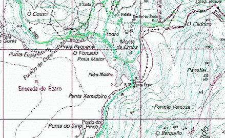
Moon rises behind
Peñafiel, looking SE from Ézaro, Dumbría
En galego
Where river Xallas pierces the stone
and falls to the sea.
The surroundings of the small village of Ézaro, Co. Dumbría, in the west coast of Galicia, NW of Spain, have three natural elements configuring its landscape:
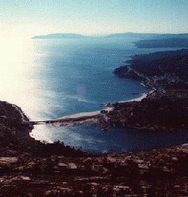
The granite mountains behind O Pindo and o Ézaro,
reaching 641m in the A Moa summit, are a remarkable spot
in the Galician landscape not only for its colours, shapes and sizes, but for being
close to the ocean. Its ridges and summits are distinctive shapes all along the coast
between Fisterra and Carnota, and clearly visible from elevated places in the surrounding
counties of Muros, Mazaricos, Outes, Dumbría, Cee, Corcubión
and farther ones. This view from the summit of Penafiel shows the bridge
joining the counties of Dumbría and Carnota, the village of O Ézaro, and
the coastline which embraces the Bay of Corcubión and ends in Fisterra.
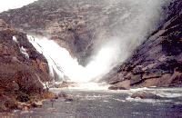
After regular flowing through
the wet hills and glens of Bergantiños, river Xallas finds its way to the sea
piercing the granite(*,*)
foundation of O Pindo mountains, forming a unique set of high and wide
waterfalls, the last and more visible one being reached by ocean tides.
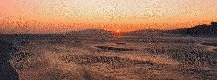 Finally,
the ocean. Barely sheltered by the yet far Finisterre cape, the wide bay of
Corcubión. Three beaches, a small harbour and a bridge over the inlet --where
river water reenters the ocean-- join the village with the sea.
There the tidal and
river currents and north winds stir the sand and grind the stone. Beach shape and slope
change continuously, and what is today shallow steady river water can be tomorrow
sound sea water flow.
Before the building of the bridge boats for people and cattle joined the old ways between O Ézaro and O Pindo. They where reffered to as the "barca dabaixo" -downstream boat-, as another did the job upstream in the parish of Arcos. A toll or a yearly subscription was due to cross the inlet. Villagers of O Pindo still recall an accident early in this XX century, when the boat drowned due to overload and seventeen people died.
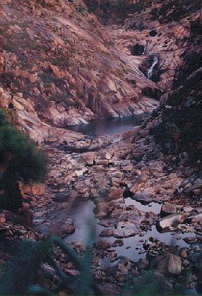
South west bound winds sweep the highlands and approach
the Pindo mountains, finding the hole dig by the Xallas in the stone, and dip in it,
like in Yeats poem The stolen child
where dips the rocky highland
of Sleuth Wood in the lake
gaining speed in a sort of wide Venturi effect, reaching a stormy
strength in some point close to the last waterfall and decaying in westward turbulence
in its way to the ocean.
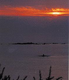
They will then sweep the nearby
road and beach, and soon after the Carrumeiro Grande -a rock holding a lighthouse-
and the Lobeira islands.
North east bound winds
bred on the Atlantic, after feeding the deep slow ocean waves,
rise Xallas waters, countering gravity.

Early in the morning, Jan 1st, 1996.
