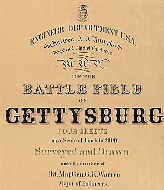
(See also "Maps of the Battle Field of Gettysburg showing troop positions on July 1st, 2nd, & 3rd, 1863.")

Surveyed and Drawn under the Direction of Bvt. Maj. Gen. G. K. Warren, Major of Engineers, By 1st Lieut. W. H. Chase, Corps of Engineers, assisted by 1st Lieut. Thomas Turtle, Corps of Engineers. [and] 2nd Lieut. F. A. Hinman, [Corps of Engineers], and Civil Assistants. Draughtsmen, Edwin A. Chase, W. A. Wansleben, John H. Dager, [and] C. F. Trill.
The survey was made during the fall of 1868 and the summer and fall of 1869, and the map was revised on the ground by P. M. Blake, Civil Engineer, in May and June 1873.
General Warren's map was produced in four sheets (I-IV) numbered east to west. The map shows terrain, topography (elevations and contours), roads, structures, place names, and some names of farmsteads (e.g., Mrs. Thompson). The scale and resolution of the digital images make some text difficult to read but the images are wonderful nonetheless.
The NARA has scanned each sheet in five parts.
Each image file is approximately 1200 x 900 pixels and is in
standard JPEG encoding. The original files were 24 bit BMP
files, each larger than 3mb. See below if you want
the originals. These files are in the public domain and
may be freely used. (NARA Control Number NWDNC-77-CWMF-E81.
Approved for unrestricted use by NARA.)
| Sheet IV | Sheet III | Sheet II | Sheet I |
| 16.jpg
Chambersburg Pike 302kb |
11.jpg
Oak Ridge 353kb |
10.jpg
Barlow's Knoll 286kb |
05.jpg
Gettysburg & Hanover RR, Hunterstown Rd. 204kb |
| 17.jpg
Herr Ridge 346kb |
12.jpg
Herr Tavern, McPherson's Ridge, Lutheran Seminary, Seminary Ridge 377kb |
09.jpg
Town and County Alms House 302kb |
04.jpg
York Pike, Title 307kb |
| 18.jpg
Black Horse Tavern 334kb |
13.jpg
Hagerstown Road, Seminary Ridge 352kb |
08.jpg
Cemetary Hill, Culp's Hill 418kb |
03.jpg
Hanover Rd., Wolf's Hill, Title, Legend, Signatures 354kb |
| 19.jpg
Marsh Creek, Pitzer School 368kb |
14.jpg
Peach Orchard, Emmitsburg Rd. 417kb |
07.jpg
Cemetary Ridge, Power's Hill, Taneytown Rd. 408kb |
02.jpg
Baltimore Pike 300kb |
| 20.jpg
Marsh Creek & Willoughby Run 309kb |
15.jpg
Devil's Den, Round Top 454kb |
06.jpg
Little Round Top, Taneytown Rd. 369kb |
01.jpg
Rock Creek 283kb |
The original images were obtained from the NARA. They are available on-line and can be found most easily by using the NARA Archival Information Locator (NAIL). Select "NAIL Digital Copies Search" to access the search form. Use keywords "battle" and "Gettysburg"; media: "Maps and Charts"; NARA Units: "All Units." Use this link to go to the NAIL search page.
This page was last edited on Thursday, February 17, 2000
.
All materials copyright © 2000 Anthony D. Becker,
