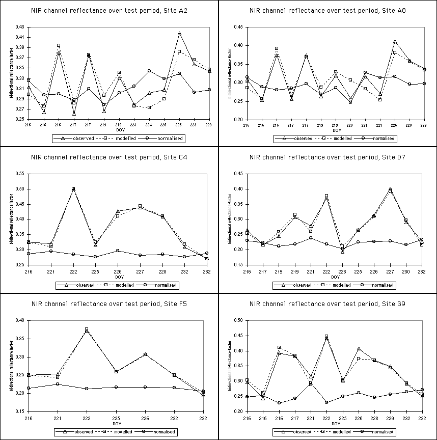

Note that there are up to three observations per location per 24-hour
period, since data from the AVHRRs on both the AM and PM satellites was
selected. In these charts, the large variation in reflectance values is not
owing to cloud or cloud shadowing of the surface (an important problem with
morning scenes, since the sun is low in the sky); it is mainly a manifestation
of BRDF effects. The modelled series is the result of fitting AVHRR channel 2
observations to the Roujean (1992) BRDF model and the normalised series uses
anisotropy factors calculated from model parameters to adjust the original
reflectances to a desired target geometry after the method of Wu et al
(1995). The samples were taken from locations in the AVHRR images closest to
these
field survey sites.
Some variation in reflectance over this period (3rd - 19th August 1996) is
likely to be owing to real changes in the surface, particularly as a result of
variations in soil moisture following heavy rainfall (August 1996 was an
exceptionally wet summer here, with some villages losing large numbers of mud
dwellings in floods, in spite of the relatively level terrain). However, this
is unlikely to be the most important factor in the deviations shown here,
especially since most of the scenes are from the afternoon AVHRR; high midday
temperatures ensure that the soil surface is almost completely dried out by
the time of the first PM overpass.