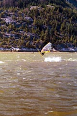
 | ||||||
| Articles | Projects | Resume | Cartoons | Windsurfing | Paintings | Album |
Windsurfing on Vancouver Island, B.C., Canada

This webpage provides qualitative information about each sailing site and strives to answer the kinds of questions I have in my mind when I go to a new site. Each site includes a description about:
- Location: General Area, Directions and Maps
- Skill Level: Beginner, Intermediate or Advanced
- Seasonal Information: What time of year do people usually sail there, What are the average dominant wind conditions, Typical sail size range in square meters used by the average size guy in average wind conditions
- Accessibility: Parking, Rigging, and Launching
- Wind Reference Station(s): The name(s) of the relevant wind data station(s) that you can check for wind data information
- Hazards: Identifies pertinent hazards such as shorbreak, debris, cold water, submerged hazards etc. Know your substrate!
- Amenities: Lists facilities available, if any such as food, camping, toilets etc.
- Wildlife: Lists common wildlife
- Other: General comments or other pertinent information
Index of Sailing Sites on Vancouver Island
Cross Reference of Sailing Sites and Wind Data Station Sites
Introduction
Map(s)
Wanted: Hot Shots of these Spots!
China Creek
Columbia Beach
Cook Street, Dallas Road, Clover Point
Elk Lake
Esquimalt Lagoon
Gordon's Beach
Island View Beach
Jordan Creek (Jordan River)
Muir Creek
Nimpkish Lake
Nitinat Lake
Pipers Lagoon
Sooke Basin
Tugwell Creek
Willows Beach
Images from the old Webcam at Gordons Beach, beside Tugwell Creek
by Geek Culture, posted with their permission [2002].
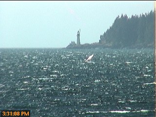
Windsurfer at Tugwell Creek
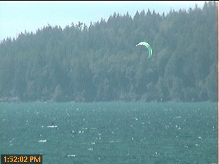
Kiter at Tugwell Creek
For 2004, we fortunately have a webcam at 'Seaya' Jack and Kathy's house at Tugwell Creek.
Thanks Jack! Shred on!
A few helpful websites:
- Big Wave Dave's Amazing Wind & Wave Information for Vancouver Island Sites: Wind Data, Wind Graphs, Wind Maps, Wind predictor
- Current Wind Map of Southern BC, updated hourly
- Island Wind Forecast for Nitinat by Randall Kashino
- Wind Cams of North America
- Intellicast Wind Maps
- Marine Weather Forecast for West Coast Vancouver Island South
- Wind Scales
- Weather Calculator - Converts weather data to different units of measure
- Weather and Wind for Sheringham Point
- Weather by Environment Canada for Sheringham Point
- Weather and Wind for Globe
- Tides by Environment Canada - my favourite tide tool
- Try the Race Rocks Live Video Cameras to see ocean conditions and marine life
- Visit www.coastalbc.com for all your Vancouver Island sports information
- Visit the US Pacific Windsurf Website
- For more detailed directions and maps, try Map Quest
- Cross Reference of Sailing Sites and Wind Data Station Sites
 Images of Wind Sailors at Tugwell Creek by Waterose
 Images of Wind Sailors at Tugwell Creek by Waterose
Windsurfing and Kitesurfing Cartoons by Waterose
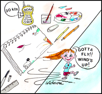
Toon of the Week
Introduction
General Overview Map of Vancouver Island Sites
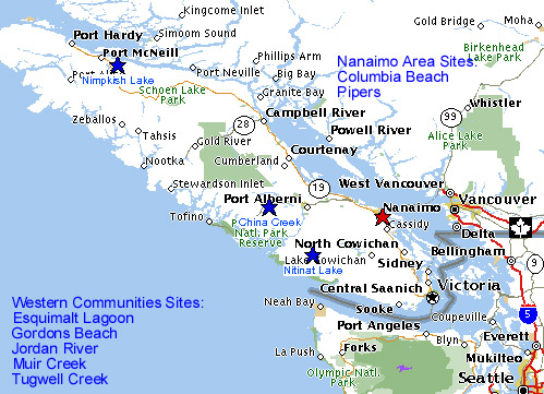
For more detailed maps, click here
Wanted: Shots of these Spots!
- Full Photo Credits Offered!
- If you have pictures of these sites, hardcopy or electronic, please contact Waterose to have them added to this Web Page!
- All Photos by Waterose unless otherwise credited
China Creek
Air time to Shredder Johnny Bear for sending these clips!
Johnny Bear shreds a Loop
Johnny Bear attempts to shred a Vulcan
Paul shreds a Vulcan
Thanks and Shred on Wind Dudes!
Live long and prosper V
- Location: Vancouver Island Central near Port Alberni
- Skill: Beginner to Intermediate
- Seasonal Information: Summer thermals, Sails - 5.0 to 6.0
- Access: Beach launch, brackish inlet, warm water
- Wind Reference Station(s): Similar to Nitinat Lake. Check Island Wind Forecast for Nitinat by Randall Kashino for most relevant information
- Hazards: Boaters, quick squalls
- Amenities: Camping at the China Creek Marina, RV's, campsites,showers, toilets
- Wildlife: Small mammals, water fowl, fish
Columbia Beach
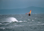
Shredder Wade Luksay jumping at Columbia Beach
Shredder Johnny Bear: Off the lip, Back Loop, and Forward Loop
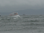
- Location: Vancover Island Central near Nanaimo, just north of Parksville
- Skill: Intermediate to Advanced
- Seasonal Information: Summer thermals (?), Sails - 4.0 to 5.0
- Access:
- Wind Reference Station(s): Check Ballenas, Entrance Island, Merry Island, Sands Head, Sisters Islands
- Hazards:
- Amenities:
- Wildlife:
Cook Street/Dallas Road/Clover Point
Check out the new webcam for this area at the Big Wave Dave Website
- Location: Downtown Victoria opposite Beacon Hill Park
- Skill: Intermediate to Advanced - very challenging. Wave and chop, strong ocean shorebreak. Can be quite congested and very busy. Share with other users - kitesurfers, paragliders etc.
- Seasonal Information: Can be windy any time of year. Summer thermals and storm fronts. W & WNW. Sails 3.5 - 5.5
- Access: Parking along Dallas Road above cliff area, large grassy rigging area, assemble and carry rig down the stairs to beach launch - pebbles and logs
- Wind Reference Station(s): Check Trial Islands, Victoria Harbour, Race Rocks, Gonzales
- Hazards: Very cold water, some large woody debris, and rocky reefs
- Amenities: None.
- Wildlife: None. Dogs.
Other:
- Trainer kite surfing lessons available from Bosuns Locker on Thursday's
- Sewage outfall, primary treatment only (that means almost raw sewage)
- Windsurfers, surfers, and kite surfers should write the Ministry of Water, Land and Air Protection, to protest our current provincial sewage regulations, which are the worst in Canada. They must be changed, and they will only change if the public starts writing letters. We must request tertiary treatment with closed loop treatment facilities. Sewage outfalls hurt people, marine life, fish, whales, etc etc etc. Visit Our No Outfall in Sooke Website for more information.
Please Add What YOU Know!
Elk Lake
- Location: Victoria North in Central Saanich
- Skill: Beginner, excellent long board site and fun board site
- Seasonal Information: Light to moderate gusty winds in spring/summer and fall, W-NW, SW, Sails - 5.5 and bigger. Lake chop, warm water.
- Access: Parking, grassy rigging area
- Wind Reference Station(s): Check Kelp Reef, Saturna Island, Smith Island, Discovery Island, Trial Island
- Hazards: None.
- Amenities: Nice Park. Rowing Club. Toilets.
- Wildlife: Water fowl.
Esquimalt Lagoon
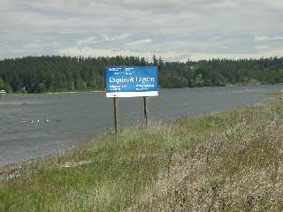
- Location: Vancover Island South, Western Communities, near Royal Roads University, just off Sooke Road (Highway 14), about 15 minutes from downtown Victoria
- Skill: Beginner on the Lagoon side and Intermediate on the Ocean side
- Seasonal Information: Summer thermals are generally onshore or sideshore, W and SW, usually 15 - 25 knots, up to 30 - 35 knots on a really good day, Sails - 4.0 to 5.5, Ocean chop, Usually good in the evening 3:00 pm to 4:00 pm in the summer
- Access:Park on Ocean Boulevard, rig on nice long sandy beach, launch from either ocean side (more advanced) or Esquimalt Lagoon side (more protected)
- Wind Reference Station(s): Esquimalt, Sheringham Point and Race Rocks. Best web site to check is Big Wave Dave, which has a wind predictor for this area.
- Hazards: Very cold water, no excessive debris
- Amenities: Lots of space for a picnic, no real amenities
- Wildlife: Water fowl, mussels, clams, seals


Other:
- Esquimalt Lagoon: State of the Ecosystem Environmental Report by Waterose et. al.
- Try the Race Rocks Live Video Cameras to see ocean conditions and marine life
Please Add What YOU Know!
Gordons Beach (Also see Tugwell Creek)
- Location: Vancouver Island South, Western Communities. About ten minutes northwest of Sooke on Highway 14, just past Otter Point. Look for a long stretch of houses and ocean views on the highway. There are three beach access points. Gordons Beach is just before Tugwell Creek.
- Skill: Intermediate
- Seasonal Information: Summer thermals, 15 - 30 knots, W, NW, and WNW, Sails 4.0 - 5.0,
- Access: Park on the highway, three access points. Rig on pebble beach. Launch - moderate shorebreak, some debris, crab traps
- Wind Reference Station(s): Sheringham Point and Race Rocks. Best web site to check is Big Wave Dave, which has a wind predictor for this area.
- Hazards: Very cold water, some debris, crab traps, fishing boats, bull kelp, mussels (booties recommended).
- Amenities: None.
- Wildlife: fish, whales, seals, otters, water fowl, raptors, etc.
Other:
- Similar conditions to Tugwell Creek: see the live webcam (Jack and Kathy) for Tugwell Creek
Island View Beach
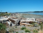
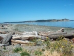
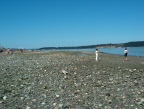
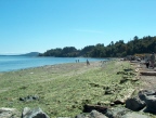
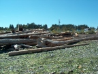
- Location: Victoria North in North Saanich
- Skill: Windsurfing: Intermediate to Advanced (Winter)
Kitsurfing: Popular summer learning spot in the summer when the conditions are right. - Seasonal Information: Spring and Fall, Winter. Summer Kiting. Side Onshore SE-E, 15 - 25 knots, Sails 3.5 - 5.5, wave and chop with shorebreak
- Kiting:Preferred local location, close to Victoria that is, for learning kiting, launching, body dragging etc
- Access: Nice Park, Parking, grassing rigging area, sandy beach, easy access.
- Wind Reference Station(s): Kelp Reef, Saturna Island, Smith Island
- Hazards: Very cold water, large debris, ocean shorebreak
- Amenities: "Jimmy Lewis", Nice Park. Tent and RV Camping, Bathrooms, Picnic areas.
- Wildlife: ?
Other:
- Check out the Island View Beach Webcam from Big Wave Dave's Website
- Also see Willows Beach for less extreme conditions
- Popular with kite surfers
- Environmental: Island View Beach: State of the Ecosystem Report by Waterose et. al.
Please Add What YOU Know!
Jordan River Point
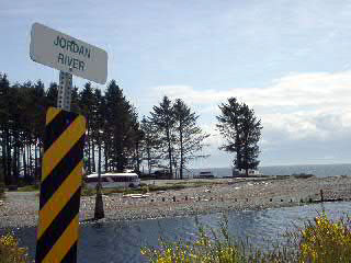
- Location: Vancouver Island South, Western Communities. About one hour from Victoria, west on Highway 14.
- Skill: Intermediate
- Seasonal Information: Summer thermals, usually windiest in August late in the day, W-NW, 15-25 knots, Sails 3.5 - 5.5, wave and chop, shorebreak.
- Access: Nice Park, Parking, grassing rigging area, sandy beach, easy access
- Wind Reference Station(s): Sheringham Point and Race Rocks. Best web site to check is Big Wave Dave, which has a wind predictor for this area.
- Hazards: Very cold water, some large woody debris from logging, ocean shorebreak, share with other users such as surfers, kiteboarders and kayakers
- Amenities: Nice Park Area; Camping: Used to be free RV and tent camping on site, but now I think that they are charging $14 or $15 (Cdn) per night; Toilets; Food - (Shakies Burger Bar and the Breakers Restaurant)
- Food: Check out Shakies Burger Bar; the surfer cookies are the best!
- Wildlife:seals, river otters, orca whales, sea birds

Other:
- Environmental: Jordan River is a river estuary that has been dammed by BC Hydro. A horn blast is sounded for periodic 'dam' water releases. BC Hydro recently completed the Jordan River Water Use Plan.
Please Add What YOU Know!
Muir Creek
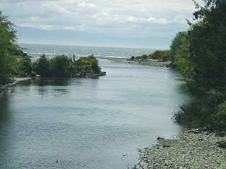
- Location: Vancouver Island South, Western Communities. About fifteen minutes northwest of Sooke on Highway 14, past Gordons Beach, and just after Tugwell Creek, just before Shirley.
- Skill: Nice spot for beginner surfers, intermediate windsurfers, kitesurfers
- Seasonal Information: Summer thermals, similar to Tugwell Creek, Wind W-NW 15-30 knots, Sails 4.5 - 5.0, wave and chop with shorebreak
- Access: Pullout northwest of bridge, with small parking lot and concrete barriers; A bit of a trek from the parking lot to the estuary to pack your gear; Rig in grassy glade; Launch - long shallow sand and pebble beach with ocean surf
- Kiting:Could be a nice launching alternative to Gordons or Tugwell for kiting.
- Wind Reference Station(s): Sheringham Point and Race Rocks. Best web site to check is Big Wave Dave, which has a wind predictor for this area.
- Hazards: Very cold water, booties recommended
- Amenities: Nothing formal. Large grassy area, very nice beach, nice day spot for picnics, walking the dog on an endless pebble beach, tide pools; Camping: No formal camping site, but folks sometimes pack in their gear to the grass glade or park their RV in the parking lotinformal camping; Food: Visit the Country Cupboard Restaurant in Shirley, about 5 minutes north of Muir Creek for an excellent quiet lunch or dinner
- Wildlife: seals, sea lions, river otters, salmon, orca whales, sea birds

Nimpkish Lake
- Location: Vancouver Island North: about 300 km north of Nanaimo near Port McNeil. Off the highway at a small, open, logging campsite, frequented by a small group of very dedicated locals and any number of visitors that choose to make the long and weary haul (good highway). Access to the water is limited to a small central area and a couple of other jump-in spots
- Skill: Intermediate
- Seasonal Information: Summer thermals, NW, Can be very windy, 4.0 - 5.0, but not as reliable as Nitinat, Lake chop with some waves up the lake
- Access: Bit of a wind shadow to get through before reaching full wind exposure.
- Wind Reference Station(s): Check marine weather and wind reports for Johnstone Strait
- Hazards: ?
- Amenities: Camping. Very casual. Friendly, with families.
- Wildlife:Fish, mammals, birds
Nitinat Lake
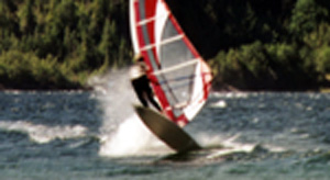
Photos of shredding at Nitinat 2001 on a typical classic 3.5 to 4.0 kind of day are from the Crickmer Family! Thanks! Shred On!


- Location: Vancouver Island Central, about 2.5 hours from Victoria or Vancouver plus BC Ferry time. Total of about 1 hour of logging roads past Youbo/Cowichan Lake, W of Duncan. Step One: Get to Vancouver Island and head for Duncan, which is south of Nanaimo and North of Victoria. Step Two: Head West to Youbou. Be sure to drive on the North side of Lake Cowichan and not on the south side. Drive straight through and past Youbou. Step Three: You will be heading (sort of) East and South on gravel logging roads to the Ninitat Lake Band Reservation and Campground. The windsurfing/kitsurfing campground is past the Indian Reservation and not far from the general store. You can stop at the local grocery store for more detailed directions. Have fun:)
- Skill: Beginner to Intermediate
- Seasonal Information: Light to strong summer thermal winds winds. Sunny days are usually reliable 15 - 25 knots/4.5 - 5.5 (average size male with course/slalom board - anywhere from 8'6" to 9'6"), with winds consistently moving up the lake off the ocean around 11 a.m. (it is remarkable to see the white caps approaching while the remainder of the lake lies calmly awaiting to be awakened!), blowing solidly until around 6 p.m., W-NW (side, side onshore), April through September (well over 100 superb sailing days per year). Lake chop conditions, with waves upwind towards the ocean.
- Access: Very long and fairly wide pebble beach provides lots of access to the lake once you get yourself out of the woods.
- Wind Reference Station(s): Check Island Wind Forecast for Nitinat by Randall Kashino for most relevant information
- Hazards: ?
- Amenities: Camping: The campground (started by Mac-Blo and popular with fishing people) is a very popular isolated spot amongst a wonderful forest of large trees and enormous stumps. A narrow road winds through a small area of camp sites that has gradually expanded over recent years to contain a large number of travelling windsurfers (Victoria Area, Vancouver/Lower Mainland Area, Squamish /Whistler Area, Other parts of BC, Other parts of Canada, Northwestern U.S.). No amenities (bring your own food, water, etc.), but recently the neighbouring Native community built a gas station/food store with hot showers. Generally very casual (leave your stuff rigged on the beach all the while you're there); very friendly (lots of socializing amongst "neighbours"; even with many of the locals/regulars), some families; some weekends can be loud. Toilets. Sauna on the beach. Due to increasing popularity of this sailing site it is hard to get a good camping site during peak periods such as during events and on weekends. There is a day launch area available.
- Wildlife: Bear, cougar, racoons, small mammals, salmon, gigantic jellyfish in late fall, water birds
Other:
- Lots of alternative activities with the hiking trails and big trees of the Carmanah Valley not far away (through some gruesome slash'n burn sites), mountain biking options, nearby walks, early morning waterline exploration options (bring your own watercraft - canoe, kayak, etc.), and of course, for those who are so inclined, (salmon) fishing.
- Popular place for learning kite boarding.
- An annual event has been running for several years now, called "WIRED" (Windsurfing Instruction, Racing, Equipment Demos), which draws something like 250 people (so I've heard). Huge success!
- Visit the Nitnat Windsurfing Society Website for more information and lots of great fotos
Pipers Lagoon
- Location: Vancouver Island Central near Nanaimo, just north of Departure Bay.
- Skill:Intermediate, ?
- Seasonal Information:Summer thermals, NW
- Access: Free parking, ?
- Wind Reference Station(s): Check Ballenas, Sands Heads, Sisters Islands, Entrance Island, Merry Island
- Hazards: ?
- Amenities: Small provincial park. ?
- Wildlife: Fish, oysters, ?
Other:
- Compliments of Sue! Thanks Sue!
- A natural inlet and perfect place to have a picnic. You can park for free and walk along the path which divides the lagoon from the Straights of Georgia. The walk leads to a small Provincial park which is easy to walk around providing you are able bodied. The lagoon at low tide is flat and muddy. The entrance to the lagoon is a seabed of oyster shells surrounded by fishing shacks on rock outcrops. The scenery is very beautiful with Vancouver's mountains in the distance and it is an ideal place to launch your kayak or canoe.
Please Add What YOU Know!
Sooke Basin
- Location: Vancouver Island South, Western Communities. End of Billings spit or from Goodridge Peninsula by Sunny Shores Marina
- Skill: Intermediate
- Seasonal Information: Summer thermals, a bit unpredictable, Wind W or SE, 15-20 knots, Sails - 4.5 to 5.5, warm water
- Access: Park on street, rig on pebble beach, launch from pebble beach for both Billings Spit and Goodridge.
- Wind Reference Station(s): Sheringham Point and Race Rocks. Best web site to check is Big Wave Dave, which has a wind predictor for this area.
- Hazards: Shallow mussel beds, eel grass, submerged obstacles, a few large logs or 'root wads'. Can only sail Billings Spit during high tide (greater than 2 meters or 6 or 7 feet)
- Amenities: None.
- Wildlife: Fish, seals, otters, mussels, crabs, water fowl
Other:
Tugwell Creek (aka Gordons)
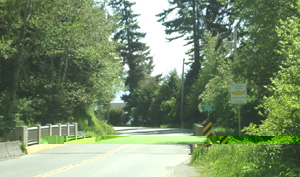
- Location: Vancouver Island South, Western Communities. About 15 minutes northwest of Sooke on Highway 14 just past Gordons Beach. There is a small cluster of houses just before (south) of the creek bridge. There is a turn around pullout just past the bridge. Drive over the bridge, turn around, and come back on the west side of the highway.
- Skill: Intermediate to Advanced. Extremely challenging on a windy day.
- Seasonal Information: Summer thermals, Winds N-NW 15-30 knots, Sails - 3.5 to 5.5, Wave chop, swells, and ocean shorebreak
- Access: Park on the west side of the highway. Look for a large wooden board fence, about seven houses from the creek bridge and a very crooked hydro pole.

- Wind Reference Station(s): Sheringham Point and Race Rocks. Best web site to check is Big Wave Dave, which has a wind predictor for this area. You can also look at Wunderground and Environment Canada for Sheringham Point.
- Hazards: Very cold water, booties recommended, very little large woody debris, large bull kelp fields (not really a hazard but more of a nuisance), wind conditions can change very fast up or down
- Amenities: None.
- Wildlife: River estuary in ocean bay. Seals, river otters, sea lions, orca whales, sea birds, salmon.

Other:
- Kiting: Not a good spot for learning kite boarding!
Consider driving another five minutes west up the highway to Muir Creek, West side of the bridge, for kiting.
- Always, always, use a safety release system!!!!! Get an Ocean Rodeo punch-out, or some other system.
- If launching in an unfamiliar location, ask around (other kiters OR windsurfers) about conditions, hazards etc.
- Wear a helmet!
- Pay attention to the wind conditions. Spend some time watching. If the wind looks and feels volatile, maybe unpredictable.....it probably is.
- At Gordons, launch up by Tugwell Creek where there is more room and a better angle.
- At Gordons, keep your kite over the water. Do not bring it over the beach, cabins or trees.
- Bring your kite up SLOWLY.
- If things go wrong upon launch and you are overpowered, let go of your kite!
- Do not launch hooked-in (I know some will disagree with this rule under certain circumstances but it could save you)
 Images of Wind Sailors at Tugwell Creek by Waterose
 Images of Wind Sailors at Tugwell Creek by Waterose
Tugwell Creek 2004 Webcam at 'Seaya' Jack & Kathy's House
Willows Beach Park
- Location: Downtown Victoria near Oak Bay, Similar to Island View, but a bit less extreme.
Small protected bay with rocky outcrops. - Skill: Intermediate, also a great learning site...my kind of place!
- Seasonal Information: Spring, Fall, Winter sailing with S and SE Winds. Good winter day 3.5-4.0 not unusual.
Winds are generally higher toward cattle point or 50M distance away from beach, with great waves developing at times depending on tide, avoid hero-jybing in front of the Cattle point launch for the parked tourists unless you want to become splattered if you blow something....also baaaad reef running a ways out (50-70 M) from the 1st launch on the E side - Access: Nice park, parking lot, beautiful grassy area, nice sand and and small pebble beach for launching
- Lauch:Just below the teahouse or slightly west of parking lot is good; can be tough water entry due to directly onshore break if S, walk 100M toward the marina bay from parking lot and look for flat reef area (watch the reef and pipe on entry); stay away from beach after launch, in particular the "beach hole" starting at playground and E along the beach as wind lifts off, causing you to be under and can get swept ashore into the break
- Wind Reference Station(s): Check Discovery Island, Kelp Reef, Saturna Island, Smith Island, and Trial Island
- Hazards:
- Watch out for the "fin eater", the small submerged outfall, at the end of the beach;
- Watch out for the "snaggers", three or four low tide walls that run out into the water (not usually a problem during high tide);
- Watch out for the "ankle breakers", small debris and rolling logs, when launching;
- In spring, watch out the "wind eaters", the small yachts, dingy racers, and wonky spinakers, in your windline;
- Watch out for the "toe biters", the crab pot buoys and lines;
- Bull Kelp is rare except during high wind events;
- And, last but not least, watch out for dog s_ _ t on the grass and walkway, and unleashed dogs running over your gear. You know the type.....
- Driftwood can be a problem, in particular on wind change from SE to S or on first day of storm, getting progressively better after that;
- Tidal change has a high impact on the wave size/sets and chop hard (worst after and E of Cattle point) on slalom gear on high wind days;
- Amenities: Great parking, Great people, Sandy beach makes barefooting okay (one of the few areas); Rigging: best behind the Kiwanis Club Teahouse (nobody in their right mind rigs on the grass because it is often too windy there), Water fountain (new and appreciated) at the Tea house, which serves hot drinks and basic food if open in the fall and spring, but is closed in winter; Snack bar and toilets.
- Wildlife: People, pets, tourists, children...
Other:
- Great safe learning spot for high winds and waves: you just get swept into the relative safety of the sandy beach where several waiting spectators and Good Samaritans will drag your sorry butt out of the water if necessary...
- Secure your gear: Swirling wind off the beach once hitting trees, cars and buildings make all gear airborne easily!! Sails are regularly peeled off adjacent trees and cars - proper laydown position doesn't always work!! Carry your board to the beach first, then your sail on higher wind days, 5.0 or better (not the other way around unless you secure the sail!!!) railings, swirling wind due to beachwalkway and beach drop make it difficult to carry both without striking something on way in or out.
Contact Information
- For further information contact:
 Questions or Comments to Waterose
Please add what YOU know!
 email Waterose
View the Guestbook

| Articles | Projects | Resume | Cartoons | Windsurfing | Paintings | Album |
 | ||||||
![[Forward Loop]](fwdloop.gif)
![[Next]](flnext.gif)
This Forward Loop site is owned by Waterose.
Click to Skip Next | Next 5 | Random
Want to join the loop? Click here for info.
