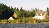
Hay River, Northwest Territories, Canada
Photographs can be seen of Hay River and Fall in Hay RiverLocation
Hay River can be found 1,130 km north of Edmonton. Geographically the town is located at 60' 49" north latitude and 115' 47" west latitude. The town lies on the south shore of the Great Slave Lake, 494 km south of Yellowknife which is the capital of the NorthWest Territories.
Five or six communities actually make up Hay River and these are spread out along the river. The modern Hay River new town sprang up after the flood of 1963. The old and new Dene village on the Hay River Reserve are located on the East Bank of the Hay River. On the shore of Great Slave Lake is the the West Channel fishing village and there is also the "old town" or Vale Island which is both residential and industrial.
Population
The population of Hay River is roughly 3400. 68% are non/native, 21% Metis, 10% Dene, 1% Inuit.
A Brief History of Hay River

Dr. David Harrison
The aboriginal Dene lived a nomadic life throughout the Hay River area. They hunted, trapped, fished and gathered the natural resources of the boreal forest. Today the Hay River Dene Reserve forms a rapidly developing community close to the mouth of the east channel of the Hay River.
Not until 1806 did the North West Company build a permanent trading post on the Hay River but considerably further to the south near Meander River in Alberta. This post established by Edward Smith closed down in 1821 following a disastrous gunpowder explosion and the amalgamation of the North West Company and Hudson's Bay Company.
In 1868, John Hope built a small trading post for the Hudson's Bay Company on the east bank of the east channel opposite island "A". At the same time the Oblate missionaries built a small log church and house near the present day Church of Ste. Anne at the northern end of the Dene Reserve. Both the fur trade post and the church closed down in 1868 because of the lack of trade and resources.
In 1880s, a small group of Slavey people built a semi-permanent settlement with a few houses, gardens of potatoes sand small herd of cattle. To this small community came Thomas Jabez Marsh in 1893 to set up a small mission for the Anglican Church. By 1909, Marsh and his successor A.J. Vale had completed St. Peter's Church which can still be visited today. Until 1937, St. Peter's Mission was the residential school for the Diocese of Mackenzie River. It was a busy self contained community with large three storey school, warehouses, cottages, barns, boat yards and 7-8 acres of vegetables and field crops. All that remains today is the church, warehouse and cemetery.
In the late 1930s, the east bank settlement of only about 150 people was visited occasionally by the Hudson's Bay Company steamers Distributor, Mackenzie River and Liard River, and an infrequently scheduled aircraft from Fort McMurray. But as northern exploration advanced and oil, pitchblende and gold were discovered new routeways to the north opened up. In early 1939, the first cat train reached Hay River en route to the gold mines of Yellowknife. Throughout World War Two these initial routes were upgraded. By 1948, a permanent all weather gravel road, the Mackenzie Highway, reached the shores of Great Slave Lake on Vale Island. Stretches of the old highway can be seen as you travel north from the NWT border.
Along this new highway came fishermen from the Prairie Provinces eager to set their nets into virgin Great Slave Lake. Vale Island between the two river channels became the new focus of Hay River. Slowly streets, houses, shops, schools, churches and businesses lined the waterfront and crisscrossed the northeast corner of the island. A dirt road was extended to the mouth of the west channel in late 1948 and a small separate fishing village created. Shipping companies began to use Hay River as their base for supplying northern settlements along the Mackenzie River and the Arctic coast. Road, air and telephone communications improved. In the late 1960s, the Great Slave Railway edged north from Roma Junction near Peace River, reaching Hay River and Pine Point in the fall of 1964. This further strengthened Hay River's Role as the "Hub of the North" linking southern Canada with the whole of the Mackenzie District.
In 1963, a disastrous spring break-up and flood destroyed much of the water front property. Town officials were forced to relocate the residential section and downtown core to the modern townsite you now see.
Karp Styles*Crochet*Dreamcatchers*
*Sign Guestbook*View Guestbook*Contact*
Graphics on this page courtesy of Destiny's Lady