|
46.89 miles, 550 vertical feet, maximum speed 32 mph
On the road by 7:30. Nice gentle tailwind and an average slight descent gave us a lot of speed, 16-23 mph range. If yesterday was granny’s day, today proved the value of the half-step gearing. Some knee pain from yesterday’s low cadences, but it worked out after a few miles and we made good time.
North of Independence, big fields of alfalfa. I have a lot of sympathy for those who protest subsidized water rates for thirsty low-value crops such as alfalfa. As we approached Independence, we could see clouds of alkali dust from the dry bed of Owens lake in the rising daily wind. Eventually, the dust clouds dispersed into a general haze and were no longer discretely visible.
We stopped at Independence for breakfast. Southern Pacific 4-6-0 oil burner at the park. At first glance, looked pretty nice, but turned out also to need some restoration. The wind became a moderate headwind from Independence to Manzanar.

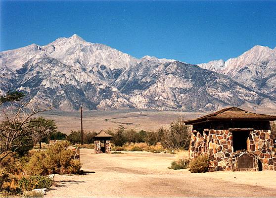
Stopped at Manzanar, the first and perhaps best known of ten internment camps for Americans of Japanese ancestry during World War II. I wanted Loren to see it; this is a sober chapter in American history. I think the most impressive thing still visible is the stone borders neatly arranged around individual lot boundaries. Obviously the people who lived there still cared! Saw some books on Manzanar at Lone Pine, but none of them worth buying. The photos in the books show barracks, rather than houses or apartments – even more surprising that their property boundaries would be decorated.
Lots of traffic, but good shoulder all the way, so not a problem. Except for the certifiable jerk, oncoming in a van, who passed in our faces, using up part of the shoulder as well as all of the lane. We could have done without him. The wind became a stiff (>30 mph) headwind from Manzanar into Lone Pine – hard work.
Stopped at ranger station at the south end of town, got some Mt Whitney trail bumpf. Another two miles to tourist information stand, where we learned there are no campgrounds here with showers. (We subsequently saw a description of the Lake Diaz campground that disagreed.) So we changed our plan to camp, and found the Trail Inn motel. (East) Indian woman running motel, wonderful 18-month old daughter wandering around everywhere. Not old enough to talk yet. Decided we might as well stay tomorrow night at the same place, cancelled Best Western reservation.
Wandered downtown. Loren suggested a Mexican place for lunch. Excellent choice. Buffet with fresh fruit and veggies and do-it-yourself Mexican stuff. I overdid the cantaloupe and fresh peaches.
Took in two rolls of film for printing. Searched out Lone Pine Riparian park to while away the afternoon on the grass in the shade. Very windy – the day would be hot if not for the wind. Pizza tonight at a restaurant that used to be a bank. The pantry is the old vault, with the armored steel door still there. I looked over the selection of beers and decided on root. The worst thing about being away from civilization is not being able to get good beer.
Mountains on the east side are still illuminated by the setting sun; the west side is in shadow. Brilliant clouds over the western mountains.
Stripped the front racks off the bikes, in preparation for Jacky’s arrival with the car. The bikes seem really light and sporty with the weight removed. Of course, I immediately added back a load of bananas, granny bars, cold weather gear, and spare water bottles for tomorrow’s Mt Whitney hike.
Things to do to bike: get front shifter working right – it never really has since I replaced the cable in Mammoth Lakes, despite repeated tinkering. Get a new screw for the front derailleur clamp to replace the makeshift I improvised a long time ago and forgot until I broke the cable again. Shim or bend the right side of the rear rack out so it will clear buckles on the panniers. The rear panniers have been so hard to mount and dismount that I haven’t removed them until today. New saddle – Lycra cover is wearing through. New handlebar tape. Other than that, Mrs Lincoln, it’s a terrific bike.
For Jacky’s bike: new handlebar tape. Smooth down areas where the road scraped it up – including the rim of the front wheel. True the front wheel.
Bike: 25.1 miles, 4380 vertical feet
Hike: 14.2 miles
Total: 39.3 miles, 9000 vertical feet Topo map
8:50 AM, 7000' hairpin on Whitney Portal road
Got up at 5:30 to maximize our daylight. Flat rear tire. Lucked out – the first patch held – I would have been embarrassed to do a defective patch in front of Loren, who’s an expert patcher by now. Managed to eat and be on the road by 6:30.
Lone Pine, at 3700', was cool and pleasant in the shadow of the Inyo mountains. The first rendezvous at 5000' was not so cool, but ok. The second rendezvous at 6000' was still okay. The heat is following us up, but we’re managing to keep ahead of it.
The last 1000' was steeper. My cadence has been in the 65-70 range – I need a lower gear or larger lungs or both. When I was here before, I don’t recall the climb being this hard – maybe I just remember the good parts.
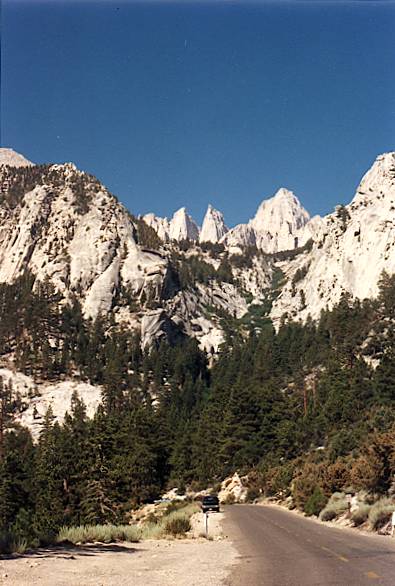
9:50 AM, 8000', just above the summer homes
The view changed from merely expansive to magnificent. High Sierra forest. Lone Pine peak filling the sky across from the road. Sweat running into my eyes, but definitely cool, even while riding in the sun. Grade still keeps me around 70 rpm.
8:30 PM
Turned out we were almost at Whitney Portal at the last stop – just altimeter error. Filled water bottles, locked bikes, changed shoes, and we were off.
Carrying a pannier in lieu of a backpack was a really poor idea. I will have sore arms and shoulders for several days [miraculously, I didn’t]. Should have rigged some kind of shoulder harness from the straps we had for tent and sleeping bags.
Tried to lighten the load by eating the bananas first, but it was still heavy. In view of the trail environment and the heavy traffic, we packed out even the banana peels, which I normally would have left for the insects.
Started hiking at 10:45. Decided we would have to turn back between 3:00 and 3:15 to assure adequate daylight to get down with some margin before 8:00 darkness.
First part – high Sierra forest, rocks, streams, wildflowers, chipmunks, hummingbirds. Steady climb, not excessively steep, but no trail for the feeble. Lots of traffic – hikers, climbers, backpackers. Skipped the side trail to Lone Pine lake, in favor of getting as far up the mountain as we could.
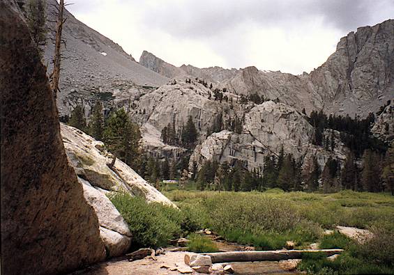
Bighorn meadow is as nice as anything in Yosemite – sheer granite walls, a meadow with a stream. Camping at one end. Solar toilets with signs asking people not to urinate in them: “Find a discreet place…” First time I ever saw a toilet marked Don’t pee in me!
Woman going up, slower than we. We’d stop for calories and she’d catch us, then we’d pass her again. She was trying to find her party of a dozen who seemed to have been misplaced. Don’t know if she ever found them – we didn’t run across a dozen random stragglers anywhere.
Ranger with a backpack at Bighorn asked if we were going up or down. We said up; he asked if we had rain gear. We said yes, he looked skeptical, then noticed our pannier where we could stow such things, and wished us a nice hike.
Clouded over. A few drops in the air.
About 11,000' it got cold enough that we added a layer of clothing. The tree line was right about there. Just below the tree line, lots of bristlecone pines [actually whitebark pines, a close relative], fat and sassy in the comparatively benign environment of Whitney. Bet they won’t live 4000 years!
Above the tree line, there’s almost no soil, just sand and rocks of varying sizes. White granite (according to the book, granodiorite). A few small wildflowers, mosses, lichens. Patches of snow, and vigorous cold streams. One trailside meadow with enough soil to grow grass along its stream.
Trail camp at 12,000' not a place you’d stay by choice. Open rock! Only good thing was that there was no wind anywhere. Presumably this is typical: one of the lakes is called Mirror lake.
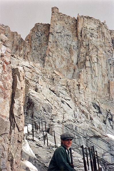
Crossed a creek we never saw, buried under the boulders. Only way we knew it was there was the roar of the water beneath our feet. We had hoped to get as far as the junction with our old friend, the John Muir trail, at Trail Crest pass, but at 3:15, we had only gotten to a section of trail protected from the abyss by a cable rail, just past the 7-mile sign. It began sleeting. We took pictures, declared victory and abandoned the field. From the topo map, we figured we were at 12,700'; the altimeter read 12,600'. Gives us 9000' for the day. |
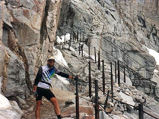
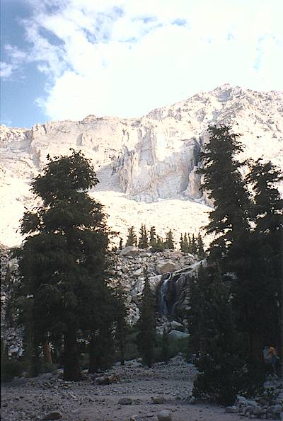
Below 11,000', it warmed up. The sun eventually returned. Beautiful.
A couple of backpacking climbers, descending faster than we – almost running. What knees they must have.
Got to the parking lot about 6:30, water bottles empty.
You don’t get extra points in heaven
for finishing with water in your bottles.
Felt like a totally different body when I got onto the bike. The roll down into Lone Pine was punctuated by lightning strokes from a sunny thunderstorm over the Inyo mountains to the east. Impressive to watch.
Some meteorology on my own descent – went from strong right crosswind to no apparent wind (ie stiff tailwind) to strong left crosswind in a space of about 30 seconds.
Brilliant sun in the Mt Whitney clouds in my rear view mirror. Doesn’t look cold and blustery at all.
Jacky was at the motel. Went to health food Mex restaurant, ate, cleaned up…
Tried for tee shirt: I damn near climbed Mt Whitney. Store with those shirts was closed. Other store was open, but didn’t have them.
Guy in the restaurant this morning, wearing a national cycling championships tee shirt, commented on Loren’s road rash. We met him and his wife on Mt Whitney trail later. They were impressed – they had passed us in their car as we rode up, and then to meet us on the trail…
More…