 |

This page is a brief collection of photographs from around, and information about, this great country of Australia. I will, each couple of weeks, change these photographs and this will give you all an idea of the great beauty and the wonders of this FANTASTIC country of mine.
Please enjoy!

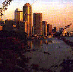 Brisbane, QLD
~ Brisbane is Australia's third largest city. Its climate is subtropical with an annual rainfall of 1,090 millimetres (most of which falls between December and March), an average of over seven hours of sunshine each day, a humidity level which hovers around 50% for all of the year, and a temperature range from 10 degrees Celsius in winter to 30 degrees Celsius in summer. There are nearly 200 parks and reserves within 97,200 hectares administered by the Brisbane City Council. Brisbane has long had a tradition of newness and consequently, unlike Sydney or Melbourne, it has few old buildings of importance. This can partly be explained by the city's long history of building in timber and the fact that in 1864 a fire destroyed many of the city's finest early buildings. Of interest, however, are the Old Government Houses (built in 1862 when the population was a mere 6,000 people), the Parliament House on the corner of George and Alice Streets (built in 1868 it is a fine example of French Renaissance architecture), St. Stephen's Church in Elizabeth Street (the city's oldest church, it was built in 1850) and St. John's Cathedral and The Deanery in Ann Street.
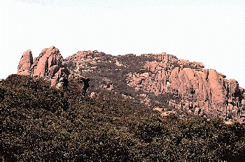
Mount Buffalo, VIC
~ Mt. Buffalo, 1,400 metres high, was formed by an upthrust of molten rock millions of years ago. The original granite bluff has lost an estimated 1,000 metres through the long process of wind and water weathering. The 35 square kilometre rock is strewn with granite boulders, tors and plateaus.
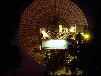 Carnarvon, WA
~ Carnarvon faces Bernier Island and the Indian Ocean and is 481 km north of Geraldton and about 900 km north of Perth. The town is named after Lord Carnarvon who was Secretary of State for the colonies from 1866 to 1874. There were European settlers in the district in 1876 and the town was proclaimed in 1886 as a service centre for the pastoral industry in the local Gascoyne district. This is a high-tech area; the satellite tracking station of the Overseas Telecommunications Commission, the base of Radio Australia and a space vehicle tracking station operated by NASA (from 1964-1974) are all in the Brown Range 12 km behind the town. Nowadays Carnarvon's prosperity is partly due to the prawning industry and to the success of the irrigated fruit and vegetable farms near the mouth of the Gascoyne River.
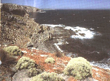
Kangaroo Island, SA
~ Camel treks atop dramatic coastal cliffs; strolls along the beach amongst families of sea lions; picnicking with kangaroos and emus; a hike through the Little Sahara ... Kangaroo Island has them all. Just 16km from the mainland, Australia's third largest island (145km long & 60km wide) has a wide variety of experiences to offer the visitor. Despite being so close to the mainland and easily accessible by both ferry & aeroplane, Kangaroo Island has managed to preserve an aura of isolation. This isolation has helped to conserve the natural flora & fauna, as pests such as foxes & rabbits have never been introduced. The range of accommodation on the island includes hotels, motels, cottages & caravan parks, most of which are located in the three main towns of Kingscote, Penneshaw & American River.
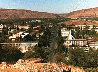 Alice Springs, NT
~ While Alice Springs has the rough-and-ready heritage associated with a cattle town thousands of kilometres from any major centre, it is essentially a modern town offering a range of high quality hotels, motels, well-ordered caravan parks and a casino. Despite modernisation, there are still many visible reminders of the old Alice. A reserve surrounds the thick-walled stone buildings of the Overland Telegraph Station which have been restored & display early photographs & documents. For a truly outback experience there is the Camel Farm, stocked by the descendants of the camel trains that once provided the only form of transport to many areas of central Australia.
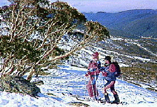
Snowy Mountains, NSW
~ This exhilarating region is part of the New South Wales section of The Great Dividing Range. Approximately 160km long & 80km wide, much of the terrain is 900m or more above sea level with the mountaineous ridge rising to 2229m, at Mount Kosciusko, Australia's highest point. The vast Kosciucko National Park occupies most of this splendid tourist region. Apart from the attraction of the snowfields in the winter, the park is an ideal location for trout fishing in the lakes & streams and in summer for mountain-top walks through fields of wildflowers, & cycling which offers awe-inspiring alpine views. January to March is the ideal time as the wildflowers are in full bloom.
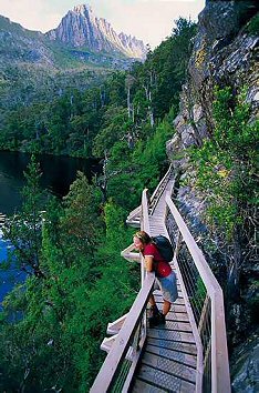 Cradle Mountain, TAS
~ From the crest of Mt. Wellington, Hobart - Australia's smallest capital - sprawls far below. With a population of 195,000 in the Greater Hobart area, this city sprawls over 936 square kilometres. 'The mountain' protects Hobart from the excesses of the wild weather flung at western shores. It has been known to snow on Christmas Day on Mt. Wellington, while the city below basks in the sun.
Animal Photographs
Flora (Plants) Photographs
Treks = Index = Links = Slanguage =
Aussie Inventions = Camp Oven Cooking = Map
 Back to Main Page
Web Page designed
by Sandy
© 1996-2007