| We decided to take the TranzAlpine Scenic Train up to Arthurs Pass instead of
driving from Christchurch. This was an all day expedition. The train left Christchurch at
9:00 A.M., dropped us off at 11:30 A.M. and picked us up for the return trip at 4:30 P.M.
At lest that was the plan. |
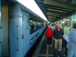 |
So we booked two seats for a Sunday and at 8:00 A.M. presented
ourselves for seating assignments at the Christchurch train station. This train was fully
booked and we were lucky to be able to get seats.
The TranzAlpine crosses the Southern Alps at Arthurs Pass on its way to Greymouth
on the West Coast. We decided to stop at Arthurs Pass and spend 5 hours lunching and
walking while waiting for the return train to come up from Greymouth and take us home to
Christchurch. |
| The train left Christchurch travelling through the flat Canterbury Plain for
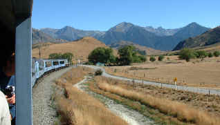
about 45 minutes, passing sheep, beef and deer farms. Vlad stood in the observation car to
take pictures on the way up to the pass. |
 |
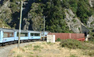 |
There are 6 viaducts and 15 tunnels on the way up. The tallest
viaduct, at 85 meters, is the 'staircase'. On the left is a photo of the train starting
across the staircase viaduct with a tunnel at the other end. The red fence along the
bridge is a windbreak to prevent workers from being blown off during high winds. |
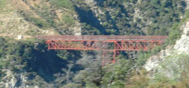
| A view of the staircase bridge from around the next curve. Even though I had a
good view from the observation car, the motion and speed of the train, as well as the
inherent limitation of the digital camera, causes some of these photo to be blurry. Within
seconds of taking this photo we were in another tunnel. |
 |
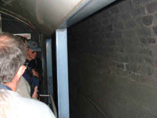 |
The 15 tunnels we went through were pretty short, the longest maybe
a mile, but most under a 1/4 mile. The longest on the line to Greymouth is over 5 miles
long. I decided to take a picture inside one of the tunnels and it worked. The observation
car is open on either side for an unobstructed view of the scenery going by. The train
also slowed down at the most interesting photo spots. The engine pulling
the train is diesel electric and there is the stink of exhaust fumes in the tunnels.
Especially in the longer tunnels where eyes start to run. The observation car is closed
for the 5 mile long tunnel. |
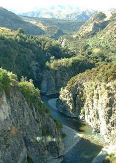
| The train tracks follow the Waimakariki river most of the way to the pass. At
90 kilometers in length, this is one of the longest rivers in N.Z. The bridges cross this
river several times as it meanders around the foothill contours of the land. This
particular gorge showed up for a few seconds as we all madly clicked away on our cameras. These
are the Southern Alps that form the backbone of South Island. They are relatively young
mountains but have been eroded by glaciation and are not as tall or as sharp as the
Rockies. There are many rock falls and slides visible on the sides of the mountains. The
river bed is made up of gray rounded stones about the size of grapefruit and smaller. The
stones are mined in many flat areas of the rivers along the East Coast. |
 |
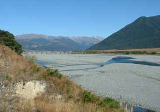 |
There are many stretches of the Waimakariri river in the wide
glacial valleys where most of the river is rock instead of water. At this time of the
year, late summer, it is pretty dry up here. There has also been a drought in most parts
of South Island and there is little water in any of the rivers. The gray
stony bed of the rivers is crisscrossed by streams of deep blue water. |
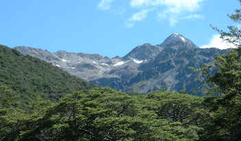
| After two and a half hours we arrived at the village of Arthurs
Pass. The day was glorious. We expected to be cold in the mountains and
brought sweaters and rain jackets with us which stayed in our backpacks. It was sunny and
warm all day. Arthurs Pass is at about 2500 feet of elevation (742M) with mountains
towering another couple thousand feet. Only a handful had any snow on them.
We had 5 hours to wander around the shorter trails and have lunch before the
return journey. |
 |
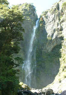 |
Punchbowl Falls is a hike of about one and a half hours and is
supposed to be easy. Well, easy is a relative term and because most Kiwis are inveterate
trampers we were huffing and puffing within 15 minutes. However, we persevered and soon
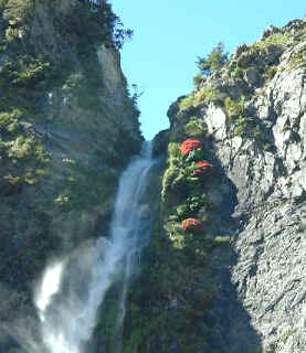
got to the base of the falls for a welcome rest in the warm sunshine. Just
visible at the top of the falls are a bunch of red flowered bushes. These may be Rata
bushes clinging precariously to the rock surviving with the help of the spray from the
falls. |
 |
| Walking back towards the village we took a detour through the dense beech tree
forest coming to a clearing every once in a while to get a glimpse of the surrounding
mountains. It is very peaceful up here. There are few other trampers around and we usually
have the scenic views and trails to ourselves. |
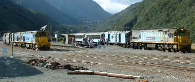 |
Our return train was supposed to arrive at 4:30 to pick us up, but
when we got to the station there was a coal train standing there. The coal train engineer
told us that he had been stopped here becasue there was a forest fire down the line and
all trains were going to be stopped at Arthurs Pass. And so it was. Our
train arrived about 30 minutes late and we were told that we would be taken back to
Christchurch by bus. We still got our seat assignments, got on the train and had a snack
and beer from the train snackbar. |
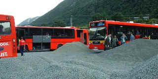
| Sure enough at about 6:30 ten red buses from Christchurch showed up and all 300
passengers scrambled to get seats for the trip back. Our Lonely Planets
guide book said that the more scenic way into Arthurs Pass is by road, so we were not too
bothered about this adventurous circumstance. It's all part of the cruising experience! |
 |
|
The scenery different and just as spectacular going by road. The road follows a
series of glacial valleys and along the wai... river for part of the way. Then winds down
and around the steep hills into the Canterbury Plain. The mountaintops were bathed in the
pink evening sunlight as the bus alternately sped down the hills and inched up the steep
grades. |
| We arrived in Christchurch around 9:00 P.M. What a day! |
|
 S/V
TETHYS
 S/V
TETHYS