 S/V
TETHYS
S/V
TETHYSTouring
New Zealand by Car
December 2000, February, March 2001
 S/V
TETHYS S/V
TETHYS |
Touring
New Zealand by Car |
| Cape Reinga | ||
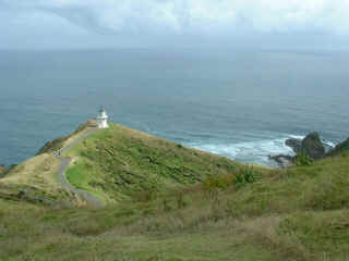
| Cape Reinga, at the
northernmost tip of New Zealand, is sacred to the Maori who believe that this is where the
spirit of the dead leave Aotearoa to make the voyage to Hawaiki, the ancestral homeland. Here the waters of the Tasman Sea and Pacific Ocean meet. It is a rugged and beautiful coast and a protected nature reserve. |
 |
|
|
|
Cape Reinga light stands 160 metres above sea level and can be seen 28 miles out at sea. We were too far away from this light as we approached NZ and saw the North Cape light, several miles to the East, instead. There has been a light at this cape for over 100 years warning sailors of the dangers of nearby Columbia Bank. |
| Far North, as it is known to the locals,
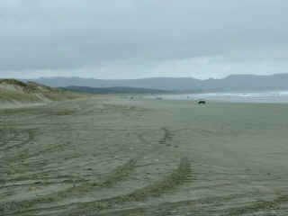
is a rugged coast with very shallow bays on the east side and the 90 Mile Beach on the
west side. The beach (which is actually about 90 km long) is a highway used by locals as
well as tour buses. It is completely flat and about 500 metres wide. The waves wash up
gently, depositing the sand, and hardpacking it so that car wheels barely make a
depression. Local knowledge is required however, especially of the state of the tide. Cars
have been buried in the sand when the tide has overtaken an unwary driver. Land yacht racing is popular. And early in the 20th century parts of the beach were used as an automobile land speed record course and an airport! It was cool when we were there before Christmas, so we saw very few swimmers along this coast. |
 |
|
|
|
| Huge dunes. Almost the whole of Northland from North Cape to
Kaitaia is sand. North Cape, Cape Reinga and Marie Van Diemen Island were once three
islands until the sands started filling in about a million years ago. Most of the dunes
stabilized and became covered with dense forest except for a section at the Te Paki
stream! (The odd fold effect on the above photo is caused by several photos being joined together.) |
|
|
|
| NZ Dotterel guarding eggs. We were lucky to find her three eggs just sitting in a slight depression in the sand. | |
|
|
The sands are constantly shifting sometimes exposing old drift wood or remnants of shipwrecks. There are also areas of sea shells scattered about. |
The Te Paki stream bed becomes the road for cars and buses to go around the dunes and access the 90 Mile Beach. |
| Back to the Northland Map |
| Charts | Journals | Ocean Voyages | Cruising Tips | Photos | Tethys | Yours truly | Links | Home Page |