Route 4 - Through Horrocks Pass and The Barossa Valley
Melrose (2453 kms) An historic town at the southern end of the Flinders Ranges, Melrose declares itself to be 'the oldest town in the Flinders Ranges'. For the bush walking enthusiast there are numerous walks from Melrose through the Mt Remarkable National Park. This is just one of many small historic towns we travel through on the way from Port Augusta to the Barossa Valley.
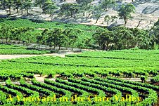
Clare (2584 kms) The main town in the Clare Valley, one of the premier wine growing districts in South Australia. It is an ideal base for exploring the thirty wineries in the region. The Clare Valley may not be as well known as the Barossa Valley but it has the typical beauty common to all wine growing areas.
Auburn (2608 kms) At the southern edge of the Clare Valley, Auburn is considered a fine example of an historic Australian town with many well preserved stone buildings.
Tarlee (2639 kms) A rural centre which came into existence in the 1860s, many of its historic buildings date from that era. During the late 19th century the local stone quarry provided the foundations for a number of Adelaide's major public buildings.
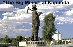
Kapunda (2655 kms) During the 1850s and 1860s Kapunda was a very rich and important copper mining centre. All mining operations closed in 1912 but the mining history is still very prominent with displays at the museum and the old Herald Printing Office, the statue of The Big Miner, and the old open cut mine which also has a number of descriptive displays. today Kapunda is an important centre for the surrounding rural district.
The Barossa Valley Once in the famous Barossa Valley there are many towns and a multitude of places of accommodation from which to choose. This link is one of the best on the web to show you the Valley in more detail.
Nuriootpa (2682 kms) Recognised as the commercial centre of the Barossa Valley, Nuriootpa is a rapidly growing centre with a population in excess of 3,000 people. The name Nuriootpa is reputedly an Aboriginal word meaning meeting place. The first impression a visitor to this town (and other towns in the Barossa) has, is that grape vines are growing everywhere, even in the main street!
Tanunda (12kms from Nuriootpa) Tanunda is the cultural heart of the Barossa Valley. A large rural settlement with tree lined streets, it is totally surrounded by vineyards.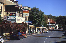 The name Tanunda is an Aboriginal name meaning either "watering hole" or "many birds on a creek". The town was settled by a large number of German immigrants in the mid 1800s, and it still has a distinct German atmosphere with sausage shops, German bread shops and German-style restaurants. Tanunda is well worth having a look at, even though it would mean a very slight diversion from the route we are taking.
Angaston (2694 kms) Another substantial and historic town in the heart of the Barossa. Angaston was established in the mid 1800s and is named after George Fife Angas who originally purchased 28,000 acres in the district and was responsible for encouraging the immigration of many German settlers to the region.
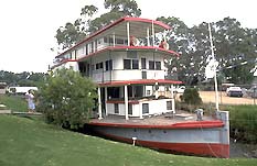 Mannum (2770 kms)A pleasant holiday town on the banks of the Murray River. Mannum has a wealth of history and owes its existence to the paddle steamers used in days gone by for transport on the river. One of the paddle steamers, the "Marion" has been restored and is operating as a passenger vessel. There is a car ferry for crossing the river at Mannum.
Murray Bridge (2810 kms) was established when a road bridge was constructed over the Murray River in 1879. A large town of approximately 17000 people, it is situated just 78kms from Adelaide. Unfortunately travellers today need not stop in Murray Bridge as the new highway bypasses the town 5kms to the south and crosses the river at a new bridge which was completed in 1979.
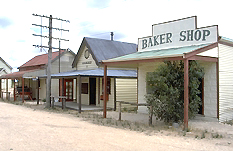 Tailem Bend (2831 kms) Essentially a railway town, Tailem Bend was established in 1887 after the railway was put through in 1886. An interesting tourist attraction is The Old Tailem Bend Pioneer Village, 5kms north of town.
Keith (2961 kms) The townsite of Keith, which is in a rich agricultural area, was first surveyed in 1884, however, it wasn't until 1894 that the first building was erected. It took another decade for the first public building (a church) to be constructed, and the Keith Hotel opened in 1910.
Bordertown (3006 kms) As its name implies, Bordertown lies very close to the border between South Australia and Victoria. The surrounding area is ideal for wheat and wool production, and is also used for vineyards,cattle and cereals.
Going this way Bordertown is the last town you pass through before the Victorian border which is 19kms to the east. The next town will be Kaniva in Victoria.
Route 2 - Adelaide and Bordertown
Route 3 - Horrocks Pass and Renmark