Otter Cliffs, Acadia National Park

We hiked further down the coast to Otter Cliffs. When you see picture postcards of Maine, with tall golden cliffs capped with pine trees, cliffs that rise proudly out of an inky blue ocean and are accented by angel-white spray wreathing the base, chances are pretty good that you are looking at a picture of Otter Cliffs. Each curve in the trail yielded another enchanting perspective of the coastline. Combined with the clanging of the bell buoys off the nearby ledges, the cries of gulls wheeling overhead, the smell of balsam, and feel of the slight breeze touching exposed skin, the overall effect is a rarely matched treat to the senses.
On another day, after Glyn and Jenny had sailed on for Nova Scotia, Cathy and I took the bus to Bubble Lake and hiked to Jordan Pond House. We followed along the shore of Eagle Lake, crystal clear and sparkling blue in the sun. The steeply wooded slopes are completely undeveloped, giving one the ability to mentally travel in time, back hundreds or even thousands of years, with no messy anachronisms to disturb the time travels. We then followed up and down the rocky, wooded trail skirting The Bubbles. The Bubbles are pair of rounded, bare granite peaks which, if the original cartographers had been less reserved, would have been named after some feature of the female anatomy.
The trail took us to Jordan Pond, where the surface improved to a maintained gravel trail, befitting the more frequent traffic. We followed the shore of Jordan Pond, until we arrived at Jordan Pond House, a restaurant that has served tea and popovers to the Island's visitors for more than a century. If you've never had a popover, it is difficult to describe. It is a pastry baked in a pan like a muffin tin, but larger. As it is baked, the top of the popover mushrooms far over the level of the top of the pan, and the outside of the popover becomes a golden dark brown color. When served, they are about the size of a softball, but when cut or torn open, all that is inside is air. Many people rave about the popovers, but to me they only serve as a repository for copious quantities of the marvelous Jordan Pond strawberry preserves that are placed inside before eating.
MINI-CRUISE
On August 1st, we raised the anchor from the thick mud of Southwest Harbor, and went for a sail. Actually, "sail" is a bit of an exaggeration. We went for a drift. With just the barest breeze, which was blocked and diverted by the shores of Manset, Clark Point, and Greening Island, we ghosted along at speeds of between zero and two knots. Our destination was Somesville, at the head of Somes Sound, some five miles away.
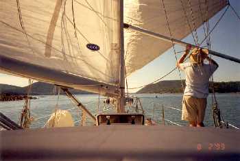
Running wing-and-wing down Somes Sound
 Somes
Sound is the only fjord on the East Coast of the United States.
It runs almost due north and south for a distance of about three and a
half miles, with a width of about 450 yards at its southern entrance at
The Narrows, widening out to almost a mile near its head, before
constricting to the 100-yard wide entrance to Somes Harbor at its
northern extremity. On the eastern side, Norumbega Mountain
climbs 850 feet up from the water, while to the west the 680-foot high
peaks of Acadia Mountain and St. Saveur border the shores, whose depths
plunge another 150 feet below the surface. About a quarter of the
way up the Sound on the west side is an indentation called Valley Cove,
which is directly below the peak of St. Saveur. The Mountain
rises so dramatically from the water here--600 feet vertically in less
than 100 yards of horizontal distance--that it is a favorite spot for
the local sightseeing boats. We enjoyed it, too.
Somes
Sound is the only fjord on the East Coast of the United States.
It runs almost due north and south for a distance of about three and a
half miles, with a width of about 450 yards at its southern entrance at
The Narrows, widening out to almost a mile near its head, before
constricting to the 100-yard wide entrance to Somes Harbor at its
northern extremity. On the eastern side, Norumbega Mountain
climbs 850 feet up from the water, while to the west the 680-foot high
peaks of Acadia Mountain and St. Saveur border the shores, whose depths
plunge another 150 feet below the surface. About a quarter of the
way up the Sound on the west side is an indentation called Valley Cove,
which is directly below the peak of St. Saveur. The Mountain
rises so dramatically from the water here--600 feet vertically in less
than 100 yards of horizontal distance--that it is a favorite spot for
the local sightseeing boats. We enjoyed it, too.We spent so much time drifting the mile or so to the entrance of the Sound, and so much longer as we watched Sovereign, with the frail breeze in her sails, battle the current ebbing through The Narrows, that we had only made the two miles from Southwest Harbor to Valley Cove before we had to start the engine to ensure we would be in Somes Harbor before dark.
After a calm night in this extremely well protected harbor, and mellowed by the pleasant, if slow pace of the previous day's drifting, we sailed off the anchor and gybed down the narrow sound in fluky winds that bounced off the mountainous walls of the fjord. We battled the current in The Narrows again, this time as it flooded into the sound on the rising tide. We passed between Bear Island to port, with the picturesque lighthouse that is the subject of dozens of postcards, and Sutton Island to starboard, with its grand waterfront houses. We sailed through Eastern Way, and set an easterly course to clear Schoodic Island.
There is something magic about Schoodic. It may be because the tides increase dramatically east of there, or that the fog is the worst in Maine a little bit beyond it, or that there are no facilities for yachts until you get to Eastport, at the Canadian boarder. It could be because Mt.. Desert Island is so pretty that it acts as a strong magnet to keep boats there. Whatever the reason, most yachts never venture beyond Mt. Desert Island, and Schoodic stands as the eastern sentinel between the more crowded harbors of the southwestern coast of Maine, and the relative wilderness of "Down East".
On our way past Schoodic Island, for about 30 minutes in the early afternoon, it looked as if the wind had died completely. We dropped the sails and motored for a while, raising the sails again as the wind returned. The wind filled in forcefully from the north, and we had a beautiful sail, the boat churning along smoothly at six and seven knots, churning smoothly even through the roughness of the shallow eleven foot bar between Petit Manan Point and Green Island . We turned the corner at Jerry Ledge and beat upwind between Bois Bubert Island and Jordan'sDelight, looking through the natural rock archway on the Jordan's western side and wondering about the people living in the solitary house at its top. We anchored at Trafton Island for the night, sheltered from the southerly swells, but exposed to the dying northerly wind.
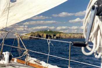
Jordan's Delight, Down East
 From
Trafton Island ,we sailed further "Down East" in a nice southerly
breeze. We passed close aboard Shipstern Island, and turned at
Black Rock to sail along the archipelago of islands that jut out to the
south of Jonesport. This area is both a thrill and a joy to sail
in. From Seahorse Rock at the southwest corner to Black Head at
the southeast corner is a seven mile stretch of coast where the
promontories and islands are placed in such a way that it is possible
to sail a straight course, passing within a literal stone's throw of
each piece of land, and still be in water more than 120 feet deep the
whole way. At Black Head, we turned north and ran the last four
miles up the entrance to The Thorofare at Roque Island.
From
Trafton Island ,we sailed further "Down East" in a nice southerly
breeze. We passed close aboard Shipstern Island, and turned at
Black Rock to sail along the archipelago of islands that jut out to the
south of Jonesport. This area is both a thrill and a joy to sail
in. From Seahorse Rock at the southwest corner to Black Head at
the southeast corner is a seven mile stretch of coast where the
promontories and islands are placed in such a way that it is possible
to sail a straight course, passing within a literal stone's throw of
each piece of land, and still be in water more than 120 feet deep the
whole way. At Black Head, we turned north and ran the last four
miles up the entrance to The Thorofare at Roque Island.The area of Roque Island is perhaps the nicest cruising destination in all of Maine. And since we consider Maine the best cruising on the U.S. East Coast, it was with great pleasure that we anchored in the protected harbor of Bunker Cove, just off The Thorofare. Roque Island and the islands nearby appear on the chart like a much abused capitol letter H. The H has been tilted off its axis 30 degrees counterclockwise ,the crossbar is bowed upward, and there are fractures separating the bottom tips of both the lower legs from the rest of the alphabetically-inclined island. The crack at the lower left of the H is called The Thorofare, and in this channel is a fine anchorage with room for just one or two boats our size, leaving allowances for the 14 foot tides. The bowed-up crossbar of the H is, in actuality, a mile-long crescent shaped white sand beach that is frequently deserted and always beautiful.
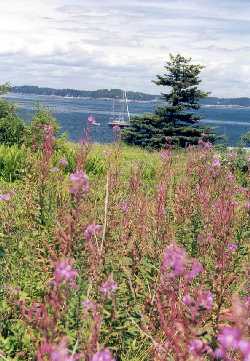
Wildflowers and view of Roque Island
 We
spent a wonderful few days here, exploring the many little coves and
islands in our dinghy. At low tide we picked mussels off the steep
rocky walls of our anchorage. Later in the day we flagged down a
passing lobster fisherman and purchased two fresh lobsters. We
dinghied over to Halifax Island, and walked ashore, picking wild
blueberries that grew in low clumps almost everywhere on the
island. We spotted a dense fog rolling in across the outer
islands, and jumped in the dinghy to race across the two and a half
miles of water between Halifax Island and where our boat was
anchored. We just made The Thorofare as the fog covered the
harbor. Behind us was a solid gray blanket where only a minute
before Halifax had been plainly visible. In a last excursion in
the dinghy, we followed the narrow cove into the shallow water to the
south and east, stopping to watch five or six seals bobbing at the
surface at the entrance to Bunker Hole. Back at the boat, we
feasted that night on boiled lobsters and steamed mussels, both fresh
from the ocean and dipped in melted butter. I don't think there
has been a meal I've ever eaten to compare with it.
We
spent a wonderful few days here, exploring the many little coves and
islands in our dinghy. At low tide we picked mussels off the steep
rocky walls of our anchorage. Later in the day we flagged down a
passing lobster fisherman and purchased two fresh lobsters. We
dinghied over to Halifax Island, and walked ashore, picking wild
blueberries that grew in low clumps almost everywhere on the
island. We spotted a dense fog rolling in across the outer
islands, and jumped in the dinghy to race across the two and a half
miles of water between Halifax Island and where our boat was
anchored. We just made The Thorofare as the fog covered the
harbor. Behind us was a solid gray blanket where only a minute
before Halifax had been plainly visible. In a last excursion in
the dinghy, we followed the narrow cove into the shallow water to the
south and east, stopping to watch five or six seals bobbing at the
surface at the entrance to Bunker Hole. Back at the boat, we
feasted that night on boiled lobsters and steamed mussels, both fresh
from the ocean and dipped in melted butter. I don't think there
has been a meal I've ever eaten to compare with it.Lobster fresh from a passing lobsterman
 We
were sad to leave this area, but we had an "engagement" scheduled back
in Southwest Harbor, so in the early daylight of August 5th, we raised
the anchor and motored out The Thorofare. As if to make up for
the lack of wind, a fair current pushed us along as we motored back to
Southwest Harbor. Near the very end of the return trip, as we
passed Schoodic, the current turned from our stern to our bow, trying
to gently push us backwards. It was as if the waters of Down East
knew the sadness we felt at leaving, and wanted to help us stay there,
even just a little longer.
We
were sad to leave this area, but we had an "engagement" scheduled back
in Southwest Harbor, so in the early daylight of August 5th, we raised
the anchor and motored out The Thorofare. As if to make up for
the lack of wind, a fair current pushed us along as we motored back to
Southwest Harbor. Near the very end of the return trip, as we
passed Schoodic, the current turned from our stern to our bow, trying
to gently push us backwards. It was as if the waters of Down East
knew the sadness we felt at leaving, and wanted to help us stay there,
even just a little longer.Smooth sailing,
Jim and Cathy