SEARCH THIS SITE | MAP OF THIS SITE
- Mount Vernon Trail (Mile 0).
- A more direct connection is planned, but for now the safe route follows Shirlington Road south two blocks to the pedestrian bridge over Interstate 395. From there follow Martha Custis Drive, turn left on West Glebe for one block, then right on South Glebe for one hundred yards to Four Mile Run trail on right. Map
- Custis Trail (Mile 4).
- Length: 4.5 miles. Some pictures Connects to: Mt. Vernon Trail, C&O Towpath, Rock Creek Park Trail, The Mall. This trail was part of a compromise between those who did not want Interstate 66 to be built inside the Capital Beltway, on the one hand, and those who wanted to build a wide expressway, on the other. The highway engineers designed the Custis Trail, and it shows. Look for example at the switchbacks on the north side of Lee Highway. Most of the intersecting paths have interchange-like ramps onto the Custis Trail. Nevertheless because of all the blind curves, the maximum safe speed on this trail is probably twenty miles per hour or less. Other interesting features on this trail are man-made ponds, a pedestrian bridge to Civil War trenches, and water fountains. By the way, both the Custis and Interstate 66 rougly follow the right-of-way of the Rosslyn branch of the Washington and Old Dominion Railroad. You would hesitate to call the Custis a rail-trail, because it twists and turns so much as it strives to keep beside Interstate 66, despite all of the overpasses and underpasses.
- City of Fairfax Connector (Mile 10.5)
- This is a hybrid trail/bike route. It connects Gateway Park, in the City of Fairfax, with the Vienna Metro Station, Nottoway Park, and the W&OD at Tapawingo Road. Map For more information, click here.
- Cross County Trail Northbound (Miles 14.5) dirt trail to Great Falls
- northbound: branches from asphalt trail on eastbound parallel gravel trail, .1 mile east of Hunter Mill Road, winds through Tamarack Park. See below.
- Cross County Trail Southbound (Mile 15.3) dirt trail to Lorton

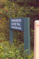
- Southbound: at Reston's Association's Twin Branches Nature Trail sign on the W&OD, at the northern foot of the steep hill west of Hunter Mill Road. More of a hiking trail than a biking trail. Infrequent yellow tape blazes. A dozen wooden signs mark it now, but that number is increasing each month.
- Fairfax County Parkway Bike Trail south-bound and north-bound (Mile 19.1)
- This trail is parallel to the the Fairfax County Parkway, which now runs from Ft. Belvoir to Rt. 7. It is not easy to follow. Devoid of landscaping, the trail disappears in some spots, only to resume its course on the other side of the highway. The North end disapears just south of Route 50 then reappears at Route
29. Some other crossings on this trail which are dangerous:
- Sunset Hills Road a/k/a Spring Street in Herndon: Very dangerous crossing, especially northbound.
- Pinecrest: The Parkway goes under Pinecrest, but the "bike trail" crosses Pinecrest dangerously.
- US Route 50: extremely dangerous.
- The Sugarland Run Trail Mile 19.1
- is an asphalt trail, well-marked southbound until it reaches the Fairfax County border. It will eventually form part of a six-mile loop which will connect back with the WOD near the Herndon Parkway. Intersects with W&OD in same vicinity as the intersection with the Fairfax County Parkway Bike Trail.
- C and O Towpath / Allegheny Trail Alliance connects via King Street/Business US 15/US 15 northeast of Leesburg (Mile 34.7)
- you can almost bike from Washington to Pittsburgh off roads. Only a few dozen miles are on-road as of March, 2001. The Norris House Inn, a bed-and-breakfast in Leesburg, Virginia, has a guide to several long-distance bike trails.
- Purcellville-Round Hill TrailPhase 1 - Round Hill to Franklin Park: The design for this section of the trail is complete and
the request to advertise for the construction bid was sent to VDOT on February 8, 2008.
VDOT has approved the environmental document and is in final review of the bid
documents. Construction is planned to begin in the September 2008 timeframe pending
Board action on this Item to re-affirm and appropriate local matching funds.
b. Phase 2 - Purcellville to Franklin Park: This section of the trail has not been designed. Since
November of 2002, the design efforts have encountered numerous delays due to alignments
that were identified, evaluated and subsequently found not to be practical. This was due to
utility relocation costs, insufficient right-of-way or impacts to numerous property owners.
Trail alignments were evaluated along both the north and south sides of Business Route 7,
Tranquility Road and the abandoned Washington and Old Dominion Railroad. The current
trail alignment being investigated exits Franklin Park onto Tranquility Road and eventually
connects with an existing Town of Purcellville trail at the intersection of Silcott Springs Road
and East A Street.
- Other connecting trails
- which were classified as hiking trails.
a look at rail-trails in the region by The Washington Post