Part 2
Perri, Charsanjak, Dersim &
The Armenian Village
Administrative Divisions
In the 1800's and early 1900's our Poochigian ancestors lived
in the village of Perri, which was ruled by the Ottoman Turks. Perri was located in
the administrative vilayet (province) of Kharpert (Harput), the sanjak
(district) of Dersim, the kaza (county) of Charsanjak, and the nahiye
(village or township) of Perri.
In 1840, the Ottoman government implemented what was referred
to as the Tanzimat Hayriye or "Auspicious Reorderings," which
reorganized the tax system and administrative divisions in each Ottoman ruled province (vilayet)
(Shaw 55). During the following years of the Ottoman rule, some
modifications were made to the administrative system through the Provincial Regulation of
1876 and 1874 (Shaw 243).
Basically, the administrative divisions were divided as
follows during the Ottoman rule of historical Armenia:
Vilayets (Provinces)
- The Poochigians' village of Perri was located in the vilayet (province, eyalet)
of Kharpert (also called Kharberd, Kharput, Kharpoot, Harpert, Harpoot, Harput, Harpout,
Harpouth, Elazig, Elaziz, Mamuret el Aziz, Mamuret-ul-Aziz, Mamurelulaziz). There
were six vilayets (provinces in historical Armenia: Erzurum, Bitlis, Van,
Diyarbekir, Sivas and Kharpert (Mamuret ul-Aziz) (Shaw 201). The area was
traditionally referred to as the "Six Vilayets" or the "Six Provinces"
in Ottoman Anatolia. (Lynch Vol. 2, 413)
Sanjaks (Districts)
- The Poochigians lived in the southern section of the sanjak of Dersim, which
was in the northern part of the Kharpert vilayet. The vilayets (provinces) were
divided into sanjaks. The boundaries of sanjaks were drawn to establish
equal units of comparable population and wealth. Each sanjak was headed by a muhassil.
Kazas or Livas
(Counties) - The Poochigians' village of Perri was located in the kaza
or liva of Charsanjak. The sanjaks were divided into kazas (counties) or livas
(the terms being used interchangeably). The kazas were headed by administrators (mudurs).
Nahiyes
(Villages or Townships) - The Poochigians lived in the village or nahiye
of Perri, which was sometimes called Charsanjak. Each kaza consisted of
subdistricts called nahiye (townships). Each nahiye usually contained
neighboring villages or at least one important town or village in a Kaza. The towns
or villages were directed by muhtars (mayors). With the
modification of the 1864 provincial system, each nahiye was given its own mudar and
an advisory council who acted on matters regarding tax assessment and collection, local
public works, agriculture and education. (Shaw 84 & 243)
Perri (Charsanjak,
Akpazar) Village
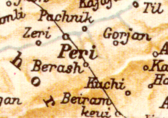 Until the early
1900's, our Poochigian ancestors lived in the village or nahiye of Perri (Peri,
Perry, Parry, Pere, Perre) in historical Armenia, which was ruled by the Ottoman
Turks. Today, Perri still exists in the Republic of Turkey, however, the modern-day
name of Perri is "Akpazar." Until the early
1900's, our Poochigian ancestors lived in the village or nahiye of Perri (Peri,
Perry, Parry, Pere, Perre) in historical Armenia, which was ruled by the Ottoman
Turks. Today, Perri still exists in the Republic of Turkey, however, the modern-day
name of Perri is "Akpazar."
Location of Perri
(Charsanjak, Akpazar). According to the U.S. Defense Mapping Agency, dated 1984,
Perri is located at 38 degrees, 51 minutes North Latitude and 39 degrees, 42 minutes East
Longitude (Aghjayan Database). The Map of Armenia and Adjacent Countries, dated 1901 (Lynch
Map), shows Perri is located about 30 miles (38 kilometers) northeast of the ancient
city of Kharpert. However, to reach Perri (Akpazar) from Kharpert and the city of
Elazig by road today, the distance is 60 to 80 miles (97 to 128 kilometers) (John
Poochigian Interview). According to Dr. John Poochigian, who visited the
outskirts of Perri (Akpazar) in eastern Turkey in 1998 (See Poochigians
on Tour),
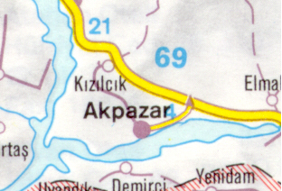 "The village we know as Perri is now
called "Akpazar." When we were trying to locate "Perri," no one
knew what we were talking about. We finally found it. We drove east from
Elazig, then north, then west toward Perri. We were stopped about 3 miles east of Perri.
This was where the road crossed over the Perri river. We took our pictures of Perri from
that point along the north bank of the Perri River. Perri (Akpazar) was in the
middle of the battlefield between the Turkish Army and the PKK [Partiya Karkere
Kurdistan--The Kurdistan Workers' Party] when we were there. If they ever settle
that conflict, it would be worth the effort to go back and walk the streets of
Perri." (John Poochigian, Jr. Interview) "The village we know as Perri is now
called "Akpazar." When we were trying to locate "Perri," no one
knew what we were talking about. We finally found it. We drove east from
Elazig, then north, then west toward Perri. We were stopped about 3 miles east of Perri.
This was where the road crossed over the Perri river. We took our pictures of Perri from
that point along the north bank of the Perri River. Perri (Akpazar) was in the
middle of the battlefield between the Turkish Army and the PKK [Partiya Karkere
Kurdistan--The Kurdistan Workers' Party] when we were there. If they ever settle
that conflict, it would be worth the effort to go back and walk the streets of
Perri." (John Poochigian, Jr. Interview)
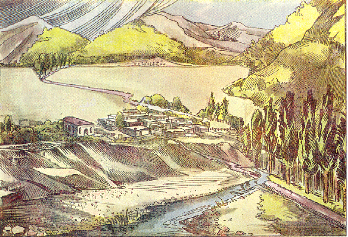 Perri River & Major Rivers. Perri is situated on the north (right) bank of the
Perri River (Perri Su or Kighi Su). Southwest of the village of Perri, the Muzur
River (Murzur Su) flows into the Perri River, which meanders over the plains and
surrounding mountains on its way to the Murad River (Eastern Euphrates; Lower Euphrates;
Armenian Aratsani; Turkish Murat; Murad Su; Murat Su). Perri River & Major Rivers. Perri is situated on the north (right) bank of the
Perri River (Perri Su or Kighi Su). Southwest of the village of Perri, the Muzur
River (Murzur Su) flows into the Perri River, which meanders over the plains and
surrounding mountains on its way to the Murad River (Eastern Euphrates; Lower Euphrates;
Armenian Aratsani; Turkish Murat; Murad Su; Murat Su).
The Murad River (Eastern Euphrates) joins the Western
Euphrates (Upper Euphrates; Armenian Eprat; Turkish Kara) to form the Euphrates River. Both the Eastern Euphrates and Western
Euphrates flow westward through a series of fertile plains, the upper arm through Erzerum
and Erzinjan, the lower through those of Bagrevand, Manazkert, Taron, Palu and Kharpert.
Then, after joining at Kaben Maden (Armenian Lusatarich), where a great dam
creating a vast lake has been constructed in recent years, the combined Euphrates pierces
the Taurus through a spectacular canyon, flowing down through the lowlands of Mesopotamia
and eventually to the Persian (Arabian) Gulf. (Hovannisian, Vol. I, 7)
The Mountains. The village of Perri is located on the broad plain
of Kharpert in the Armenian tableland in historical Armenia. The Kharpert plain is
an extensive, relatively flat region between hills and mountains. Historical Armenia
is mountainous country, surrounded by great mountain chains on every side and crossed by
lesser ranges that link the major ones together. Within this framework, the Armenian
tableland contains a number of smaller plateaus set at different altitudes, the regions of
Karin (Erzerum) and Erznga (Erzinjan) being the highest. Apart from these lesser
plateaus, the ranges and their spurs divide Armenia into a number of small but
well-defined districts ranging from broad plains such as those of Kharpert, Erzerum,
Erzinjan and Mush, to small valleys and narrow gorges. (Hovannisian, Vol. I, 5)
The village of Perri is
situated in historical Armenia, which is buttressed by mountain chains to the north and
south and crisscrossed by other chains that cover the Armenia plateau. The Upper Armenian
Mountains (Central Mountains) are located to the north of Perri; the Sasoun (Sassoun)
Mountains and the Taurus and Armenian Taurus Mountains, to the south; and the Biuraknian
(Byurakan) Mountains to the east.
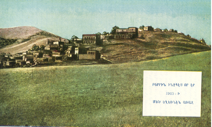 The Village of Perri. In 1900, the village of Perri was the
principal town in the larger sanjak (district) of Charsandjak (Kevorkian). As a result, the
residents of Perri sometimes referred to the village as "Charsandjak," although
they most often called it "Perri." People from Perri frequently
referred to themselves as "Perritsi," meaning they came from
from Perri. The Village of Perri. In 1900, the village of Perri was the
principal town in the larger sanjak (district) of Charsandjak (Kevorkian). As a result, the
residents of Perri sometimes referred to the village as "Charsandjak," although
they most often called it "Perri." People from Perri frequently
referred to themselves as "Perritsi," meaning they came from
from Perri.
In the French book, Les
Armeniens dans L'Empire Ottoman a la Veille du Genocide written by Raymond Kevorkian
and Paul Paboudjian, the authors report that in 1900, the number of Armenians in
Perri/Charsanjak, was 1,763 Armenians (310 families), 350 Turks and 80 Kurds (Kevorkian).
Kevorkian and Paboudjian
continue to explain, in 1900, the town of Perri was an agricultural settlement, which was
built on the slope of a hill along the Perri River. Perri was divided into six
quarters, of which five were inhabited:
1. Galerou Tagh,
2. Yegeghetsvo
T'agh (quarter of the Notre Dame
Cathedral),
3. Gamar-Aghpiuri T'agh,
4. Khorchougui
T'agh, and
5. Don-Aghpiuri
T'agh (Periphery of the Rouge
[Red] Monastery)
(Kevorkian)
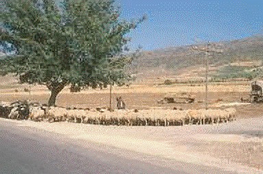 When our Poochigian ancestors lived in the village
of Perri, sheep were a valuable livestock. Today, sheep are still considered
Turkey's most important livestock, and Turkey is one of Europe's wool and cotton producers
(World Association of Travel Agencies). When our Poochigian ancestors lived in the village
of Perri, sheep were a valuable livestock. Today, sheep are still considered
Turkey's most important livestock, and Turkey is one of Europe's wool and cotton producers
(World Association of Travel Agencies).
It was common for villages to
preserve traditional Armenian customs and folk dances. Every village and region in
historical Armenia had its own folk dances. In modern times, the descendents of the
Poochigians from the village of Perri still do traditional Armenian folkdances at
weddings, picnics and other gatherings in America.
Today, the population of Perri (Akpazar) and Turkey's eastern
provinces is primarily Kurdish. In recent years, clashes between the Turkish armed
forces and the PKK (Partiya
Karkere Kurdistan--The Kurdistan Workers' Party), a Kurdish separatist group that
wants to establish an independent state out of portions of Turkey, Iran, Syria, and Iraq,
has restricted the movement of foreign visitors in eastern Turkey (Mangin 187).
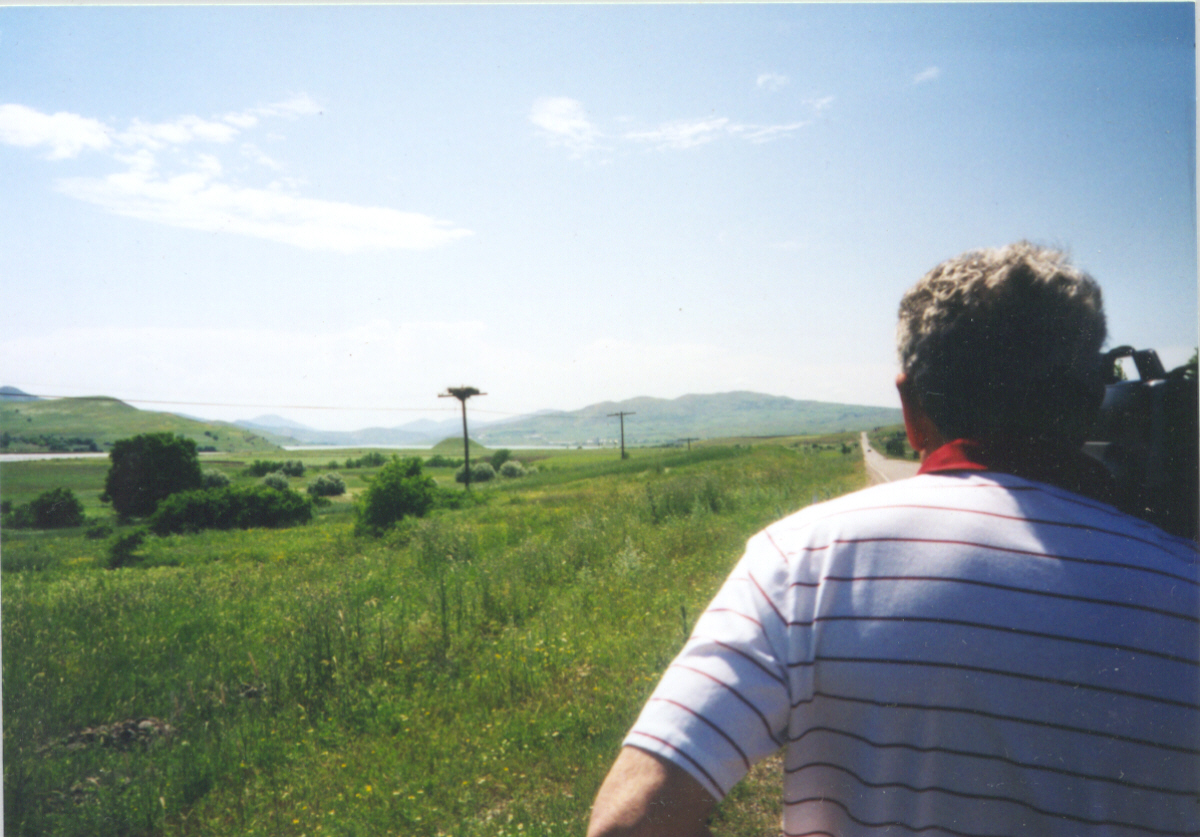
John Poochigian Looking Towards Perri
& the Perri River
Photo by Haig Krikorian, 1998
In the above photograph taken
in the Spring, 1998, John Poochigian looks towards the village of Perri at the base of the
hill in the background of the photograph. In an interview with John Poochigian, who
visited the outskirts of Perri, (See Poochigians
on Tour) he described his visit to
the area:
"From Kharpert [Apkazar], we drove about two
hours, 60 to 80 miles [97 to 128 kilometers], through a rural area.
Along the way, there were a few houses and herds of sheep walking on the highway.
When we were about three miles from Perri, the Turkish military police stopped us.
They recommended that we do not continue to drive into the village because the Kurds and
Turks had a skirmish in Perri the night before.
When we looked ahead toward the village of Perri, we could see
the roof tops on the houses. Perri is a village of an appreciable size of 500-1,000
people. The
low-frame houses in the Perri area are made of mud.
The residents of Perri,
and all of eastern Turkey, are made up of Kurds. Today, there's no Armenians left,
except just a few, and nobody really knows what an Armenian is. When we said, 'we're
Armenians, they said, what's that?''
The countryside around Perri, along the Perri River, is
very beautiful, with green rolling hills and high mountains off in the distance. The
area is very agricultural, with primarily ground vegetation and lots of livestock. The
farms are worked by women who are seen out in the fields. There are a few cows for milk,
but the livestock consists of primarily sheep that are raised, sold and butchered.
Around Perri, and in the countryside of Turkey, the people
travel in buses and cars, if they can afford them. Horse drawn wagons are also
used to transport people and farm goods. (John Poochigian)
When commenting on the area
around the town of Perri, John Poochigian, Jr., who also visited Turkey in 1996 and 1998
(See Poochigians on Tour), remarked:
"Eastern Turkey and
the area around the village of Perri probably hasn't changed much in the last 100 years.
The only difference is the residents of the area are now all Kurds. Most of the
province of Kharpert is now under water because of the artificial lakes.
The village of Perri,
which is now called 'Akpazar,' is located on the side of a hill overlooking the north bank
of the Perri River. The Perri River is a good size body of water, large enough for the
people to travel along the river in small boats and trade their goods.
There are beautiful
green, rolling hills around Perri. The agrarian area around Perri, as well as most of
eastern Turkey, consists of farming, particularly growing grain crops and raising sheep.
There's negligible industry in the region. (John Poochigian, Jr.)
Charsanjak Kaza
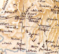 Perri (Charsandjak) was located in the kaza
(county) district of Charsanjak (Charsandjak, Tcharsandjak). Charsanjak was
the name of both the larger kaza (casa) district as well as one of the names for the
village of Perri/Charsanjak. Perri (Charsandjak) was located in the kaza
(county) district of Charsanjak (Charsandjak, Tcharsandjak). Charsanjak was
the name of both the larger kaza (casa) district as well as one of the names for the
village of Perri/Charsanjak.
According to Raymond
Kevorkian and Paul Paboudjian, there were 7,940 Armenians (1136 families) reported
in 43 localities in the Charsanjak Kaza (Caza de Tcharsandjak). There were also 51
churches, 15 monasteries and 23 schools (1,114 students). The center of Charsanjak
was the fortress of Kodaridj. (Kevorkian)
According to the Armenian Patriarchate at
Constantinople, there were 12 Armenian schools in the geographical district of Charsanjak
(Tcharsandjak) in 1901-1902. The schools included 18 teachers, 617 boys pupils and
189 girl pupils. (Armenian Patriarchate)
Dersim Sanjak
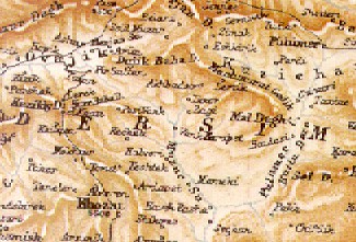 The village of
Perri and kaza of Charsanjak were located in the southern part of the Dersim sanjak
(sancak, sandjak). The Dersim sanjak was situated in the northern part of the
Kharpert province (Vilayet). Today, the Dersim province is called Tunceli, although
some still refer to the area as the Dersim. The village of
Perri and kaza of Charsanjak were located in the southern part of the Dersim sanjak
(sancak, sandjak). The Dersim sanjak was situated in the northern part of the
Kharpert province (Vilayet). Today, the Dersim province is called Tunceli, although
some still refer to the area as the Dersim.
Sanjak was a Turkish term used for an administrative
district during the Ottoman rule. The Turkish term, sanjak, also means flag
or military unit. (Today, the same term, Sanjak, is used to describe a Yugoslavia
region that includes parts of Serbia and Montenegro, and the capital is Novi Pazar.
The name Novi Pazar was shortened from Sanjak of Novi Pazar to just Sandjak.)
Mountains and forests are characteristic of the Dersim Sanjak.
According to Kevorkian,
in the Charsanjak Kaza, the mountains are less obvious and the area is more heavily
populated than in the north zone of the Dersim (Kevorkian).
In the 1890's, Lynch defined the Dersim as a "country and
administrative district belonging to western Armenia" (Lynch Vole 2, 503).
Lynch described the Dersim as a thinly populated district (Lynch Vol. 2, 405).
In Lynch's Table--Population of the Armenian Tableland in
Turkey (about the year 1890), he showed that the Sanjak Dersim had a population of a
total population of 70,000. The total population included 8,000 Armenians and 62,000
Moslems (Lynch Vol. 2, 412-413). Lynch further explained, "The
population of the Dersim Sanjak has been estimated from various sources. The
estimate is little better than a guess" (Lynch Vol. 2, 413).
Today, the Dersim Sanjak is still considered "wild
country--but 100 years ago it was even more so, says George Aghjayan who visited the area
in August, 1996. He continues to say, "It looks just like it did 100 years ago
when our families lived there. They still dry cow dung for fuel and the dwellings
are much the same. The Dersim was wild because of the large and unruly Kurdish
population. Many an Armenian survived the Genocide by going into the Dersim and then
having Kurds help them get to Russia." (Aghjayan Comments)
The modern-day Dersim is a battleground between the Turkish military and
the PKK (Partiya Karkere
Kurdistan--The Kurdish Workers Party). Because the Kurds believe
that the Dersim is part of Kurdistan and the land belongs to them, Kurdish men and women
continue to carry on a struggle as guerilla fighters in the mountains in the Dersim.
(DHKC Information Bureau)
Armenian Village &
Family Organization
Typical Armenian villages were built around a central square
with a church, school, and coffee house. The coffee house was the men's domain where
important issues such as politics and crop prices were discussed and local gossip was
exchanged. Villagers traveled to and from the fields and orchards on donkeys (Focus Multimedia, The Village).
According to Susie Hoogasian Villa and Mary Kilbourne Matossian in
their book, Armenian Village Life Before 1914,
The Armenian 'village'
was a collection of households with certain common interests and shared obligations.
For example, all villagers had common rights to the use of certain natural resources:
water, wild animals and plants, wood, clay, construction, stone, lime, and unused
land. If the village depended on irrigation, it was the collective responsibility of
all households to keep the canals clean and in good repair.
The general Armenian word
for family was 'undanik,' which meant a nuclear family consisting of father, mother, and
children only. 'Gerdastan' referred to the extended family clan, which could be
traced to the same person or grandparents. The Armenian extended family, the
gerdastan, usually consisted of several generations and included as many as five to six
generations. The clan comprised fifteen to one hundred persons, and sometimes
lived under the same roof. The gerdastan was patriarchal and patrilineal, tracing
the relationships through male lines only, and included all descendants from a common
ancestor in the male line for six to eight generations.
The gerdastan, the
largest kinship unit among the Armenians was strongest in the mountainous and subalpine
regions of forested areas where peasants privately owned land. There
the central government was weakest and the need for self-defense greatest.
In a typical village in
Western Armenian, the people constructed their houses with mud bricks. The homes of
neighbors were tightly clustered and close together. Home, stables, and sheepfold
were often interconnected. Most houses were adjoined on two or even three sides with
the street side protected by a high, mud-brick wall. Behind the wall was an open
courtyard, called either a 'pag' (Armenian) or 'dord ' (Turkish). The courtyard often
included a fireplace and a garden with flowers, vegetables, and fruit-bearing trees.
The lowest level of the dwelling contained the 'maran,' a storeroom where the family kept
grain, dried fruits and other foodstuffs. The family kept its sheep, cattle,
mules, horses and other animals in a stable, called 'akhor,' during the winter. The
animals moved about in the reserved section, which was usually dug out of the ground and
separated from the family dwelling.
In order to conserve
heat, the Armenians used a minimum of living space for several different purposes. A
typical village house included a central living room, which served as a sitting, sleeping
and dining room. Some houses included a separate room for preparing food. When
the main room was used as a dining room, the family members sat in a circle on the ground
to eat their meals.
The two basis forms of
fuel available in the Armenian villages were wood and dried dung. Dried dung, called
'goashgoor,' burned hotter than wood, but it did not last long and initially created a
great deal of smoke. The household prepared its supply of goashgoor in the
summer. The accumulated dung was carried to a large pit, where it was mixed with
water and usually fine straw. (Hoogasian 1-36)
Go to:
Part 3 - Kharpert
Regions
& the Cities of Kharpert & Elazig
Last Updated 05/03/99 |