|
BWCA
Maps
|
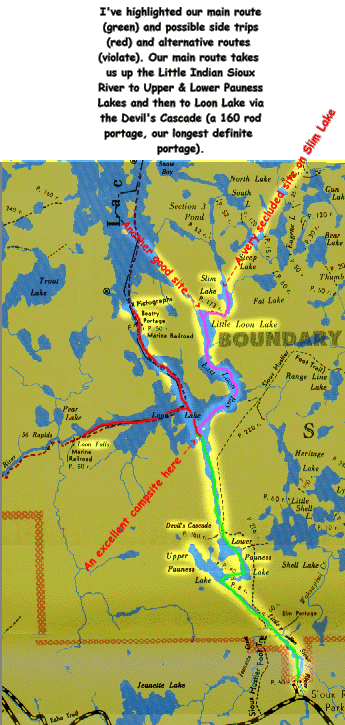
Here's a map of the
area we will be canoeing in. I'll post a map of the highway route to
Ely and the outfitter later on. The map is fairly self explanatory,
but as time allows, I'll try to post more about the side trips and
the alternative routes. Also note that the camping sites that are
pointed out on the map are ones we were familiar with 10+ years ago
and may no longer be there (the Forest Service tries to minimize the
impacts to campsites on heavilly travelled routes by occasionally
closing high use sites). Our outfitter may be able to tell us more
regarding the available sites.
 Back to BWCAW Home


