S/V Tethys British Columbia, Summer 1999

The summer of 1999 was spent cruising the Northwest Coast of B. C. and the West Coast of Vancouver Island:

On May 1, 1999 we left the Pier 32 Marina in False Creek, Vancouver, B.C. and joined our friends for a goodbye raft-up.
After enjoying the Gulf Islands in May, stopping off to visit Paula’s Dad in Maple Bay and attending a Bluewater Cruising Association rendezvous on the May long weekend, we sailed up Georgia Strait to Gorge Harbour on Cortes Island. 
We continued north through Surge Narrows and Upper Rapids to Johnstone Straits and an exhilarating 11 knot trip through Race Passage on our way to Port Neville and Port Harvey. We spent a good part of June here, crabbing in Cutter Cove, prawning off Broughton Island, fishing here and there (we only caught rockfish there but big ones are very tasty).
Port McNeill, on Vancouver Island, is a excellent place to visit for provisioning. The town marina is very well maintained and very close to several supermarkets, laundry, post office hardware and marine supplies.
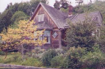
The wind was on the beam for a leisurely reach across Broughton Strait to Sointula, on Malcolm Island. Sointula is delightful – quiet, serene, tidy and picturesque with its many wooden houses with Scandinavian influence. The island was settled by Finns who intended to lead a communal existence but local conditions and their misunderstanding of them caused their farming experiment to fail. A devastating fire at the community centre in 1904 was the end for many and at least half the original settlers left the island. Those who remained settled down to fishing and logging.
Just south of Malcolm Island is  Alert Bay on Cormorant Island. This is a reserve for the local Kwakiutl people. We were lucky enough to catch a glimpse of the inside of the new Big House (a traditional community building), which recently opened.
Typical Sointula house (17537 bytes)
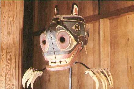
Wolf mask at U'Mista (20180 bytes) The U’Mista Cultural Center's collection of potlatch regalia is probably the best in the country. The collection had been assembled from storage rooms in Ottawa and other museums and brought back home to Alert Bay. Interestingly, the masks are not behind glass, but are out in the open as the elders believed that the regalia had been "in prison" for too long already. The U’Mista curator is a First Nations woman and very interested in making sure first nations culture does not disappear and that the people keep in touch with their rich heritage. The center has programs to instill pride in the culture in the local community.This museum is well worth visiting.
From Port McNeill we crossed the eastern portion of Queen Charlotte Strait back to the Broughton Archipelago on the mainland side. We had only six sunny days in June, but we enjoyed fishing and exploring by dinghy and watching the local wildlife. In this area we also stopped at Echo Bay and Sullivan Bay, both floating villages. Towards the end of June we made several long passages along the east shore of Queen Charlotte Strait north of Vancouver Island. Motoring past Cape Caution to Calvert Island was uneventful but foggy and damp. We were glad to have the radar which made identifying landmarks a lot easier. We meandered north toward Bella Bella in more fog. Islets were darker grey blobs in the general grey gloom and even though it was not actually raining, everything was almost permanently wet from the heavy mist (otherwise known as liquid sunshine). The diesel stove was on almost every day to keep the boat warm and dry. On the occasional sunny morning we would go exploring or fishing.

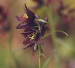
Wild purple lily (46096 bytes)

Bella Bella, a large Indian community, was wet and depressing, but the band store was surprisingly well stocked, the ferry having recently called. Diesel is available although very expensive.

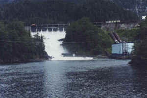
A side trip to Ocean Falls where we had a completely clear, sunny day with absolutely no cloud cover for the first time since coming north of Cape Caution. Up until then, it seemed that all the islands were rather flat and forested to a height of 60 feet and about twenty feet deep (the fog level). Imagine our surprise then, going up Cousins Inlet in bright sunshine, to discover that our world was composed of hills, backed by mountains, backed by yet more mountains (with snow on them). Ocean Falls, a thriving community until its mill closed in the seventies, is rather ghostly, with shut up hotels, the pulp mill, apartments and houses. Only the power plant at the dam is still in service, providing power to Ocean Falls, Bella Bella and Shearwater.
On to Laredo Inlet, on the south side of Princess Royal Island we followed a creek at the head of one anchorage about a mile at high water and had an interesting trip through grassy, alluvial banks of thick black mud, some of which have stunted apple trees on them. We did not see much wildlife here although Princess Royal Island is famous for the Kermodei bears.
The falls at Ocean Falls B.C. (7497 bytes)
It was at this point, around July 8, that we decided that we did not want to go further north. After one sunny day in Meyers Passage, we had returned to fog and drizzle. When the clouds cleared for a while we noted new snow on the mountains on Princess Royal Island while CBC (picked up on short-wave radio) suggested that the weather further south was finally warming up a little. So we decided to return south. We headed back down across Queen Charlotte Sound towards Vancouver Island.
We waited in Bull Harbour at the top of Vancouver Island for a weather window to go around Cape Scott spending a day  fishing and walking on shore. The trip around Cape Scott at the tip of Vancouver Island to Quatsino Sound can be very nasty in bad weather, but we had absolutely no wind at all and motored the entire way on a glassy swell. For Paula, the high point of the trip was sighting a single and then two pairs of sea otters, happily floating along on the swells, peering at the boat with complete unconcern. This was in 70 metres of water, between Cape Scott and Sea Otter Cove. Vlad had taken a Gravol and was too sleepy to appreciate the sighting. Later on, as we were anchored in Quatsino Sound, a sea otter dove for his dinner and then ate it a few hundred yards behind the boat.
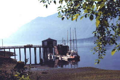
We explored Winter Harbour, just inside Quatsino Sound, and walked along the boardwalk along the village shore, which has been the main route through the village for years, and is still the only way to reach the cottages and houses. The village of Coal Harbour is right inside Quatsino Sound and is actually only twelve miles by road from Port Hardy across Vancouver Island but we had travelled a hundred miles or so to get there.There is lots of wildlife up here. In one very picturesque cove we counted three eagles, six herons, two kingfishers and a deer within the first five minutes and we again saw schools of the pilchards swimming by. A family of river otters fished along the old boom logs. Government Dock at Coal Harbour B.C. (15551 bytes)
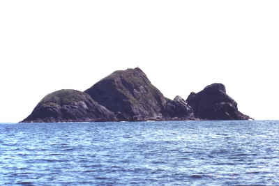
Solanger Island of Brooks Peninsula (11811 bytes) South of Quatsino Sound is the dreaded Brooks Peninsula which is a large rectangular piece of land jutting out about six miles into the ocean. The trip around the peninsula can be extremely rough in bad weather as swells come from different directions resulting in heaped up waves at the north and south west points. As it turned out, we had a sunny day with light wind out of the southeast for our passage so it was an easy trip. At the northwest tip of the peninsula is Solander Island, a great bare chunk of rock with a lighthouse. It is a favourite nesting spot for seabirds and as we motored along, we were passed by strings of murres heading home from their fishing.
We stopped in a cove just inside the inlet on the south side of the Brooks Peninsula, enjoying the warmer water (11 Deg C north of it, to 16 Deg on the south).
This area of the west coast is Checleset Bay and the coast is protected by a long string of islets and reefs known as the Barrier Islands. Very typically for this time of year, it was often foggy in the morning and then the sun would burn the fog away by about eleven, so we usually held off leaving for a new anchorage until the visibility improved later in the day.
Just before Kyuquot Sound we went to the small village of Walters Cove (Kyuquot). A walk around Kyuquot village on the boardwalk and dirt paths does not take long. The village is an odd combination of the natural beauty of the area (a sea otter bashing a shell on the rock on his chest off one of the docks in the bay) and human detritus (an ugly heap of stoves and other electrical appliances rusting away at the tideline).
Kyuquot Sound, the second of the five big sounds which indent Vancouver Island’s west side was busy with kayakers. We could see their brightly coloured tents on several beaches in the area. Many of them set off from Fair Harbour which can be reached by road from the island highway and has a large parking area. We were interested in the fish farming operations which are numerous here, and went to a large one by dinghy to see if we could get a tour. We were made very welcome and shown over the operation by the shift foreman. We were given a smaller fish which was dipped out of a tank for us. It turned out to be a slightly imperfect one, with some scale loss, which was fine with us. When we got back to the boat, Vlad cleaned the fish and got six salmon steaks and two large fillets out of it, enough for 5 meals.
From Kyuquot Sound we headed for Esperanza Inlet which is the northern entrance to Nootka Sound. Again a sunny day with light winds. Sailing up Esperanza Inlet on our way to Tahsis we were thrilled to watch a grey whale breach several times. The weather, which had been sunny and warm almost every day for a couple of weeks, now decided to turn to rain and mist so we moved along fairly quickly through Nootka Sound and then down around Estevan Point to Hot Springs Cove at the entrance to Clayoquot Sound. Off the lighthouse at Estevan Point, we saw several grey whales feeding and watched quite large flocks of sooty shearwaters flying low over the waves.
We bypassed Ucluelet and went directly to Effingham Bay in the Broken Islands anchoring in the southeast cove. We stayed several days, exploring the area by dinghy and walking ashore on sunny days, and sitting out a couple of windy, fogbound days. The whole area is a provincial park and is quite busy with kayakers, sports fishermen and cruising boats. From the Broken Islands we backtracked to Ucluelet where we did final provisioning and laundry while waiting for a reasonable weather window to go south. On Saturday August 28, we were off, our greatly anticipated ocean passage to San Francisco, then continuing along The West Coast U.S.A. to San Diego.
Charts Journals Ocean Voyages Cruising Tips Photos Tethys Yours truly Links Home Page
1